
MyTopo
Little Pine Canyon Colorado US Topo Map
Couldn't load pickup availability
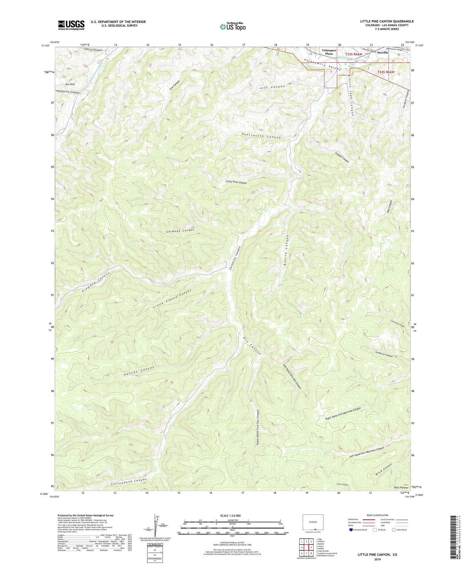
2022 topographic map quadrangle Little Pine Canyon in the state of Colorado. Scale: 1:24000. Based on the newly updated USGS 7.5' US Topo map series, this map is in the following counties: Las Animas. The map contains contour data, water features, and other items you are used to seeing on USGS maps, but also has updated roads and other features. This is the next generation of topographic maps. Printed on high-quality waterproof paper with UV fade-resistant inks.
Quads adjacent to this one:
West: Tercio
Northwest: Vigil
North: Weston
Northeast: Madrid
East: Valdez
Southeast: McWilliams Canyon
South: Caliente Canyon North
Southwest: Casa Grande
This map covers the same area as the classic USGS quad with code o37104a7.
Contains the following named places: Alamosa Canyon, Alamosito Canyon, Bonita Canyon, Cherry Canyon, Chimney Canyon, Cottonwood Canyon, Coyote Canyon, Dorn Ditch, Jeff Canyon, Left Hand Fork Oso Canyon, Little Almosa Canyon, Little Jeff Canyon, Little Pine Canyon, Lorencito Canyon, Oso Canyon, Pancho Canyon, Pentitente Canyon, Puertecito Canyon, Quinto Mine, Right Hand Fork Oso Canyon, Sarcillo Canyon, Trail Canyon, Velasquez Plaza


