MyTopo
Cedar Canyon New Mexico US Topo Map
Couldn't load pickup availability
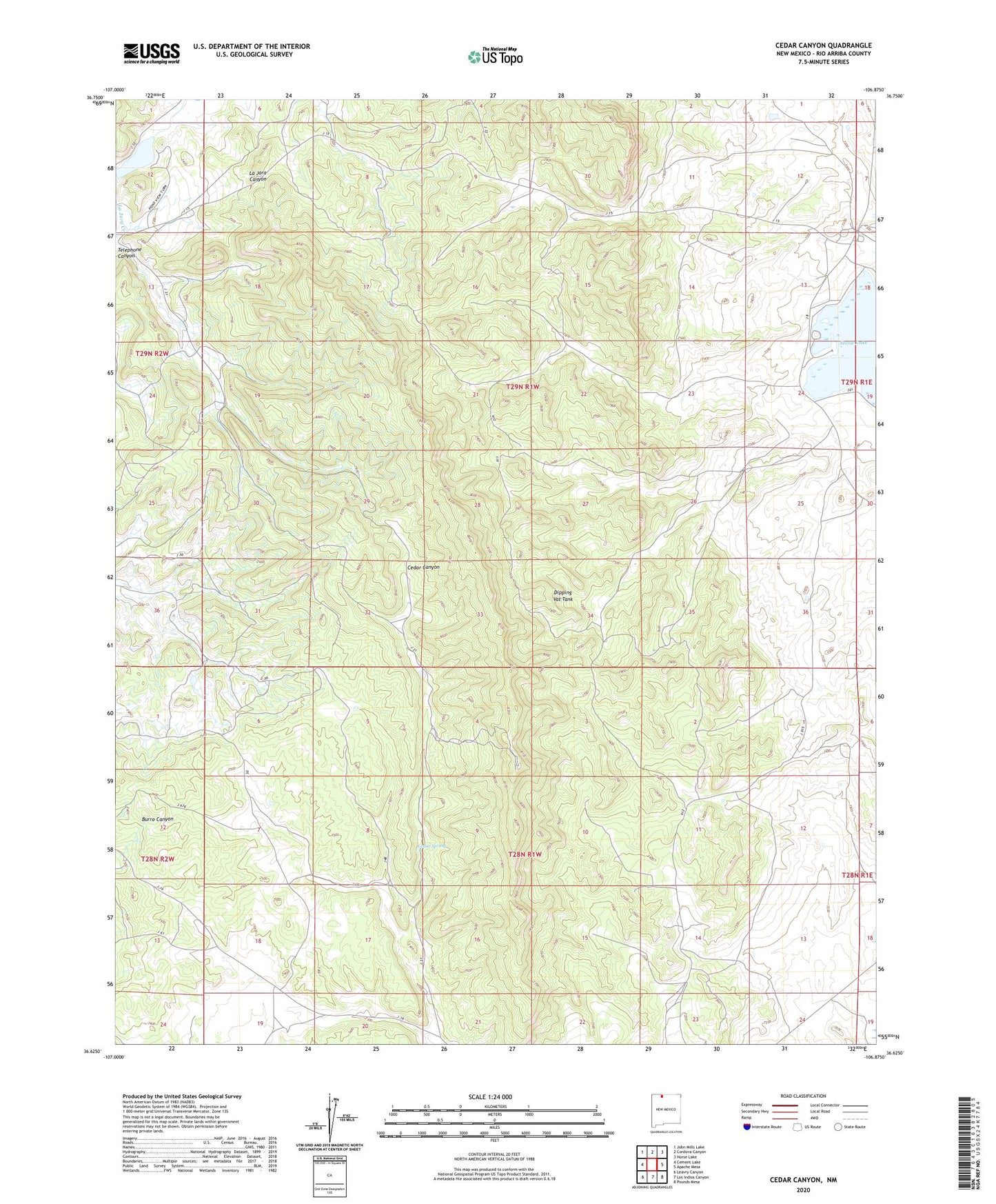
2023 topographic map quadrangle Cedar Canyon in the state of New Mexico. Scale: 1:24000. Based on the newly updated USGS 7.5' US Topo map series, this map is in the following counties: Rio Arriba. The map contains contour data, water features, and other items you are used to seeing on USGS maps, but also has updated roads and other features. This is the next generation of topographic maps. Printed on high-quality waterproof paper with UV fade-resistant inks.
Quads adjacent to this one:
West: Cement Lake
Northwest: John Mills Lake
North: Cordova Canyon
Northeast: Horse Lake
East: Apache Mesa
Southeast: Pounds Mesa
South: Los Indios Canyon
Southwest: Leavry Canyon
This map covers the same area as the classic USGS quad with code o36106f8.
Contains the following named places: Cedar Spring, Cedar Springs Lookout, Dipping Vat Tank, La Jara Lake, Stone Lake, Stone Lake Lodge, ZIP Code: 87528