MyTopo
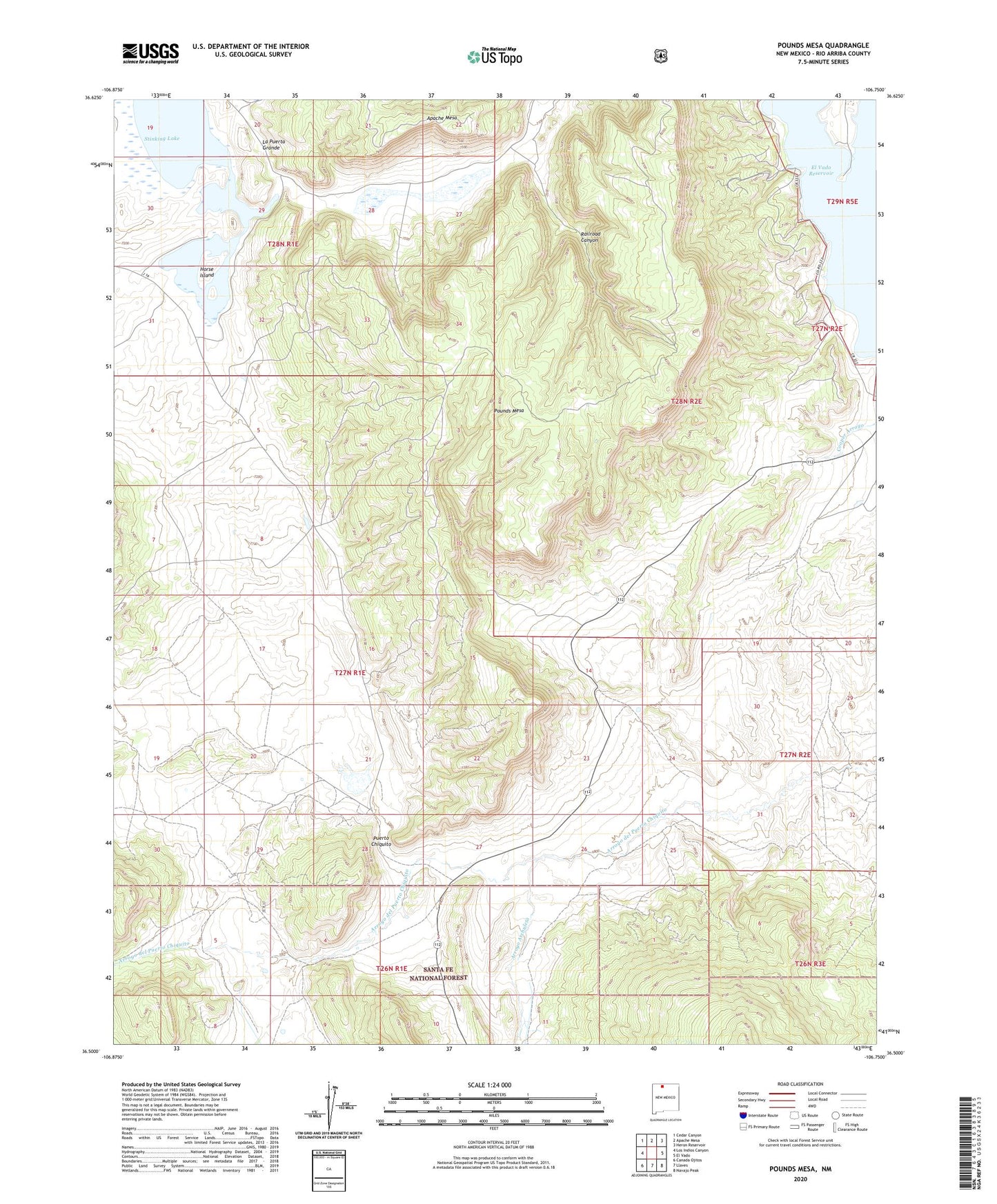
Pounds Mesa New Mexico US Topo Map
Couldn't load pickup availability
Also explore the Pounds Mesa Forest Service Topo of this same quad for updated USFS data
2023 topographic map quadrangle Pounds Mesa in the state of New Mexico. Scale: 1:24000. Based on the newly updated USGS 7.5' US Topo map series, this map is in the following counties: Rio Arriba. The map contains contour data, water features, and other items you are used to seeing on USGS maps, but also has updated roads and other features. This is the next generation of topographic maps. Printed on high-quality waterproof paper with UV fade-resistant inks.
Quads adjacent to this one:
West: Los Indios Canyon
Northwest: Cedar Canyon
North: Apache Mesa
Northeast: Heron Reservoir
East: El Vado
Southeast: Navajo Peak
South: Llaves
Southwest: Canada Ojitos
This map covers the same area as the classic USGS quad with code o36106e7.
Contains the following named places: Apache Mesa, Arroyo Archuleta, El Vado Reservoir, Hargroves Point, Horse Island, Pounds Mesa, Puerto Chiquito, Railroad Canyon, Stinking Lake, Thompson Lake