MyTopo
Chicken Mountain New Mexico US Topo Map
Couldn't load pickup availability
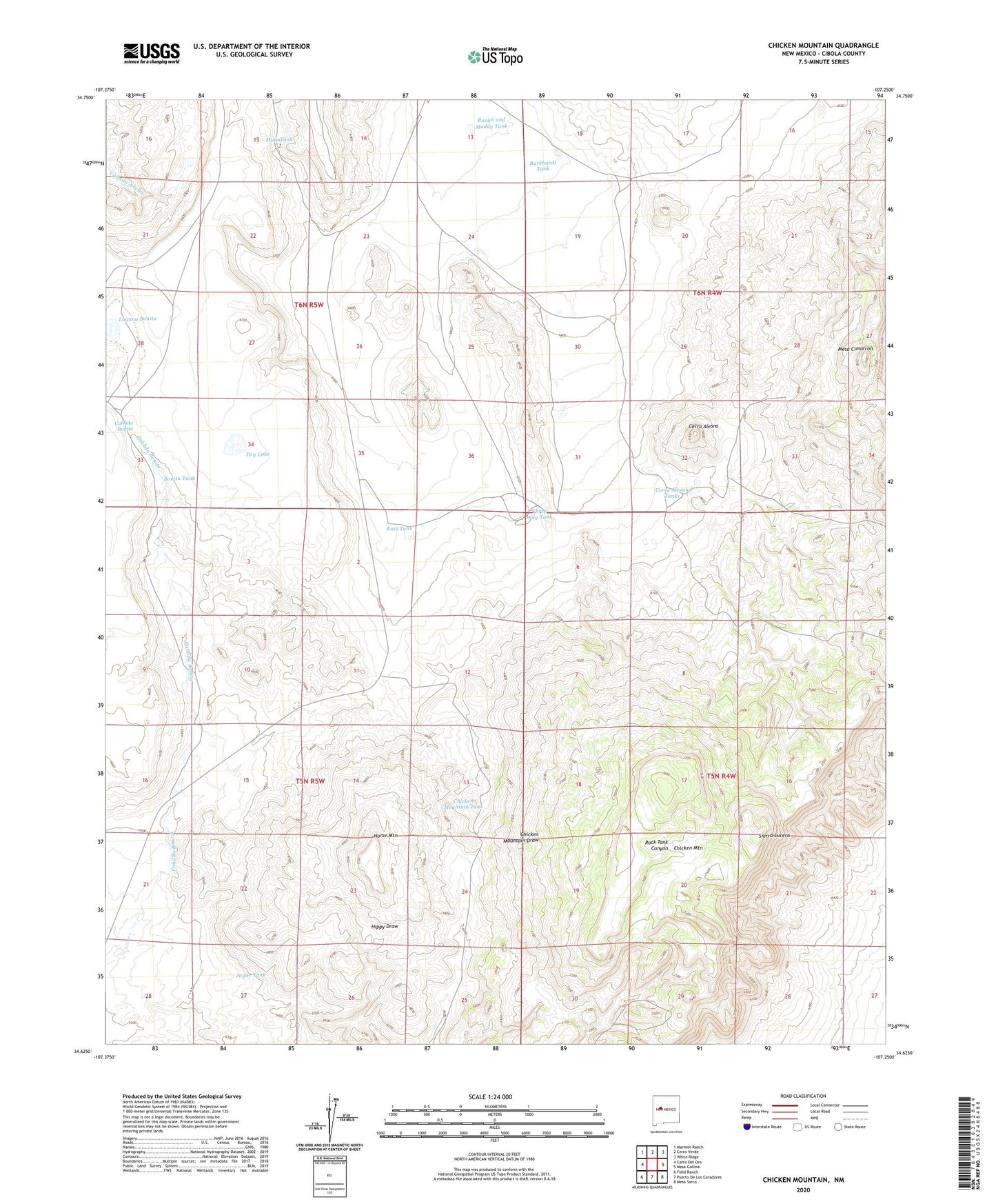
2023 topographic map quadrangle Chicken Mountain in the state of New Mexico. Scale: 1:24000. Based on the newly updated USGS 7.5' US Topo map series, this map is in the following counties: Cibola. The map contains contour data, water features, and other items you are used to seeing on USGS maps, but also has updated roads and other features. This is the next generation of topographic maps. Printed on high-quality waterproof paper with UV fade-resistant inks.
Quads adjacent to this one:
West: Cerro Del Oro
Northwest: Marmon Ranch
North: Cerro Verde
Northeast: White Ridge
East: Mesa Gallina
Southeast: Mesa Sarca
South: Puerto De Los Cavadores
Southwest: Field Ranch
This map covers the same area as the classic USGS quad with code o34107f3.
Contains the following named places: Bonita Tank, Burkhardt Tank, Cerro Alesna, Cerro Alesna Tanks, Chicken Mountain, Chicken Mountain Tank, Davy Water Well, Davy Windmill, Dry Lake, East Tank, Horse Mountain, Jayne Tank, Laguna Bonita, Mesa Cimarron, Mule Tank, Pie Ranch, Pie Ranch Water Well, Pronto Detention Dam, Rough and Muddy Tank, Sierra Lucero, T X Detention Dike Number 1, T X Diversion Dam Number Three, Three Way Tank, Virgils Windmill