MyTopo
Bull Basin New Mexico US Topo Map
Couldn't load pickup availability
Also explore the Bull Basin Forest Service Topo of this same quad for updated USFS data
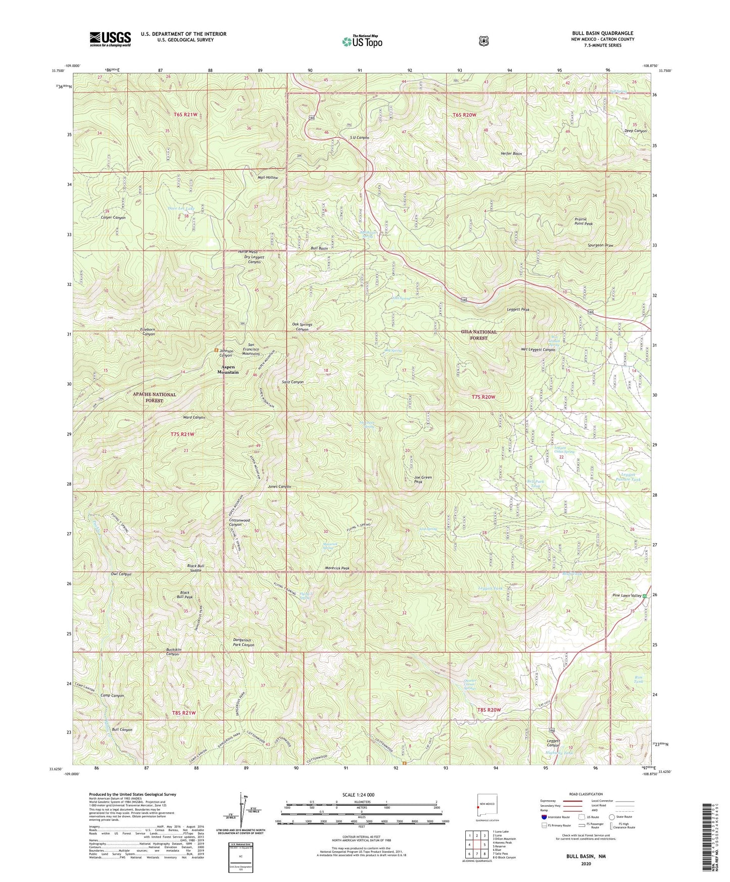
2023 topographic map quadrangle Bull Basin in the state of New Mexico. Scale: 1:24000. Based on the newly updated USGS 7.5' US Topo map series, this map is in the following counties: Catron. The map contains contour data, water features, and other items you are used to seeing on USGS maps, but also has updated roads and other features. This is the next generation of topographic maps. Printed on high-quality waterproof paper with UV fade-resistant inks.
Quads adjacent to this one:
West: Maness Peak
Northwest: Luna Lake
North: Luna
Northeast: Dillon Mountain
East: Reserve
Southeast: O Block Canyon
South: Saliz Pass
Southwest: Blue
This map covers the same area as the classic USGS quad with code o33108f8.
Contains the following named places: Aspen Mountain, Bell Park Tank, Black Bull Peak, Black Bull Saddle, Bluff Tank, Bull Basin, Bull Basin Spring, Bull Canyon, Camp Canyon, Dangerous Park, Dave Lee Lake, Flying T Spring, Heifer Basin, Highway Tank, Horse Mesa, Joe Green Peak, Joe Green Spring, Jones Corral, Leggett Cabin Spring, Leggett Canyon, Leggett Pasture Tank, Leggett Peak, Leggett Tank, Lost Spring, Maverick Peak, Maverick Spring, Nutt Spring, Oak Spring, Owl Canyon, Pine Lawn Camp, Pine Lawn Valley, Prairie Point Peak, Quarry Tank, Quarter Corner Springs, Rim Tank, San Francisco Mountains, Tuff Spring, Ward Canyon, Wet Leggett Spring