MyTopo
Dona Ana New Mexico US Topo Map
Couldn't load pickup availability
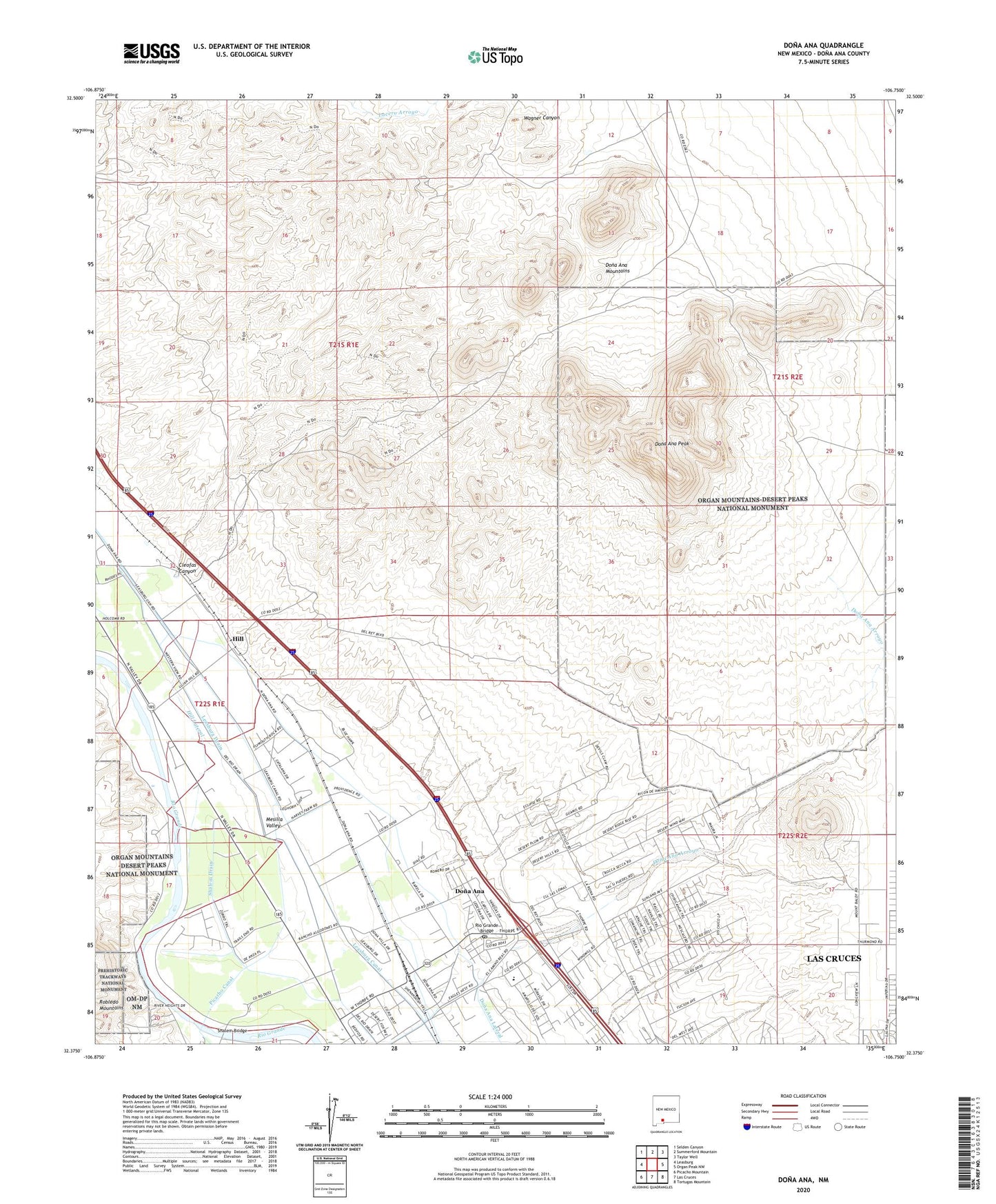
2020 topographic map quadrangle Dona Ana in the state of New Mexico. Scale: 1:24000. Based on the newly updated USGS 7.5' US Topo map series, this map is in the following counties: Doña Ana. The map contains contour data, water features, and other items you are used to seeing on USGS maps, but also has updated roads and other features. This is the next generation of topographic maps. Printed on high-quality waterproof paper with UV fade-resistant inks.
Quads adjacent to this one:
West: Leasburg
Northwest: Selden Canyon
North: Summerford Mountain
Northeast: Taylor Well
East: Organ Peak NW
Southeast: Tortugas Mountain
South: Las Cruces
Southwest: Picacho Mountain
Contains the following named places: Cleofas Canyon, Cleofas Well, Cox Tank, Dona Ana, Dona Ana Cemetery, Dona Ana Census Designated Place, Dona Ana- East Picacho, Dona Ana Lateral, Dona Ana Mountains, Dona Ana Peak, Dona Ana Post Office, Dona Ana Site Dam, Hill, Hill Lateral, Hill Post Office, Historic Dona Ana Cemetery, Leasburg Canal, Leasburg Drain, Old Methodist Cemetery, Our Lady of Purification Catholic Church Historic Site, Picacho Canal, Piedra Blanca Claim, Rio Grande Bridge, Shalem Bridge, Shalem Drain, TW-26 Water Well, USBR-26 Water Well, Wagner Well, ZIP Code: 88032