MyTopo
Doyle Peak New Mexico US Topo Map
Couldn't load pickup availability
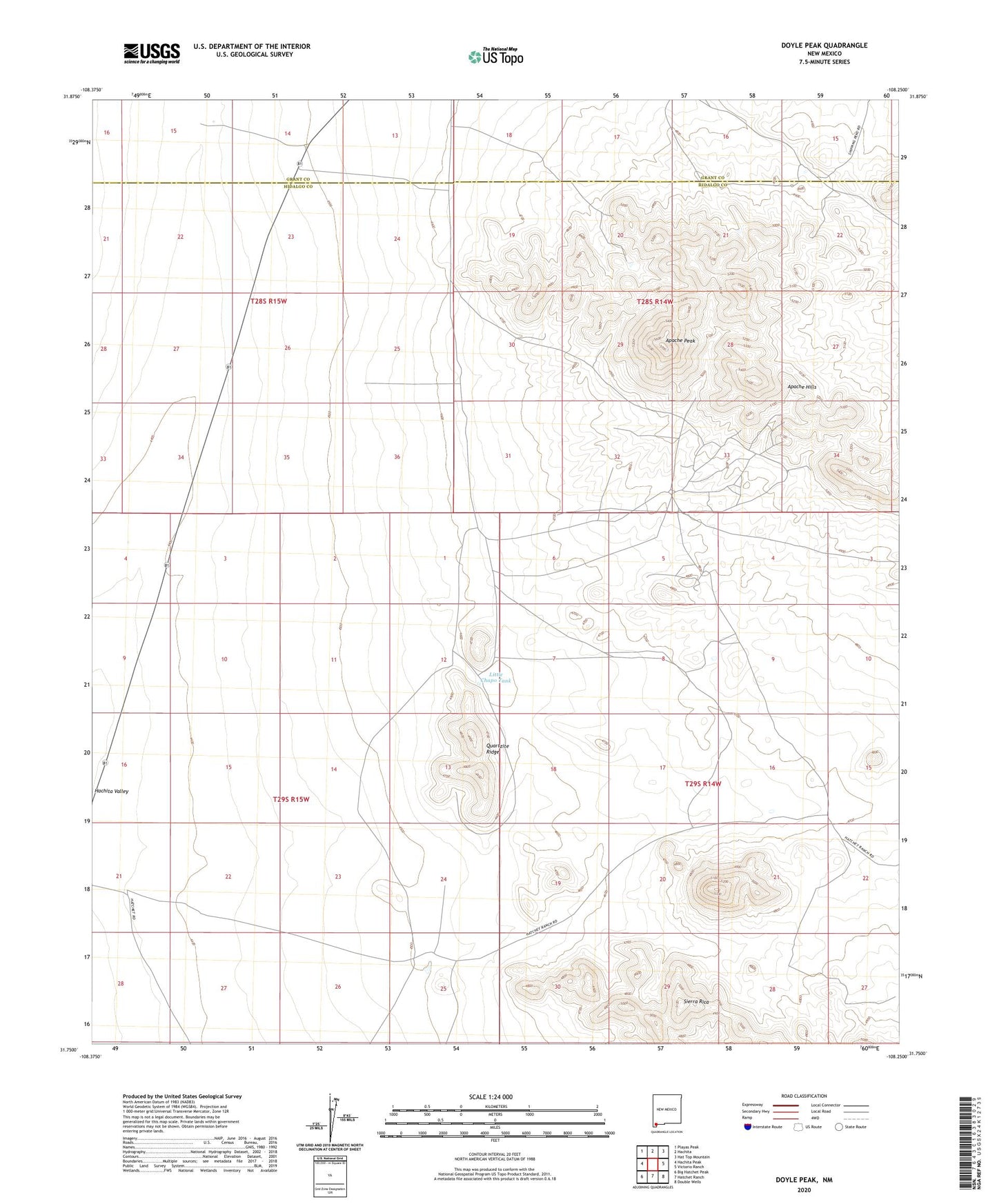
2020 topographic map quadrangle Doyle Peak in the state of New Mexico. Scale: 1:24000. Based on the newly updated USGS 7.5' US Topo map series, this map is in the following counties: Hidalgo, Grant. The map contains contour data, water features, and other items you are used to seeing on USGS maps, but also has updated roads and other features. This is the next generation of topographic maps. Printed on high-quality waterproof paper with UV fade-resistant inks.
Quads adjacent to this one:
West: Hachita Peak
Northwest: Playas Peak
North: Hachita
Northeast: Hat Top Mountain
East: Victorio Ranch
Southeast: Double Wells
South: Hatchet Ranch
Southwest: Big Hatchet Peak
Contains the following named places: 8 Mile Water Well, Apache Hills, Apache Mine, Apache Peak, Chapo Mine, Chapo Tank, Christmas Tree Mine, Eightmile Wells, Fourmile Wells, Hachita Pit, Last Chance Lode, Little Chapo Tank, Luna Mine, Mairland Mine, Quartzite Ridge, Summertime Mine