MyTopo
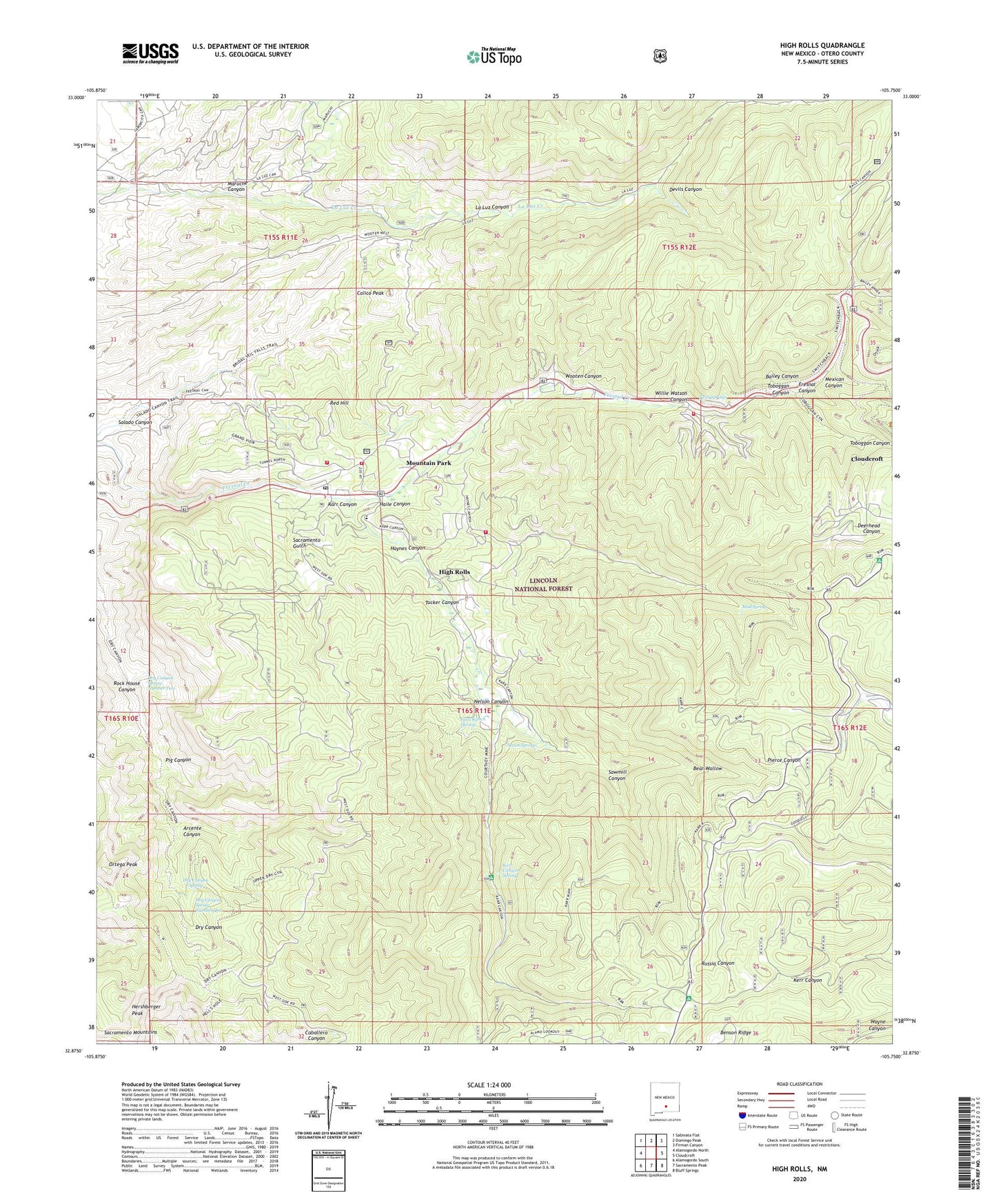
High Rolls New Mexico US Topo Map
Couldn't load pickup availability
Also explore the High Rolls Forest Service Topo of this same quad for updated USFS data
2023 topographic map quadrangle High Rolls in the state of New Mexico. Scale: 1:24000. Based on the newly updated USGS 7.5' US Topo map series, this map is in the following counties: Otero. The map contains contour data, water features, and other items you are used to seeing on USGS maps, but also has updated roads and other features. This is the next generation of topographic maps. Printed on high-quality waterproof paper with UV fade-resistant inks.
Quads adjacent to this one:
West: Alamogordo North
Northwest: Sabinata Flat
North: Domingo Peak
Northeast: Firman Canyon
East: Cloudcroft
Southeast: Bluff Springs
South: Sacramento Peak
Southwest: Alamogordo South
This map covers the same area as the classic USGS quad with code o32105h7.
Contains the following named places: Apache Canyon, Arcente Canyon, Bailey Canyon, Bear Wallow, Black Bear, Burro Flats, Calico Peak, Courtney Mine, Deerhead Canyon, Devils Canyon, Dry Canyon Spring, Dry Canyon Spring Number One, Dry Canyon Spring Number Two, Fresnal Ranger Station, Goat Ranch Spring, Haile Canyon, Haynes Canyon, Hells Hole, Hershberger Peak, High Rolls, High Rolls Census Designated Place, High Rolls Mountain Park Post Office, High Rolls Volunteer Fire Department Forestry Substation, High Rolls Volunteer Fire Department Haynes Canyon Substation, High Rolls Volunteer Fire Department Headquarters, High Rolls Volunteer Fire Department Piney Woods Substation, High Rolls-Mountain Park Methodist Church Historic Site, High Rolls-Mountain Park School, Karr Canyon, Karr Canyon Picnic Area, Karr Canyon Spring, Luz Prospects, Maruche Canyon, Mexican Canyon, Mountain Park, Mountain Park Post Office, Mountain Park Weather Station, Mud Spring, Nelson Canyon, Nelson Vista/Point of Interest, Ortega Peak, Osha Trail, Pig Canyon, Red Hill, Rock House Canyon, Sacramento Gulch, Sawmill Canyon, Seven Springs, Skyline Ranch, Slide Campground, Toboggan Canyon, Trinity Baptist Church, Tucker Canyon, Tunnel Vista, Twin Springs, Warnock Mine, Willie Watson Canyon, Wooten Canyon