MyTopo
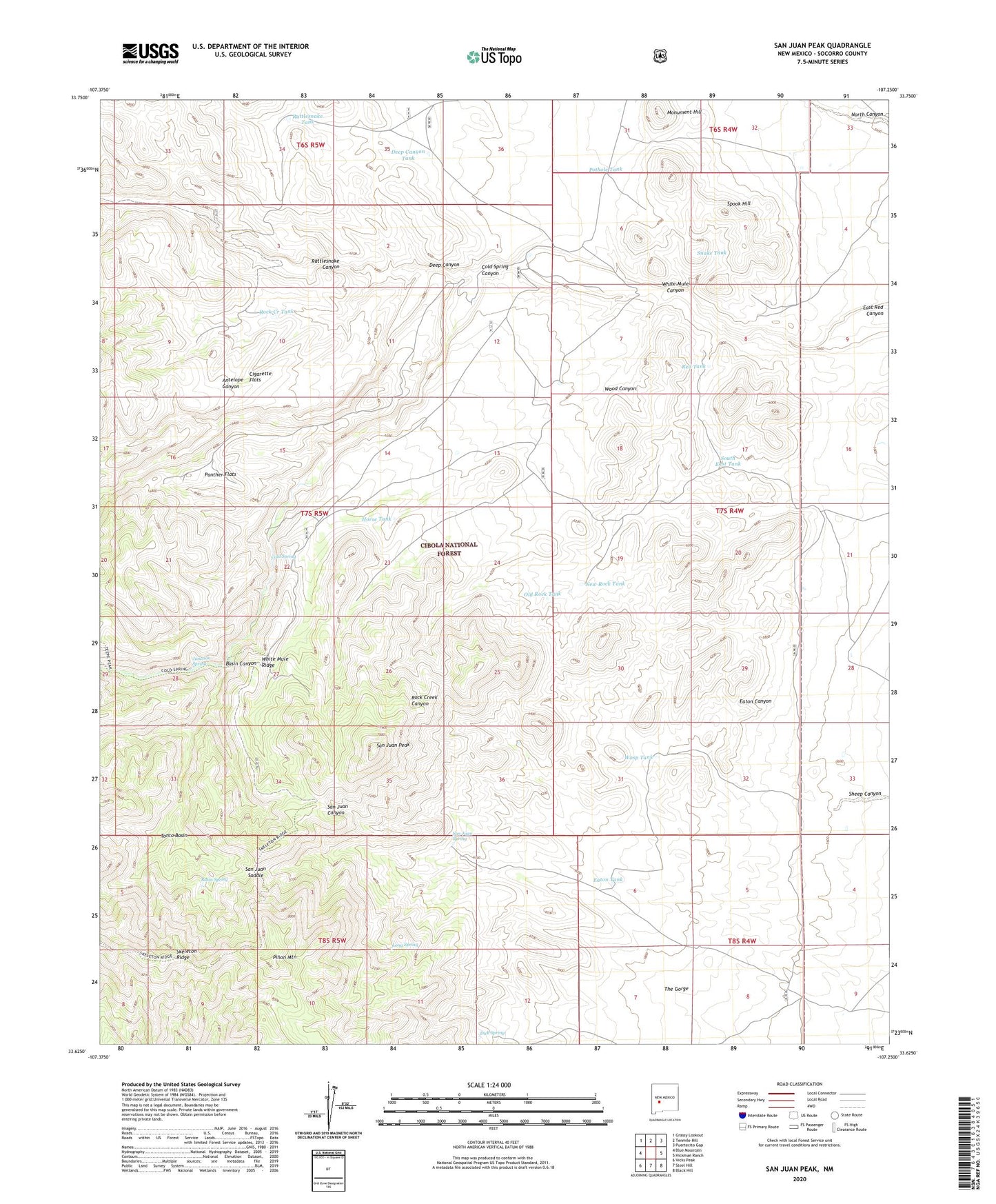
San Juan Peak New Mexico US Topo Map
Couldn't load pickup availability
Also explore the San Juan Peak Forest Service Topo of this same quad for updated USFS data
2023 topographic map quadrangle San Juan Peak in the state of New Mexico. Scale: 1:24000. Based on the newly updated USGS 7.5' US Topo map series, this map is in the following counties: Socorro. The map contains contour data, water features, and other items you are used to seeing on USGS maps, but also has updated roads and other features. This is the next generation of topographic maps. Printed on high-quality waterproof paper with UV fade-resistant inks.
Quads adjacent to this one:
West: Blue Mountain
Northwest: Grassy Lookout
North: Tenmile Hill
Northeast: Puertecito Gap
East: Hickman Ranch
Southeast: Black Hill
South: Steel Hill
Southwest: Vicks Peak
This map covers the same area as the classic USGS quad with code o33107f3.
Contains the following named places: Antelope Canyon, Basin Canyon, Basin Spring, Cigarette Flats, Cold Canyon Windmill, Cold Spring, Cold Spring Canyon, Cold Spring Dam, Deep Canyon, Deep Canyon Tank, Deer Tank, Dick Spring, East Tank, Eaton Tank, Horse Tank, House Water Well, Juan Tank, Junction Spring, Little Well, Long Spring, Monument Hill, New Rock Tank, Ocotillo Tank, Old Rock Tank, Old Tank, Old Tank Corral, Panther Flats, Pinon Mountain, Pothole Tank, Quail Pot Well, Rattlesnake Canyon, Rattlesnake Tank, Red Tank, Rock Creek, Rock Creek Tank, Rock Creek Well, San Juan Corral, San Juan Peak, San Juan Saddle, San Juan Spring, Snake Tank, South East Tank, South Tank, Spook Hill, The Gorge, Tonto Basin, Wasp Tank, Wasp Windmill, White Mule Canyon, White Mule Ridge, Wood Canyon