MyTopo
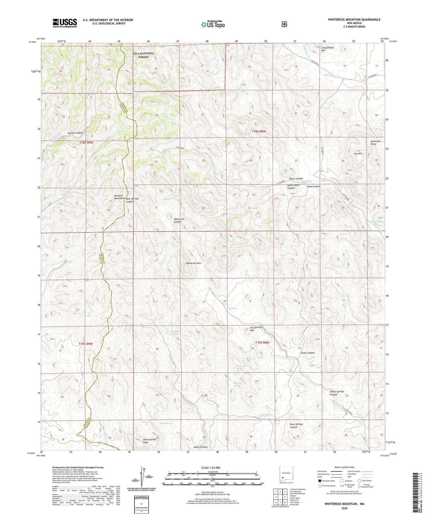
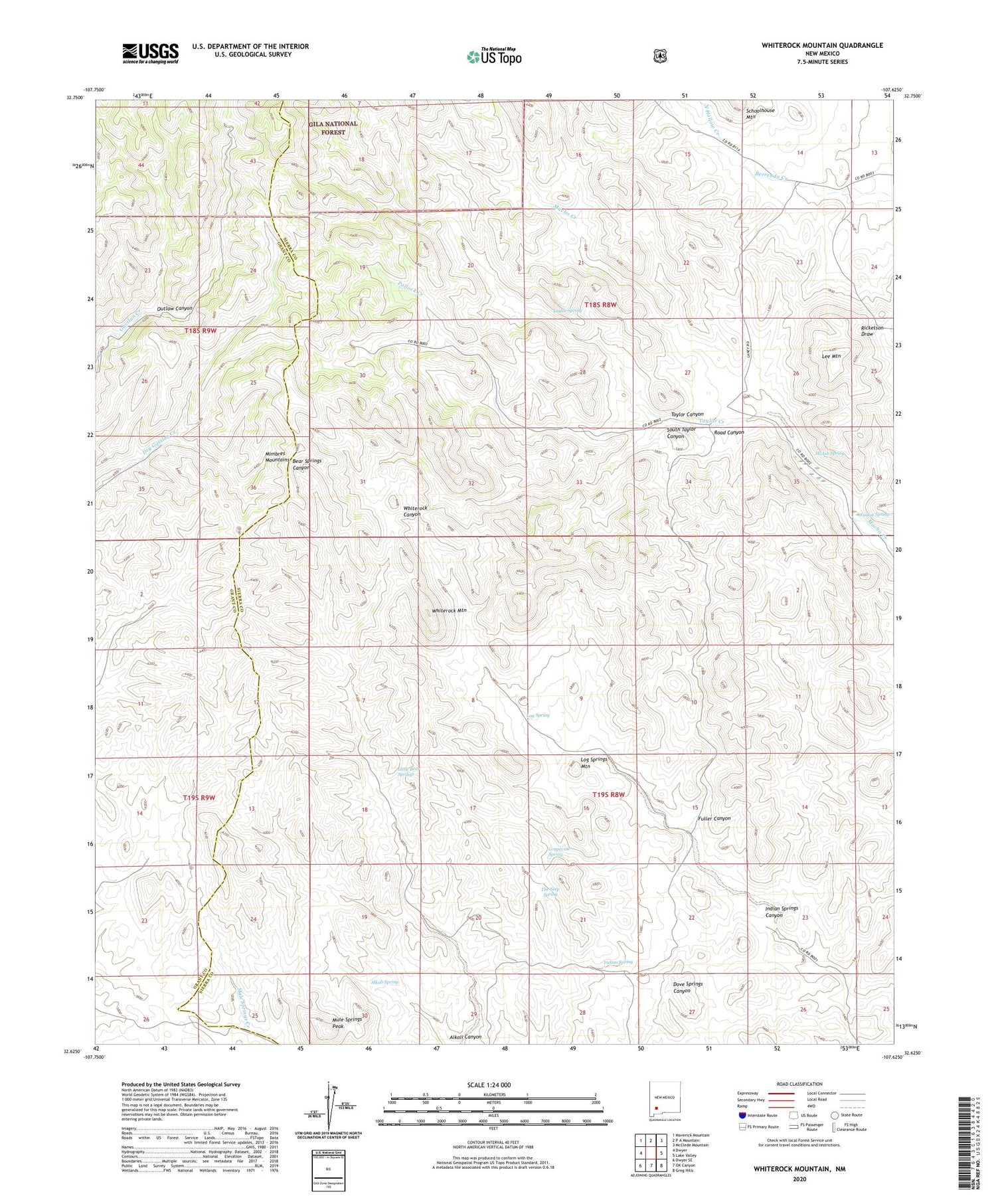
Whiterock Mountain New Mexico US Topo Map
Couldn't load pickup availability
Also explore the Whiterock Mountain Forest Service Topo of this same quad for updated USFS data
2023 topographic map quadrangle Whiterock Mountain in the state of New Mexico. Scale: 1:24000. Based on the newly updated USGS 7.5' US Topo map series, this map is in the following counties: Sierra, Grant. The map contains contour data, water features, and other items you are used to seeing on USGS maps, but also has updated roads and other features. This is the next generation of topographic maps. Printed on high-quality waterproof paper with UV fade-resistant inks.
Quads adjacent to this one:
West: Dwyer
Northwest: Maverick Mountain
North: P A Mountain
Northeast: McClede Mountain
East: Lake Valley
Southeast: Greg Hills
South: OK Canyon
Southwest: Dwyer SE
This map covers the same area as the classic USGS quad with code o32107f6.
Contains the following named places: Alkali Spring, Bear Springs Windmill, Booth Ranch, F Latham Ranch, Fuller Canyon, Grapevine Spring, Indian Spring, Indian Springs Canyon, Lee Mountain, Lightfoot Well, Little Bear Springs, Log Spring, Log Springs Mountain, Macho Well, McAsh Spring, Mule Springs Peak, N Latham Ranch, North Hollow Creek, Outlaw Canyon, Parks Ranch, Pollock Creek, Road Canyon, South Taylor Canyon, T Latham Ranch, Taylor Canyon, Taylor Creek, Taylor Spring, Taylor Tank, Taylor Well, The Seep Spring, Walnut Spring, Whiterock Mountain