
MyTopo
Hardscrabble Mountains New Mexico US Topo Map
Couldn't load pickup availability
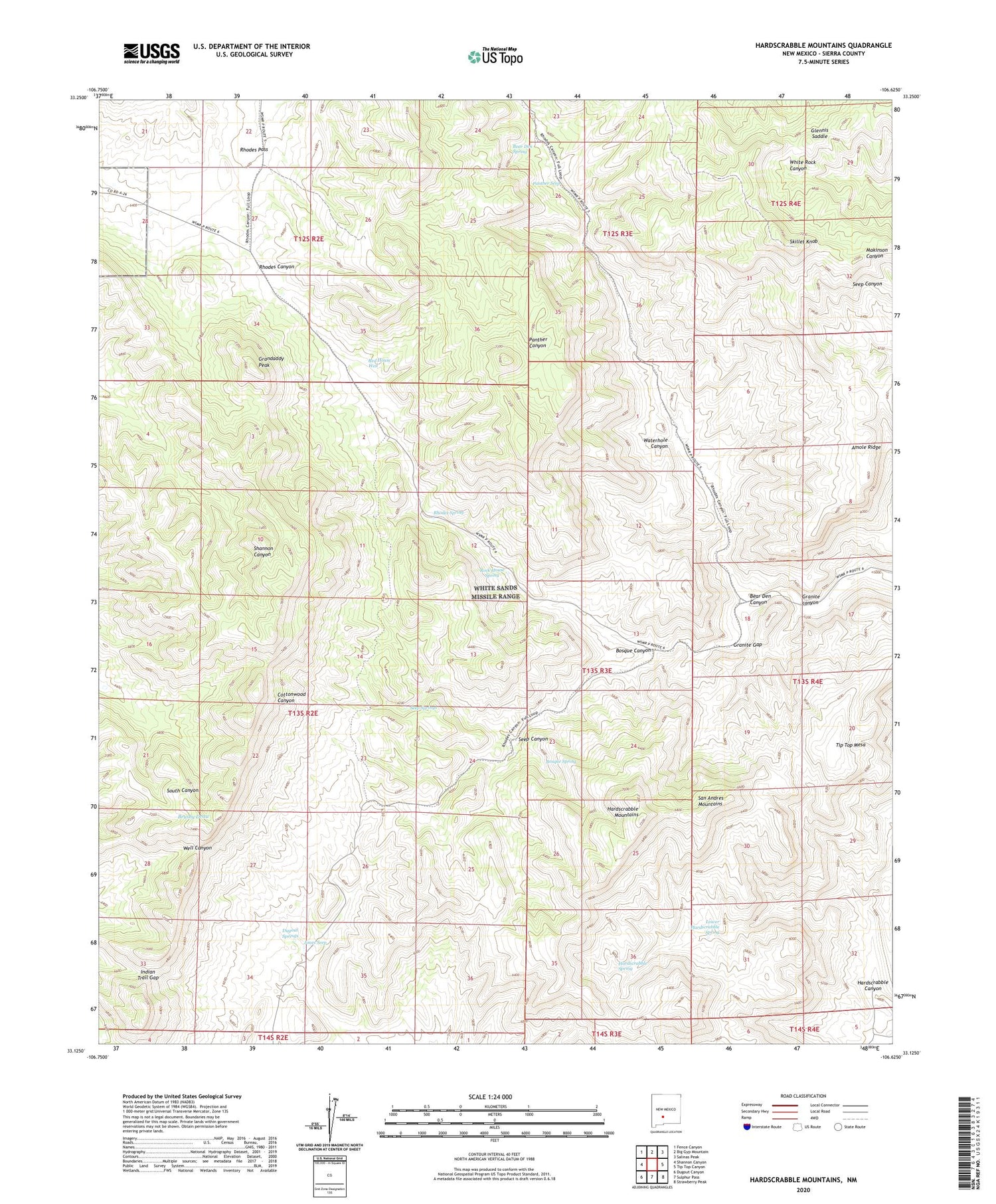
2023 topographic map quadrangle Hardscrabble Mountains in the state of New Mexico. Scale: 1:24000. Based on the newly updated USGS 7.5' US Topo map series, this map is in the following counties: Sierra. The map contains contour data, water features, and other items you are used to seeing on USGS maps, but also has updated roads and other features. This is the next generation of topographic maps. Printed on high-quality waterproof paper with UV fade-resistant inks.
Quads adjacent to this one:
West: Shannon Canyon
Northwest: Fence Canyon
North: Big Gyp Mountain
Northeast: Salinas Peak
East: Tip Top Canyon
Southeast: Strawberry Peak
South: Sulphur Pass
Southwest: Dugout Canyon
This map covers the same area as the classic USGS quad with code o33106b6.
Contains the following named places: Amole Ridge, Bear Den Canyon, Bear Den Spring, Bear Den Tank, Bear Den Well, Black Bear Mine, Black Den Tank, Bosque Canyon, Bosque Spring, Cantrell Well, Dugout Springs, F E Henderson, Fleming Well, Glennis Saddle, Grandaddy Peak, Granite canyon, Granite Gap, Hardin Ranch, Hardscrabble Canyon, Hardscrabble Mountains, Hardscrabble Spring, Hardscrabble Well, Indian Trail Gap, Jones Seep, Lower Hardscrabble Spring, Miller Ranch Headquarters, Panther Canyon, Panther Seep, Potter Ranch, Potter Ranch Headquarters, Red Hill Well, Red House Well, Rhodes Pass, Rhodes Spring, Rock House Spring, Seep Canyon, Seep Springs, Skillet Knob, Tip Top Mesa, Towner Well, Waterhole Canyon


