
MyTopo
Tip Top Canyon New Mexico US Topo Map
Couldn't load pickup availability
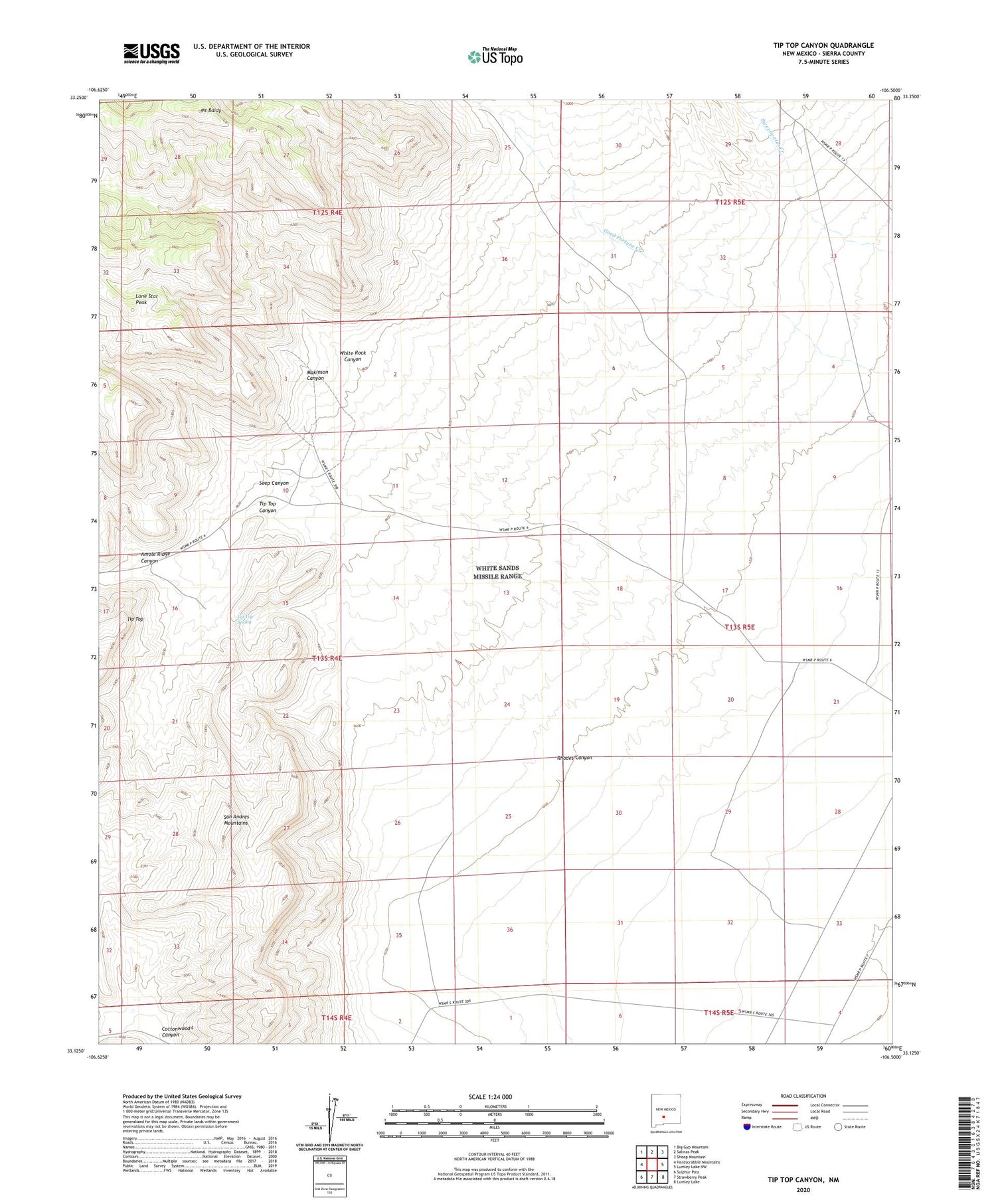
2023 topographic map quadrangle Tip Top Canyon in the state of New Mexico. Scale: 1:24000. Based on the newly updated USGS 7.5' US Topo map series, this map is in the following counties: Sierra. The map contains contour data, water features, and other items you are used to seeing on USGS maps, but also has updated roads and other features. This is the next generation of topographic maps. Printed on high-quality waterproof paper with UV fade-resistant inks.
Quads adjacent to this one:
West: Hardscrabble Mountains
Northwest: Big Gyp Mountain
North: Salinas Peak
Northeast: Sheep Mountain
East: Lumley Lake NW
Southeast: Lumley Lake
South: Strawberry Peak
Southwest: Sulphur Pass
This map covers the same area as the classic USGS quad with code o33106b5.
Contains the following named places: Amole Ridge Canyon, Gem Group, Henderson Ranch, Lone Star Peak, Makinson Canyon, Middle Well, Mount Baldy, Rhodes Canyon, Ridner Tank, Rigon Tanks, Seep Canyon, South Well, Tip Top, Tip Top Canyon, Tip Top Spring, Tip Top Tank, Twin Tanks, Valle Vista, White Rock Canyon, White Rock Well


