MyTopo
Hillsboro Peak New Mexico US Topo Map
Couldn't load pickup availability
Also explore the Hillsboro Peak Forest Service Topo of this same quad for updated USFS data
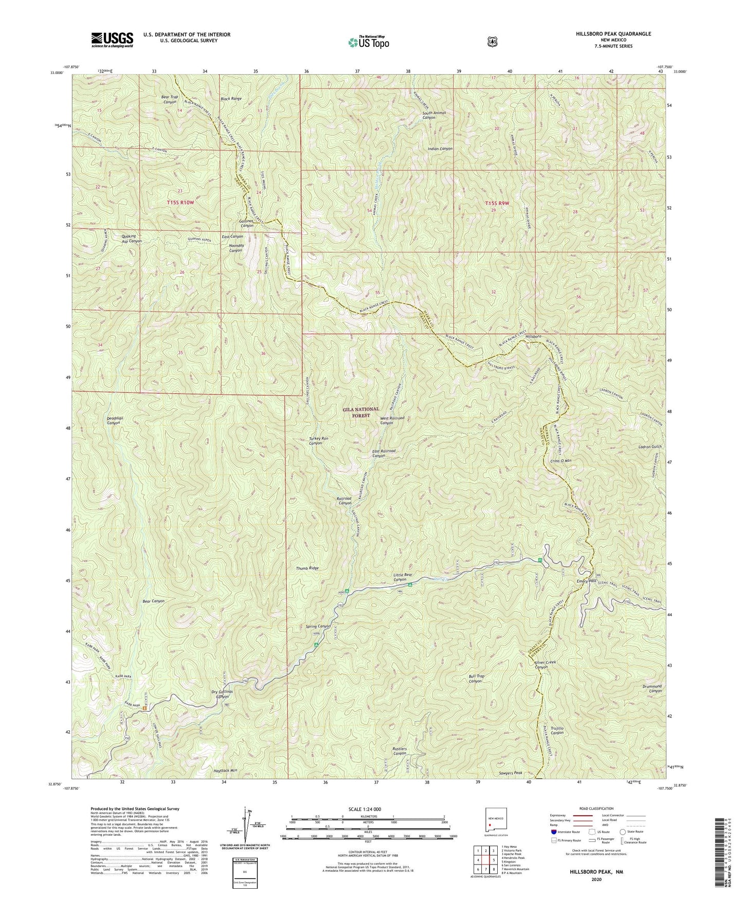
2023 topographic map quadrangle Hillsboro Peak in the state of New Mexico. Scale: 1:24000. Based on the newly updated USGS 7.5' US Topo map series, this map is in the following counties: Grant, Sierra. The map contains contour data, water features, and other items you are used to seeing on USGS maps, but also has updated roads and other features. This is the next generation of topographic maps. Printed on high-quality waterproof paper with UV fade-resistant inks.
Quads adjacent to this one:
West: Hendricks Peak
Northwest: Hay Mesa
North: Victorio Park
Northeast: Apache Peak
East: Kingston
Southeast: P A Mountain
South: Maverick Mountain
Southwest: San Lorenzo
This map covers the same area as the classic USGS quad with code o32107h7.
Contains the following named places: Bear Canyon, Cross-O Mountain, Deadman Canyon, Dry Gallinas Canyon, East Railroad Canyon, Emory Pass, Emory Pass Historical Marker, Emory Pass Vista Campground, Gallinas Recreation Area, Grandview Mines, Hillsboro, Hillsboro Peak Lookoout, Indian Canyon, Iron Creek, Iron Creek Campground, Little Bear Canyon, Mineral Mountain Mine, Old Government Trail, Railroad Campground, Railroad Canyon, Rustlers Canyon, Sawyers Peak, Silver Creek Canyon, South Animas Canyon, Spring Canyon, Thumb Ridge, Turkey Run Canyon, Upper Gallinas Campground, West Railroad Canyon, Wrights Cabin Campground