MyTopo
Las Nutrias New Mexico US Topo Map
Couldn't load pickup availability
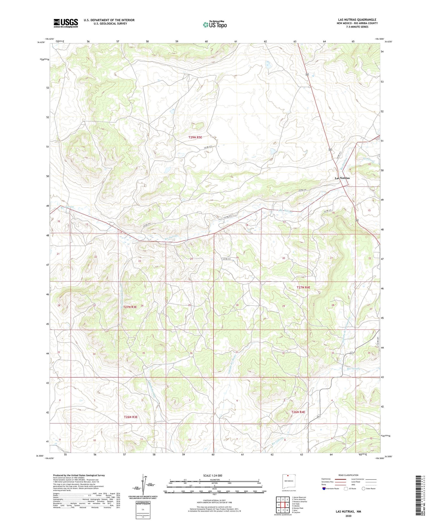
2023 topographic map quadrangle Las Nutrias in the state of New Mexico. Scale: 1:24000. Based on the newly updated USGS 7.5' US Topo map series, this map is in the following counties: Rio Arriba. The map contains contour data, water features, and other items you are used to seeing on USGS maps, but also has updated roads and other features. This is the next generation of topographic maps. Printed on high-quality waterproof paper with UV fade-resistant inks.
Quads adjacent to this one:
West: El Vado
Northwest: Heron Reservoir
North: Tierra Amarilla
Northeast: Penasco Amarillo
East: Cebolla
Southeast: Canjilon
South: Alire
Southwest: Navajo Peak
This map covers the same area as the classic USGS quad with code o36106e5.
Contains the following named places: Canada de la Lagunita, Canada del Policarpo, Canada Sanchez, Cebolla Church, Duran, Las Nutrias, Lower Nutrias School, Nutrias, Santa Rita Church, Terrero Creek, ZIP Code: 87518