MyTopo
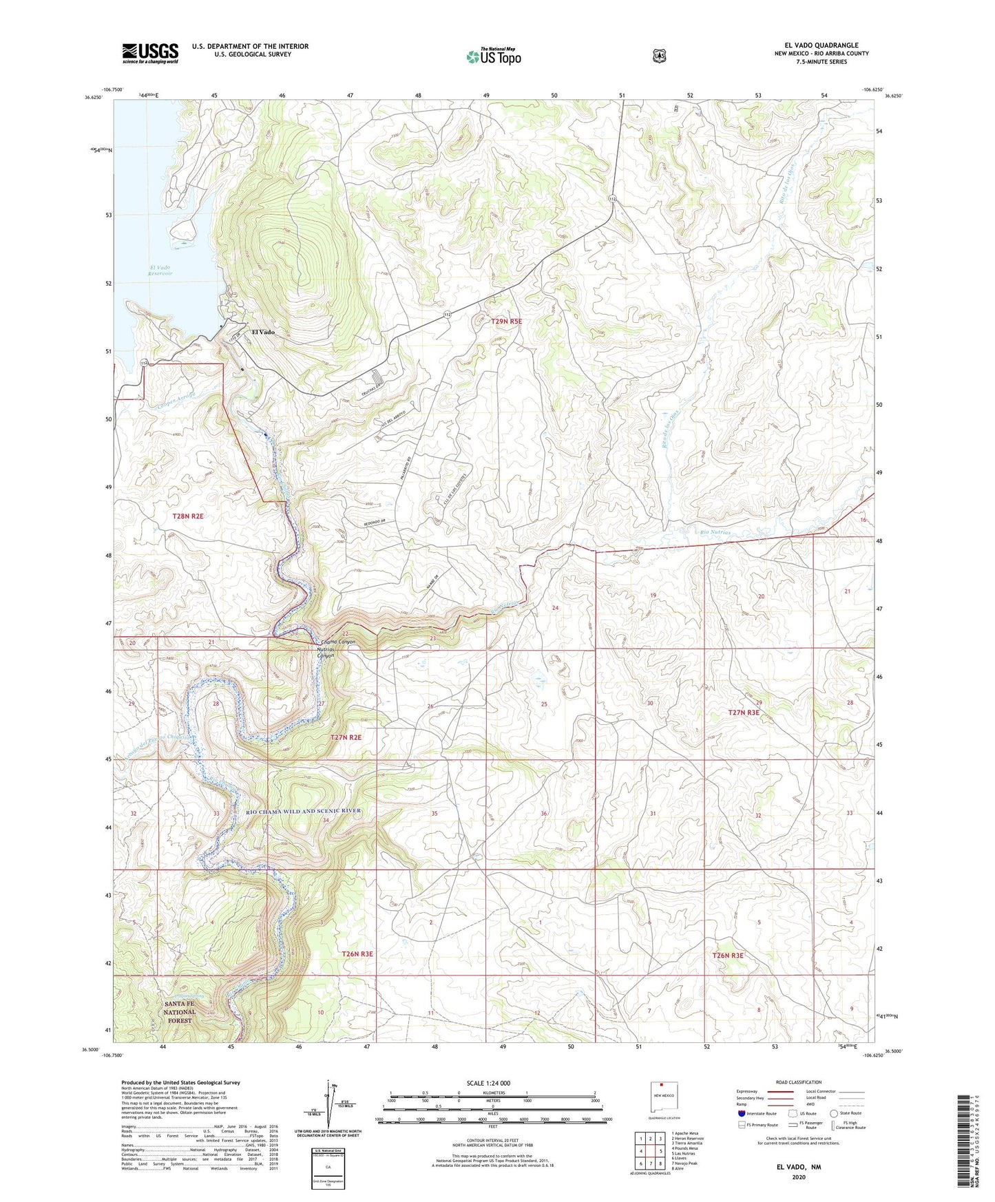
El Vado New Mexico US Topo Map
Couldn't load pickup availability
Also explore the El Vado Forest Service Topo of this same quad for updated USFS data
2023 topographic map quadrangle El Vado in the state of New Mexico. Scale: 1:24000. Based on the newly updated USGS 7.5' US Topo map series, this map is in the following counties: Rio Arriba. The map contains contour data, water features, and other items you are used to seeing on USGS maps, but also has updated roads and other features. This is the next generation of topographic maps. Printed on high-quality waterproof paper with UV fade-resistant inks.
Quads adjacent to this one:
West: Pounds Mesa
Northwest: Apache Mesa
North: Heron Reservoir
Northeast: Tierra Amarilla
East: Las Nutrias
Southeast: Alire
South: Navajo Peak
Southwest: Llaves
This map covers the same area as the classic USGS quad with code o36106e6.
Contains the following named places: Aragon Spring, Archuleta Ranch, Arroyo del Puerto Chiquito, Barb, Cooper Arroyo, El Teromote, El Vado, El Vado Dam, El Vado Lake State Park, El Vado Post Office, El Vado Weather Station, Nutrias Canyon, Rio Arriba County, Rio Nutrias, Rito de los Ojos, Shale Point, Tierra Amarilla Air Force Station, Ward Ranch, Wright Place