MyTopo
Holloman New Mexico US Topo Map
Couldn't load pickup availability
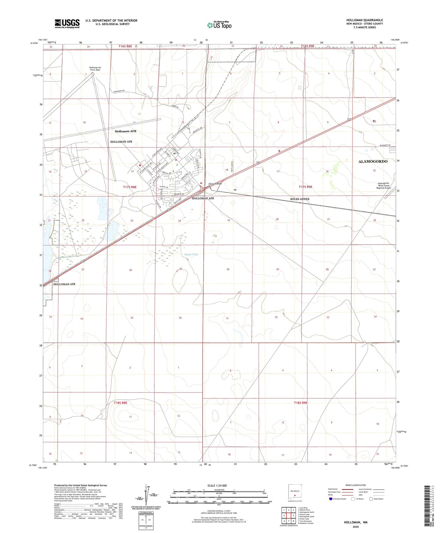
2023 topographic map quadrangle Holloman in the state of New Mexico. Scale: 1:24000. Based on the newly updated USGS 7.5' US Topo map series, this map is in the following counties: Otero. The map contains contour data, water features, and other items you are used to seeing on USGS maps, but also has updated roads and other features. This is the next generation of topographic maps. Printed on high-quality waterproof paper with UV fade-resistant inks.
Quads adjacent to this one:
West: Garton Lake
Northwest: Lost River
North: Malone Draw
Northeast: Alamogordo North
East: Alamogordo South
Southeast: Deadman Canyon
South: Tres Hermanos
Southwest: Foster Lake
This map covers the same area as the classic USGS quad with code o32106g1.
Contains the following named places: 10048 Water Well, 88330, Alamo West Fire Rescue Station 2, Arrington Tank, Brownfield Well, Chaplains-Holloman Air Force Base Church, Dagger Tank, Dillard Draw, Dillard Well, Harrington Well, Holloman Air Force Base, Holloman Air Force Base Census Designated Place, Holloman Air Force Base Library, Holloman Air Force Base Post Office, Holloman Fire and Emergency Services Department of Defense Station 1, Holloman Fire and Emergency Services Department of Defense Station 1 Headquarters, Holloman Fire and Emergency Services Department of Defense Station 3, Holloman Post Office, Huss Well, Kennedy Tank, Mogee Tank, Monista, Prather Water Well, Red Arroyo, Red Barn Well, United States Air Force Hospital Library, US Air Force Hospital Library