MyTopo
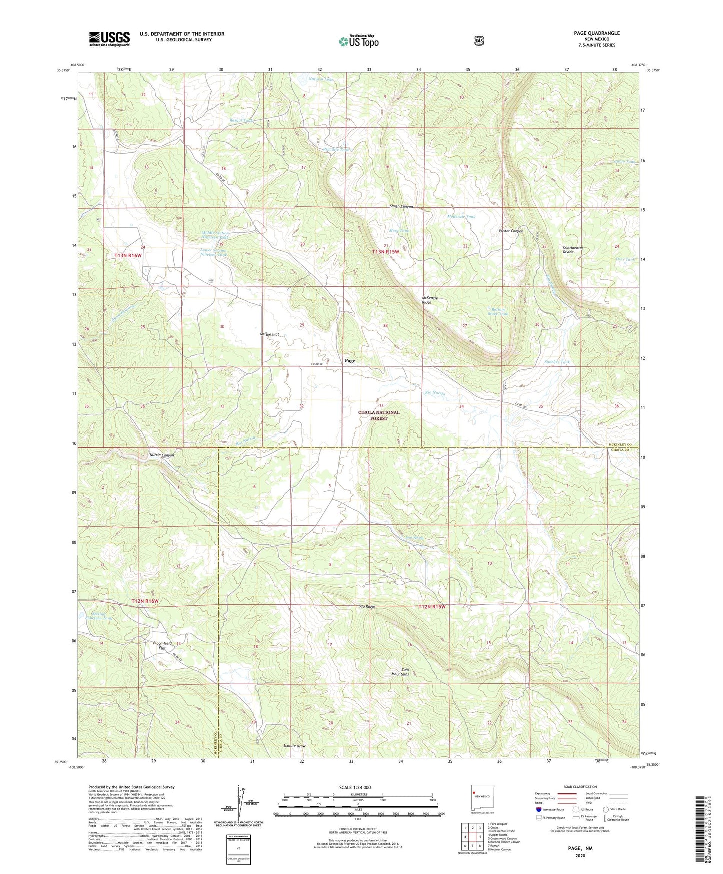
Page New Mexico US Topo Map
Couldn't load pickup availability
Also explore the Page Forest Service Topo of this same quad for updated USFS data
2023 topographic map quadrangle Page in the state of New Mexico. Scale: 1:24000. Based on the newly updated USGS 7.5' US Topo map series, this map is in the following counties: McKinley, Cibola. The map contains contour data, water features, and other items you are used to seeing on USGS maps, but also has updated roads and other features. This is the next generation of topographic maps. Printed on high-quality waterproof paper with UV fade-resistant inks.
Quads adjacent to this one:
West: Upper Nutria
Northwest: Fort Wingate
North: Ciniza
Northeast: Continental Divide
East: Cottonwood Canyon
Southeast: Kettner Canyon
South: Ramah
Southwest: Burned Timber Canyon
This map covers the same area as the classic USGS quad with code o35108c4.
Contains the following named places: Basgal Place, Basgal Tank, Bear Spring, Bloomfield Flat, Blue Tank, Boon Place, Bottom Stock Tank, Deer Tank, Grubisich Place, Hausner Tank One, Hausner Tank Three, Hausner Tank Two, Lower Section Nineteen Tank, McKenzie Ridge, McKenzie Tank, McQue Flat, Merrill Place, Mesa Tank, Middle Section Nineteen Tank, Natural Lake, Navarre Place, Page, Page Post Office, Polich Place, Radosevich Ranch, Rim Site Tank, Sanchez Place, Sanchez Tank, Section Fourteen Tank, Silva Ranch, Stump Tank, Upper Section Nineteen Tank, ZIP Code: 87316