MyTopo
Alegres Mountain New Mexico US Topo Map
Couldn't load pickup availability
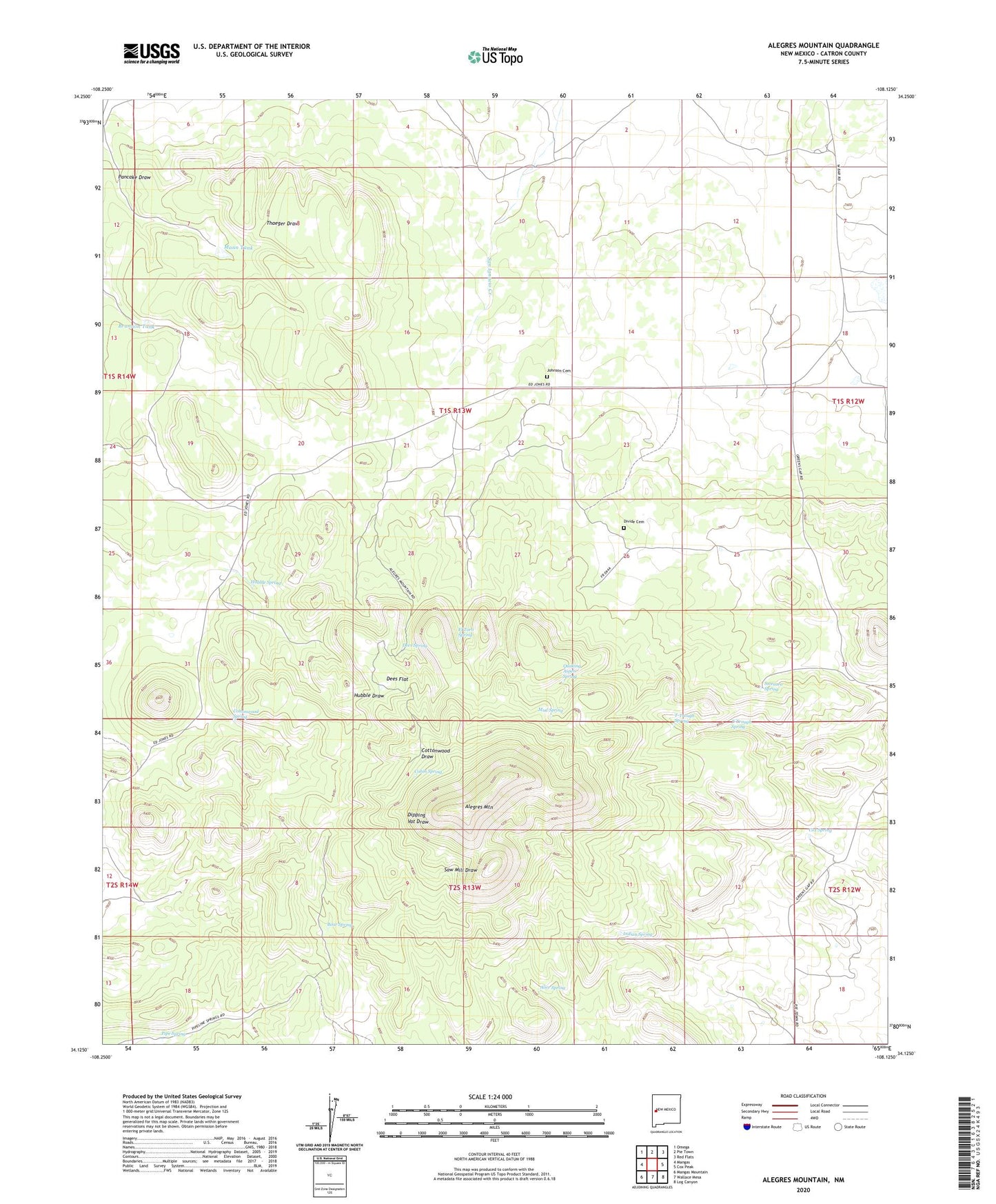
2023 topographic map quadrangle Alegres Mountain in the state of New Mexico. Scale: 1:24000. Based on the newly updated USGS 7.5' US Topo map series, this map is in the following counties: Catron. The map contains contour data, water features, and other items you are used to seeing on USGS maps, but also has updated roads and other features. This is the next generation of topographic maps. Printed on high-quality waterproof paper with UV fade-resistant inks.
Quads adjacent to this one:
West: Mangas
Northwest: Omega
North: Pie Town
Northeast: Red Flats
East: Cox Peak
Southeast: Log Canyon
South: Wallace Mesa
Southwest: Mangas Mountain
This map covers the same area as the classic USGS quad with code o34108b2.
Contains the following named places: Alegres Mountain, Alice Spring, Bear Spring, Brannon Tank, Cabin Spring, Cottonwood Spring, Cox Spring, Dees Flat, Dees Spring, Divide Cemetery, El Toro Spring, Garnett, Hubble Spring, Indian Spring, Johnson Cemetery, Mann Tank, Mud Spring, Pancake Well, Pipe Spring, Quaking Aspen Spring, South Well, Sweazea Spring, T-Trough Spring, Uranium Well, W Bar Ranch