MyTopo
McClede Mountain New Mexico US Topo Map
Couldn't load pickup availability
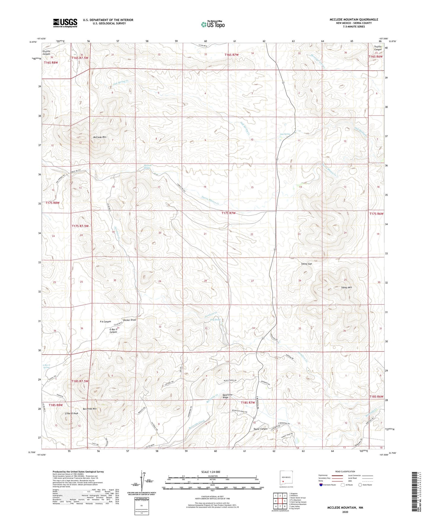
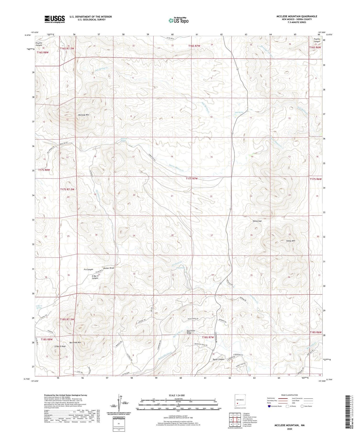
2020 topographic map quadrangle McClede Mountain in the state of New Mexico. Scale: 1:24000. Based on the newly updated USGS 7.5' US Topo map series, this map is in the following counties: Sierra. The map contains contour data, water features, and other items you are used to seeing on USGS maps, but also has updated roads and other features. This is the next generation of topographic maps. Printed on high-quality waterproof paper with UV fade-resistant inks.
Quads adjacent to this one:
West: P A Mountain
Northwest: Kingston
North: Hillsboro
Northeast: Skute Stone Arroyo
East: Clark Spring Canyon
Southeast: Jug Canyon
South: Lake Valley
Southwest: Whiterock Mountain
Contains the following named places: Berrenda Mountain, Decker Draw, Dry Draw, E Nunn Ranch, McClede Mountain, McClede Spring, McGregor Ranch, O Bar O Canyon, O Bar O Peak, O Bar O Spring, Oak Spring, Oak Spring Creek, P A Canyon, Sibley Gap, Sibley Mountain, Wilson Ranch, ZIP Code: 88042