MyTopo
P A Mountain New Mexico US Topo Map
Couldn't load pickup availability
Also explore the P A Mountain Forest Service Topo of this same quad for updated USFS data
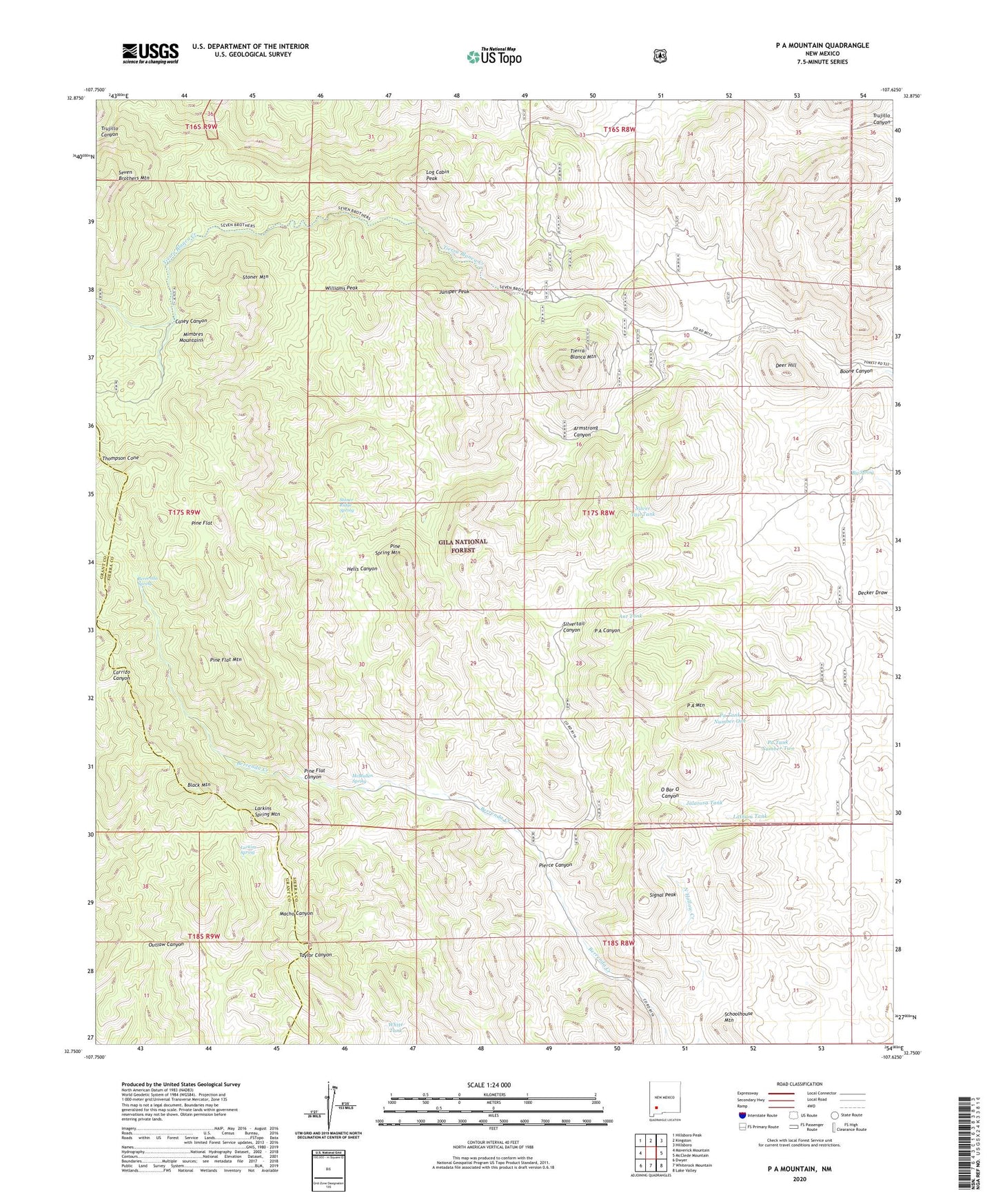
2023 topographic map quadrangle P A Mountain in the state of New Mexico. Scale: 1:24000. Based on the newly updated USGS 7.5' US Topo map series, this map is in the following counties: Sierra, Grant. The map contains contour data, water features, and other items you are used to seeing on USGS maps, but also has updated roads and other features. This is the next generation of topographic maps. Printed on high-quality waterproof paper with UV fade-resistant inks.
Quads adjacent to this one:
West: Maverick Mountain
Northwest: Hillsboro Peak
North: Kingston
Northeast: Hillsboro
East: McClede Mountain
Southeast: Lake Valley
South: Whiterock Mountain
Southwest: Dwyer
This map covers the same area as the classic USGS quad with code o32107g6.
Contains the following named places: Ant Tank, Armstrong Canyon, Beardog Mine, Berrenda Spring, Big Japanese Mine, Big Spring, Black Mountain, Blue Bell Number Two, Boone Canyon, Casey Canyon, Cottonwood Creek, Deer Hill, Hells Canyon, Hornet Group, Jalarosa Tank, Japanese Mine, Jayhawk Group, Juniper Peak, Larkins Spring, Larkins Spring Mountain, Latham Iron Mine, Lathum Tank, Lockwood Well, Log Cabin, Log Cabin Peak, Lookout, Mackey Ranch, McMullen Spring, Mimbres Mountains, P A Mountain, Pa Tank Number One, Pa Tank Number Two, Patton Creek, Pierce Canyon, Pine Flat, Pine Flat Canyon, Pine Flat Mountain, Pine Spring Mountain, Schoolhouse Mountain, Signal Peak, Silver Tail, Silver Tail Tank, Silver Top, Silvertail Canyon, Silvertail Mine, Standard Metal Mine, Stoner Creek, Stoner Mountain, Stoner Ridge Spring, Tierra Blanca Mountain, Tierra Blanca Ranch, Toggery Mine, Uncle Lewis Well, Upper Macho Windmill, Upper Trap Corral, White Tank, Williams Peak