MyTopo
McWilliams Canyon New Mexico US Topo Map
Couldn't load pickup availability
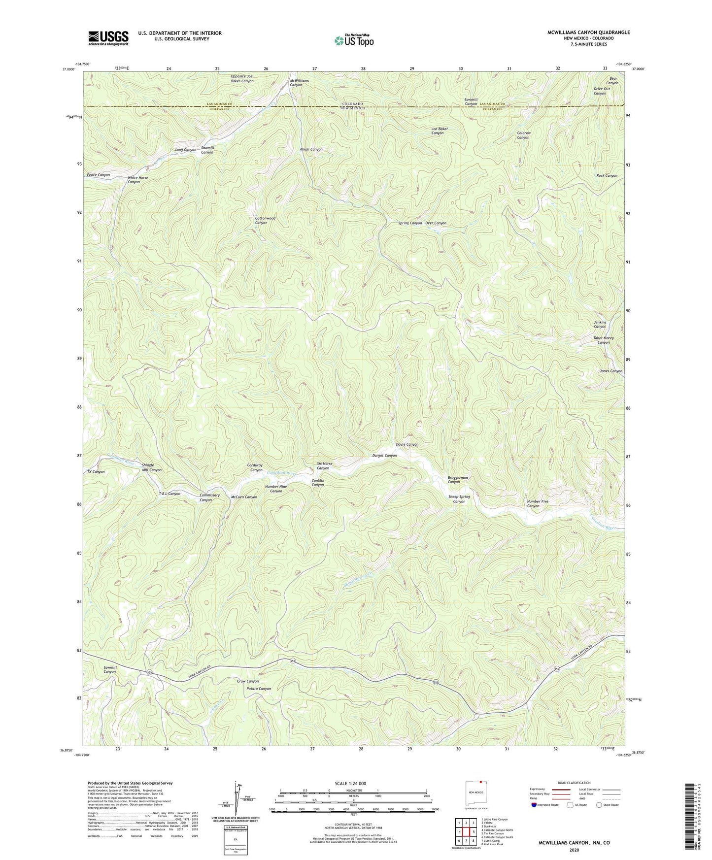
2023 topographic map quadrangle McWilliams Canyon in the states of New Mexico, Colorado. Scale: 1:24000. Based on the newly updated USGS 7.5' US Topo map series, this map is in the following counties: Colfax, Las Animas. The map contains contour data, water features, and other items you are used to seeing on USGS maps, but also has updated roads and other features. This is the next generation of topographic maps. Printed on high-quality waterproof paper with UV fade-resistant inks.
Quads adjacent to this one:
West: Caliente Canyon North
Northwest: Little Pine Canyon
North: Valdez
Northeast: Starkville
East: Tin Pan Canyon
Southeast: Red River Peak
South: Curtis Camp
Southwest: Caliente Canyon South
This map covers the same area as the classic USGS quad with code o36104h6.
Contains the following named places: Alkali Canyon, Bruggerman Canyon, Commissary Canyon, Conklin Canyon, Corduroy Canyon, Cottonwood Canyon, Dargot Canyon, Deer Canyon, Doyle Canyon, Drive Out Canyon, Fence Canyon, Jenkins Canyon, Jones Canyon, McCuen Canyon, McWilliams Canyon, Number Eight Canyon, Number Five Canyon, Number Nine Canyon, Sawmill Canyon, Sheep Spring Canyon, Sheep Spring Creek, Shingle Mill Canyon, Six Horse Canyon, Spring Canyon, T B L Canyon, Taber Morey Canyon, TX Canyon, White Horse Canyon