MyTopo
Valdez Colorado US Topo Map
Couldn't load pickup availability
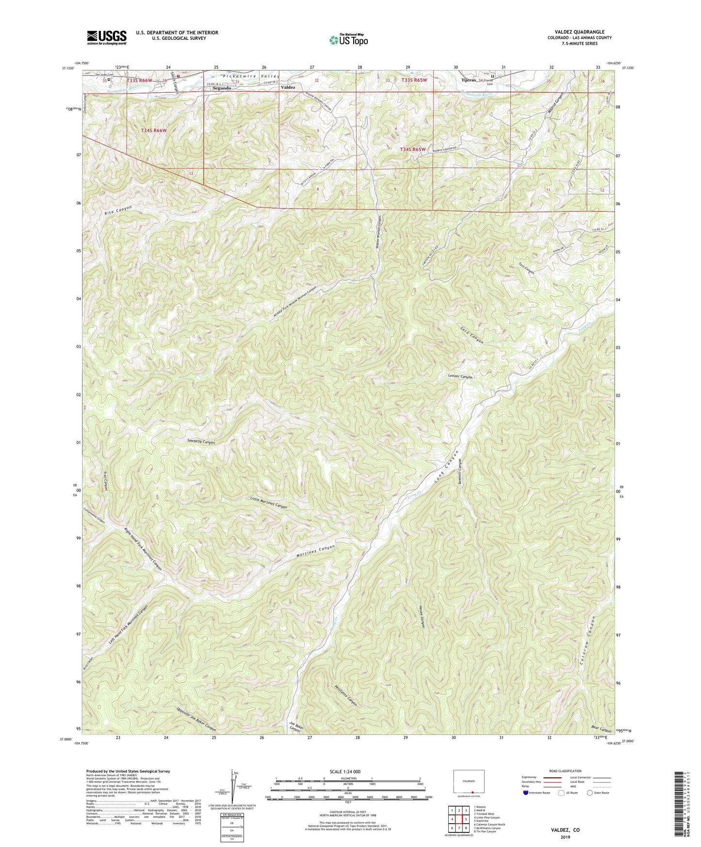
2022 topographic map quadrangle Valdez in the state of Colorado. Scale: 1:24000. Based on the newly updated USGS 7.5' US Topo map series, this map is in the following counties: Las Animas. The map contains contour data, water features, and other items you are used to seeing on USGS maps, but also has updated roads and other features. This is the next generation of topographic maps. Printed on high-quality waterproof paper with UV fade-resistant inks.
Quads adjacent to this one:
West: Little Pine Canyon
Northwest: Weston
North: Madrid
Northeast: Trinidad West
East: Starkville
Southeast: Tin Pan Canyon
South: McWilliams Canyon
Southwest: Caliente Canyon North
This map covers the same area as the classic USGS quad with code o37104a6.
Contains the following named places: Bear Canyon, Blind Canyon, Burro Canyon, Cordova Canyon, Cottonwood Canyon, Frederick Mine, Gunbarrel Canyon, House Canyon, Joe Baker Canyon, Left Hand Fork Martinez Canyon, Leonor Canyon, Little Martinez Canyon, Madrid Plaza Mine, Martinez Canyon, Middle Fork Widow Woman Canyon, Opposite Joe Baker Canyon, Parsons Cow Camp, Penitente Canyon, Right Hand Fork Martinez Canyon, Rita Canyon, Rock Canyon, San Juan Cemetery, Sawmill Canyon, Seco Canyon, Segundo Census Designated Place, Sequndo, Smith Canyon, Sowbelly Canyon, Stonewall Fire Protection District Segundo Station, Tijeras Cemetery, Tijeras Ditch, Toro Canyon, Trail Canyon, Valdez, Valdez Census Designated Place, Widow Woman Canyon