
MyTopo
La Jara Peak New Mexico US Topo Map
Couldn't load pickup availability
Also explore the La Jara Peak Forest Service Topo of this same quad for updated USFS data
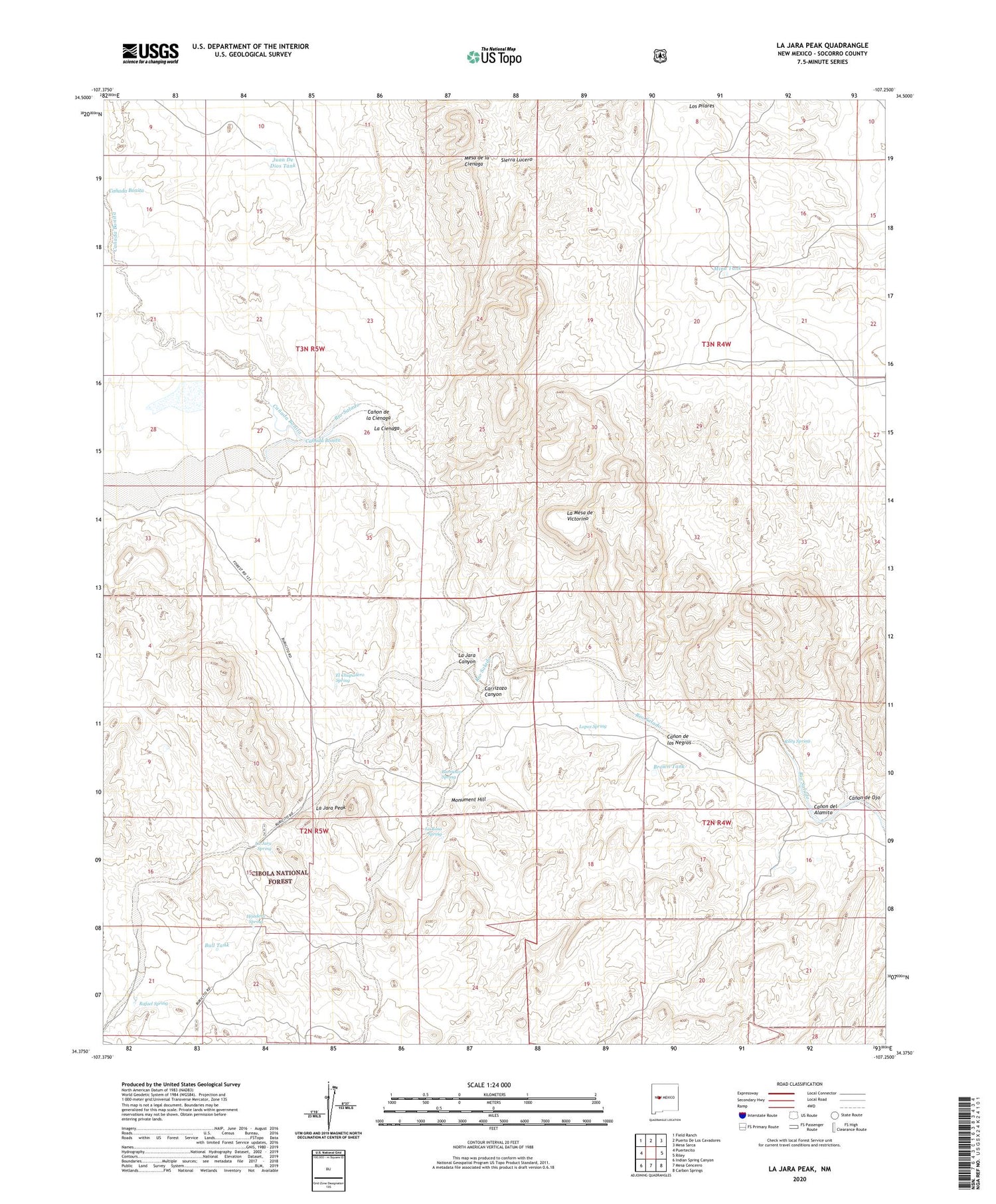
2023 topographic map quadrangle La Jara Peak in the state of New Mexico. Scale: 1:24000. Based on the newly updated USGS 7.5' US Topo map series, this map is in the following counties: Socorro. The map contains contour data, water features, and other items you are used to seeing on USGS maps, but also has updated roads and other features. This is the next generation of topographic maps. Printed on high-quality waterproof paper with UV fade-resistant inks.
Quads adjacent to this one:
West: Puertecito
Northwest: Field Ranch
North: Puerto De Los Cavadores
Northeast: Mesa Sarca
East: Riley
Southeast: Carbon Springs
South: Mesa Cencerro
Southwest: Indian Spring Canyon
This map covers the same area as the classic USGS quad with code o34107d3.
Contains the following named places: Alamito Well, Barranco Spring, Benjamin Ranch, Brown Tank, Bull Pasture Corral, Bull Tank, Canada Bonita, Canon de la Cienaga, Canon de los Negros, Canon de Ojo, Canon del Alamito, Carrizozo Canyon, El Chupadero Spring, Helen, Hijadero Spring, Juan De Dios Tank, Katherine, La Cienaga, La Jara Canyon, La Jara Peak, La Jara Spring, La Mesa de Victorino, La Rosa Spring, Lopez Spring, Los Pilares, Mina Tank, Monument Hill, Rafael Spring, Rancho de los Chavez, Riley Spring, Romero


