MyTopo
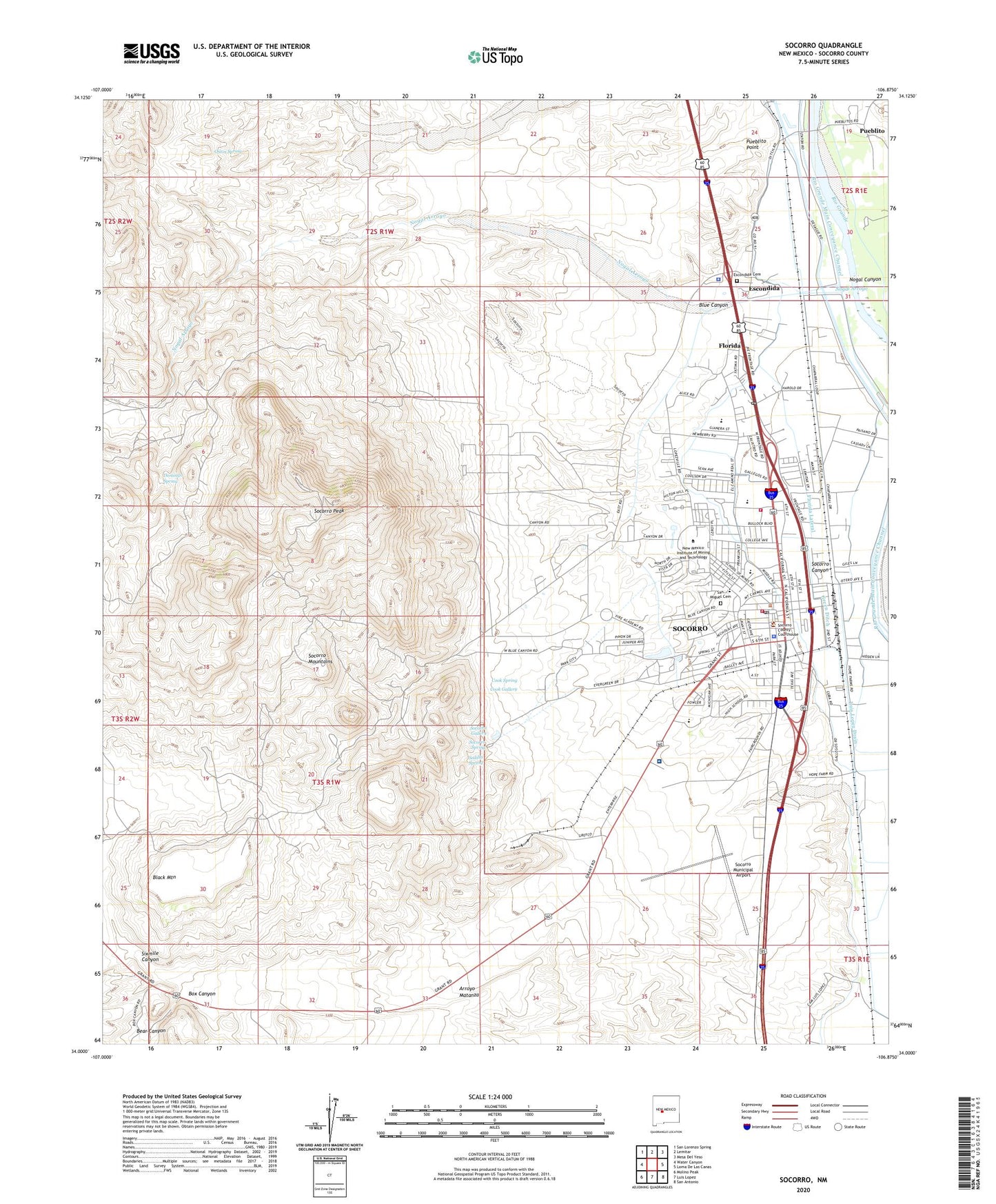
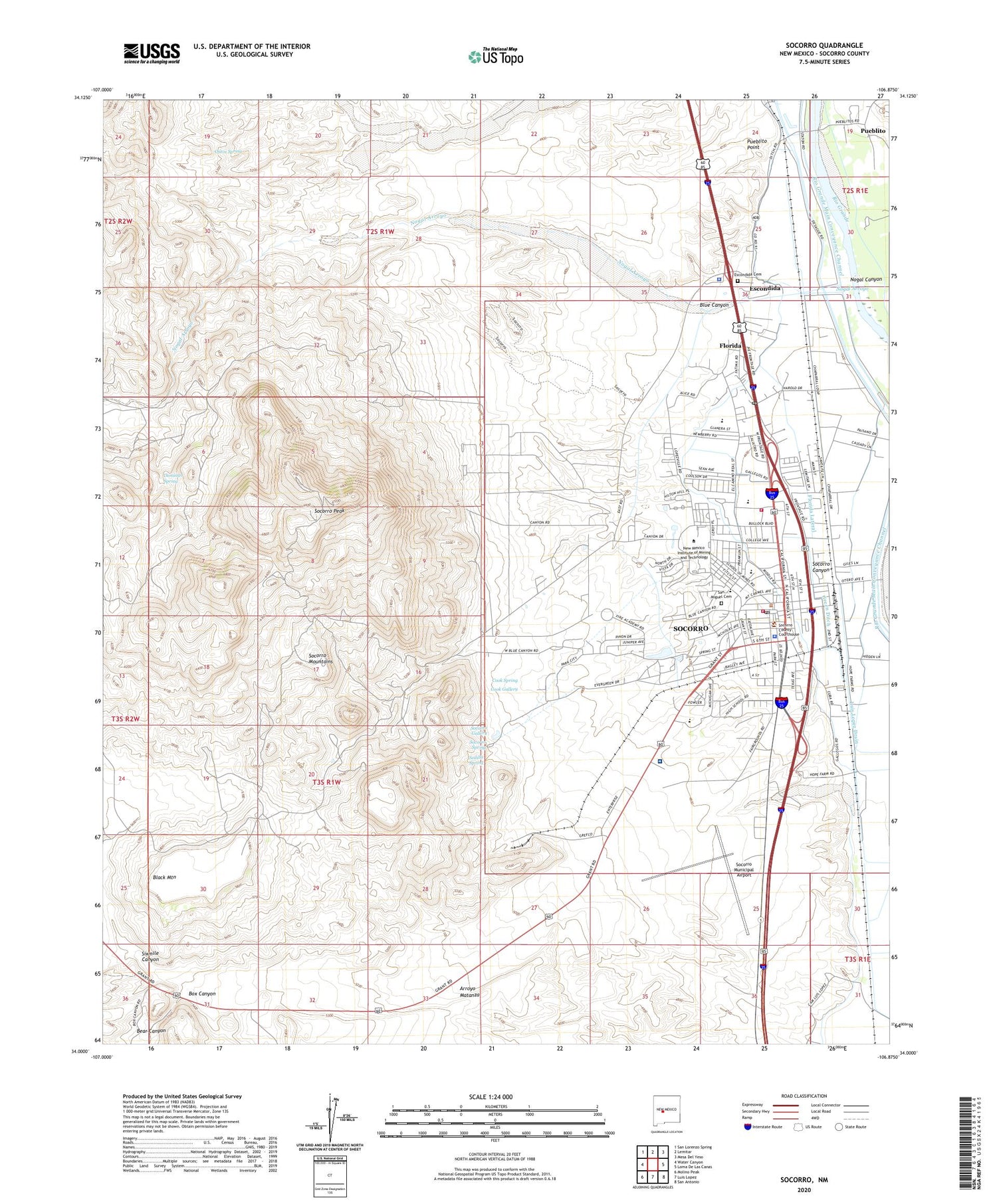
Socorro New Mexico US Topo Map
Couldn't load pickup availability
2023 topographic map quadrangle Socorro in the state of New Mexico. Scale: 1:24000. Based on the newly updated USGS 7.5' US Topo map series, this map is in the following counties: Socorro. The map contains contour data, water features, and other items you are used to seeing on USGS maps, but also has updated roads and other features. This is the next generation of topographic maps. Printed on high-quality waterproof paper with UV fade-resistant inks.
Quads adjacent to this one:
West: Water Canyon
Northwest: San Lorenzo Spring
North: Lemitar
Northeast: Mesa Del Yeso
East: Loma De Las Canas
Southeast: San Antonio
South: Luis Lopez
Southwest: Molino Peak
This map covers the same area as the classic USGS quad with code o34106a8.
Contains the following named places: A G Torres House, Abeytia Aniceto House Historic Site, Aerojet Building, Alvarea Briggs House Historic Site, Anastacio Sedillo House, Animal Care Facility, Anthony Cortsey House Historic Site, Array Operations Center Building, Atchison Topeka and Santa Fe Railway Depot Historic Site, August Holver Hilton House Historic Site, Baca Hall, Bear Canyon, Billing Smelter Historic Site, Black Mountain, Blue Canyon, Blue Canyon Well, Boarding House Tunnel, Bourguignon House Historic Site, Box Canyon, Brown Hall, Brown Hall Historic Site, Brown House Historic Site, Brown Lateral, Bursum House Historic Site, Byerts Tunnel, Capitan Michael Cooney House, Chama House Historic Site, Chihuahua Historic District, Church of Christ, Church of San Miguel Historic Site, Church of the Epiphany Historic Site, Church-McCutcheon Historic District, City of Socorro, Cook Gallery, Cook Spring, Crabtree Building Historic Site, Cramer Hall, Dewey Lode Mine, Domingo Spring, Driscoll Hall, Eaton House Historic Site, Edward E Torres Elementary School, El Torreon Historic Site, Escondida, Escondida Cemetery, Escondida Census Designated Place, Escondida Post Office, Family Christian Center, First Assembly of God Church, First Baptist Church, First Presbyterian Church, Fitch Building Historic Site, Fitch Hall, Florida, Florida Lateral, Florida Post Office, Fortune Property Historic Site, Friendship Baptist Church, Gleeson Mine, Green Ditch, Grefco Socorro Perlite, Herrick House Historic Site, Illinois Brewery, Jacobo Sedillo House Historic Site, Jaral Ditch, Juan Gurden Fitch House Historic Site, Juan Jose Baca House Historic Site, Juan Nepomuceno House Historic Site, Juan Nepomuceno Opera House Historic Site, Keith House Historic Site, Kelly Petroleum Building, Kingdom Hall, Kittrel Park, Kittrel Park-Manzanares Avenue Historic District, KMXQ-FM (Socorro), Knights of Pythias Hall, KSRC-AM (Socorro), La Parida, Lopez Lateral, Lopezville Drain, Luis Lopez and Drain B, Luis Lopez Ditch, Lupe Torres House Historic Site, Marcos Gonzales House Historic Site, Merritt Mine, National Radio Astronomy Observatory, Nestor P Eaton House Historic Site, New Mexico Bureau of Mines and Mineral Resources Building, New Mexico Bureau of Mines Mineral Museum, New Mexico Institute of Mining and Technology, New Mexico State Bank Building Historic Site, New Mexico State Police District 11 Socorro, Nogal Arroyo, Nogal Canyon, Ojitos Spring, Presidents Hall, Price-Loewenstein Mercantile, Public Information and Print Shop, Pueblito, Pueblito Point, Raymond S Sarracino Middle School, Rio Grande Main Conveyance Channel, Rufina Vigil House, Saint Paul Church, San Felipe Pueblo Ruin, San Miguel Cemetery, San Miguel Church, San Miguel Historic District, San Miguel School, Sedillo Spring, Seventh Day Adventist Church, Severo Baca House Historic Site, Silver Bar Mine, Sixmile Canyon, Socorro, Socorro Baptist Temple, Socorro Canyon, Socorro County, Socorro County Courthouse Historic Site, Socorro County Sheriff's Office, Socorro Ditch, Socorro Fire Department Station 1, Socorro Fire Department Station 2, Socorro Gallery, Socorro General Hospital, Socorro General Hospital Heliport, Socorro High School, Socorro Historic District, Socorro Historical Marker, Socorro Main Canal, Socorro Mountains, Socorro Municipal Airport, Socorro Peak, Socorro Plaza, Socorro Police Department, Socorro Post Office, Socorro Riverside Drain, Socorro Spring, Socorro Thermal Known Geothermal Resource Area, Socorro Weather Station, South Hall, Speare Building, Stapleton Brothers Mercantile Historic Site, Student Activities Center, Student Union Building, Teypama Piro Site, The Capitol, The Church of Jesus Christ of Latter Day Saints, Torrance Mine, Town of Socorro, US Bureau of Land Management Socorro Library, Weir Hall, Wells Hall, West Hall, Woods Tunnel, Workman Center, Zimmerly School, Zingerle House


