MyTopo
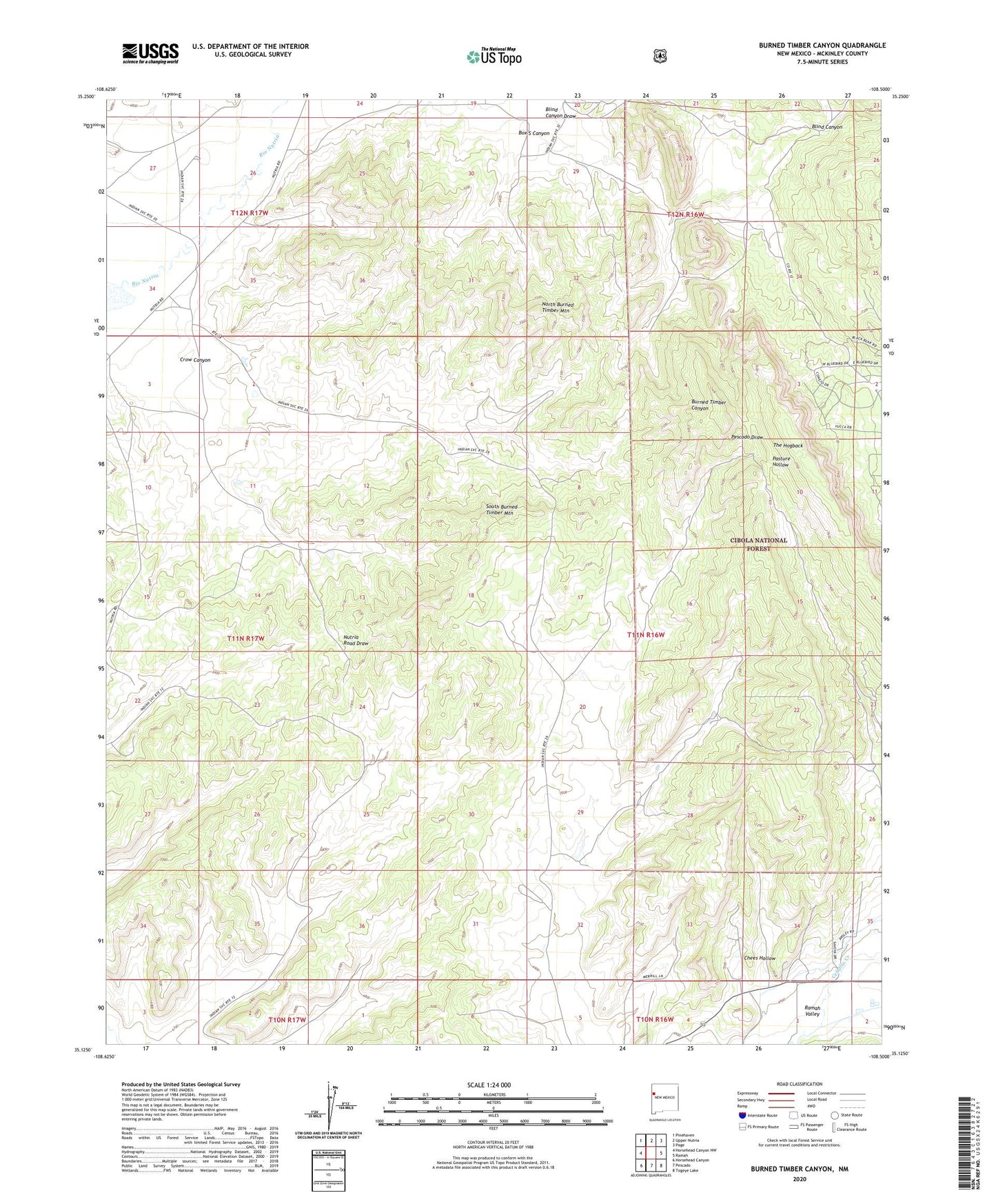
Burned Timber Canyon New Mexico US Topo Map
Couldn't load pickup availability
Also explore the Burned Timber Canyon Forest Service Topo of this same quad for updated USFS data
2023 topographic map quadrangle Burned Timber Canyon in the state of New Mexico. Scale: 1:24000. Based on the newly updated USGS 7.5' US Topo map series, this map is in the following counties: McKinley. The map contains contour data, water features, and other items you are used to seeing on USGS maps, but also has updated roads and other features. This is the next generation of topographic maps. Printed on high-quality waterproof paper with UV fade-resistant inks.
Quads adjacent to this one:
West: Horsehead Canyon NW
Northwest: Pinehaven
North: Upper Nutria
Northeast: Page
East: Ramah
Southeast: Togeye Lake
South: Pescado
Southwest: Horsehead Canyon
This map covers the same area as the classic USGS quad with code o35108b5.
Contains the following named places: Blind Canyon, Blind Canyon Draw, Box S Canyon, Chees Hollow, Crow Canyon, North Burned Timber Mountain, Ralph Bond Ranch, Ramah Census Designated Place, Ramah Indian Tribal Lands, South Burned Timber Mountain, Zuni Indian Tribal Lands