MyTopo
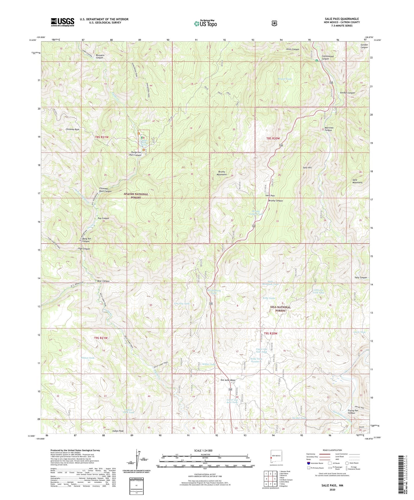
Saliz Pass New Mexico US Topo Map
Couldn't load pickup availability
Also explore the Saliz Pass Forest Service Topo of this same quad for updated USFS data
2023 topographic map quadrangle Saliz Pass in the state of New Mexico. Scale: 1:24000. Based on the newly updated USGS 7.5' US Topo map series, this map is in the following counties: Catron. The map contains contour data, water features, and other items you are used to seeing on USGS maps, but also has updated roads and other features. This is the next generation of topographic maps. Printed on high-quality waterproof paper with UV fade-resistant inks.
Quads adjacent to this one:
West: Blue
Northwest: Maness Peak
North: Bull Basin
Northeast: Reserve
East: O Block Canyon
Southeast: Mogollon
South: Alma
Southwest: Alma Mesa
This map covers the same area as the classic USGS quad with code o33108e8.
Contains the following named places: Bang Tail Canyon, Bear Canyon, Bear Canyon Corral, Bisquit Tank, Blue Range Wilderness, Brushy Canyon Corral, Brushy Canyon Tank, Brushy Mountain, Brushy Mountains, Brushy Well, Buckskin Canyon, Chimney Rock, Chimney Rock Canyon, Cottonwood Campground, Cottonwood Canyon, Dangerous Park Canyon, Frying Pan Canyon, Gordon Canyon, Gut Ache Corral, Gut Ache Mesa, Indian Peak Tank, Javeling Tank, Jones Canyon, Kelly Camp, Kelly Tank Number 2, Kelly Tanks, L Kelly Ranch, Lewis Tank, Line Gap Tank, Little Joe Tank, Little Joe Trick Tank, Lower Gut Ache Tank, Martinez Canyon, Martinez Ranch, Old Highway Tank, Pueblo Park, Pueblo Park Campground, Pueblo Park Corral, Pueblo Park Spring, Pup Canyon, Ribbon Tank, River Tank, Saliz Corral, Saliz Hill, Saliz Mountain Tank, Saliz Pass, Serna Ranch, Six Bar Tank, Tige Canyon, Upper Gut Ache Tank, West Fork Pueblo Creek, Willie Kelly Place, Willies Tank, WS Corral