MyTopo
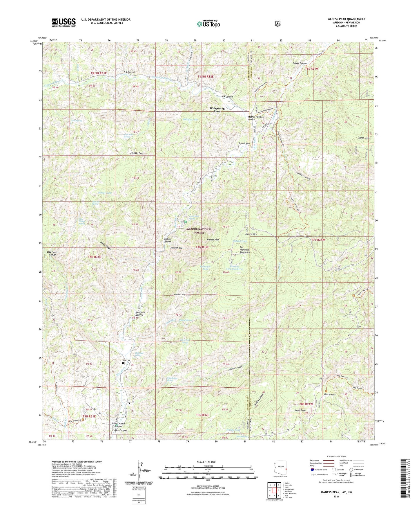
Maness Peak Arizona US Topo Map
Couldn't load pickup availability
Also explore the Maness Peak Forest Service Topo of this same quad for updated USFS data
2021 topographic map quadrangle Maness Peak in the states of Arizona, New Mexico. Scale: 1:24000. Based on the newly updated USGS 7.5' US Topo map series, this map is in the following counties: Greenlee, Catron. The map contains contour data, water features, and other items you are used to seeing on USGS maps, but also has updated roads and other features. This is the next generation of topographic maps. Printed on high-quality waterproof paper with UV fade-resistant inks.
Quads adjacent to this one:
West: Beaverhead
Northwest: Alpine
North: Luna Lake
Northeast: Luna
East: Bull Basin
Southeast: Saliz Pass
South: Blue
Southwest: Bear Mountain
Contains the following named places: Apache National Forest, Bentonite Tank, Blue Cemetery, Blue Crossing, Blue Crossing Campground, Blue Elementary School, Blue River Ranch, Bobcat Flat, Bobcat Tank, Box Canyon, Brooks Ranch, Burke Ranch, Campbell Blue Creek, Cat Creek, Centerfire Creek, Clay Hunter Canyon, Clay Hunter Spring, Colyer Canyon, Dam Canyon, Fall Creek, Fogg 8 Ranch, Fogg Cabin, Frieborn Canyon, Hinkle Park, Holbrook Spring, Jack Spring, Jackson Box, Jackson Canyon, Johnson Canyon, Jones Canyon, K E Canyon, Lazy YJ Ranch, Luce Ranch, Maness Mountain, Maness Peak, Mexican Spring, Milligan Lake, Milligan Peak, Mother Hubbard Canyon, Mud Spring, Mud Springs, Muddy Canyon Spring Tank, Muddy Tank, Noland Creek, Noland Mountain, Noland Spring, Noland Tank, North Fork Spring, Pace Creek, School House Canyon, Schoolhouse Spring, Sheep Basin, Spring Branch, Stateline Tank Number 2, Swafford Canyon, Turkey Creek, Tutt Creek, Tutt Creek Trailhead, Twin Tubs Spring, Upper Blue Campground, Upper Blue Spring, Upper Tank, Whispering Pines