MyTopo
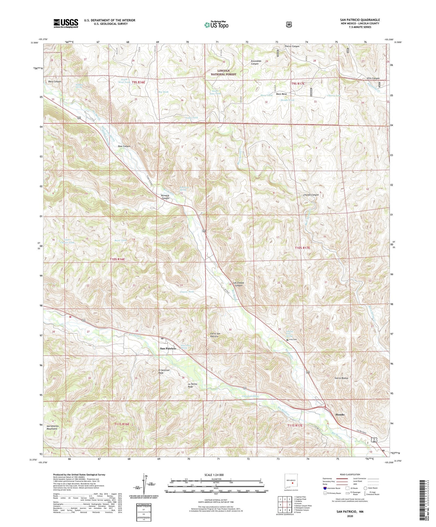
San Patricio New Mexico US Topo Map
Couldn't load pickup availability
Also explore the San Patricio Forest Service Topo of this same quad for updated USFS data
2023 topographic map quadrangle San Patricio in the state of New Mexico. Scale: 1:24000. Based on the newly updated USGS 7.5' US Topo map series, this map is in the following counties: Lincoln. The map contains contour data, water features, and other items you are used to seeing on USGS maps, but also has updated roads and other features. This is the next generation of topographic maps. Printed on high-quality waterproof paper with UV fade-resistant inks.
Quads adjacent to this one:
West: Lincoln
Northwest: Capitan Pass
North: Capitan Peak
Northeast: Arabela
East: Nelson Canyon West
Southeast: Tinnie
South: Wahalee Canyon
Southwest: Sheeppen Canyon
This map covers the same area as the classic USGS quad with code o33105d3.
Contains the following named places: Baca Mesa, Berts Tank, Big Tank, Cerro San Patricio, Cherry Lake, Colonel Fritz Spring, Dow Canyon, El Sentinel Peak, Ellis Canyon, Emil Fritz Spring, Fritz Cemetery, Glencoe - Palo Verde Fire Department, Graves Tank, Hondo, Hondo Elementary School, Hondo Post Office, Hondo Tank, Hondo Valley School, Hulbert Spring, La Tetita Peak, Las Chosas Canyon, Mesa Tank, Mission Fountain of Living Water Full Gospel, Peter Hurd Spring, Pierce Canyon, Rio Bonito, Rio Ruidoso, Saint Jude Catholic Mission Cemetery, San Patricio, San Patricio Catholic Church Cemetery, San Patricio Post Office, South East Tank, South West Tank, Upper Chosas Tank, Vorwerk Canyon, Whiskey Trail, Wilbur McKnight Ranch, Yates Tank, Yates Well, ZIP Code: 88348