MyTopo
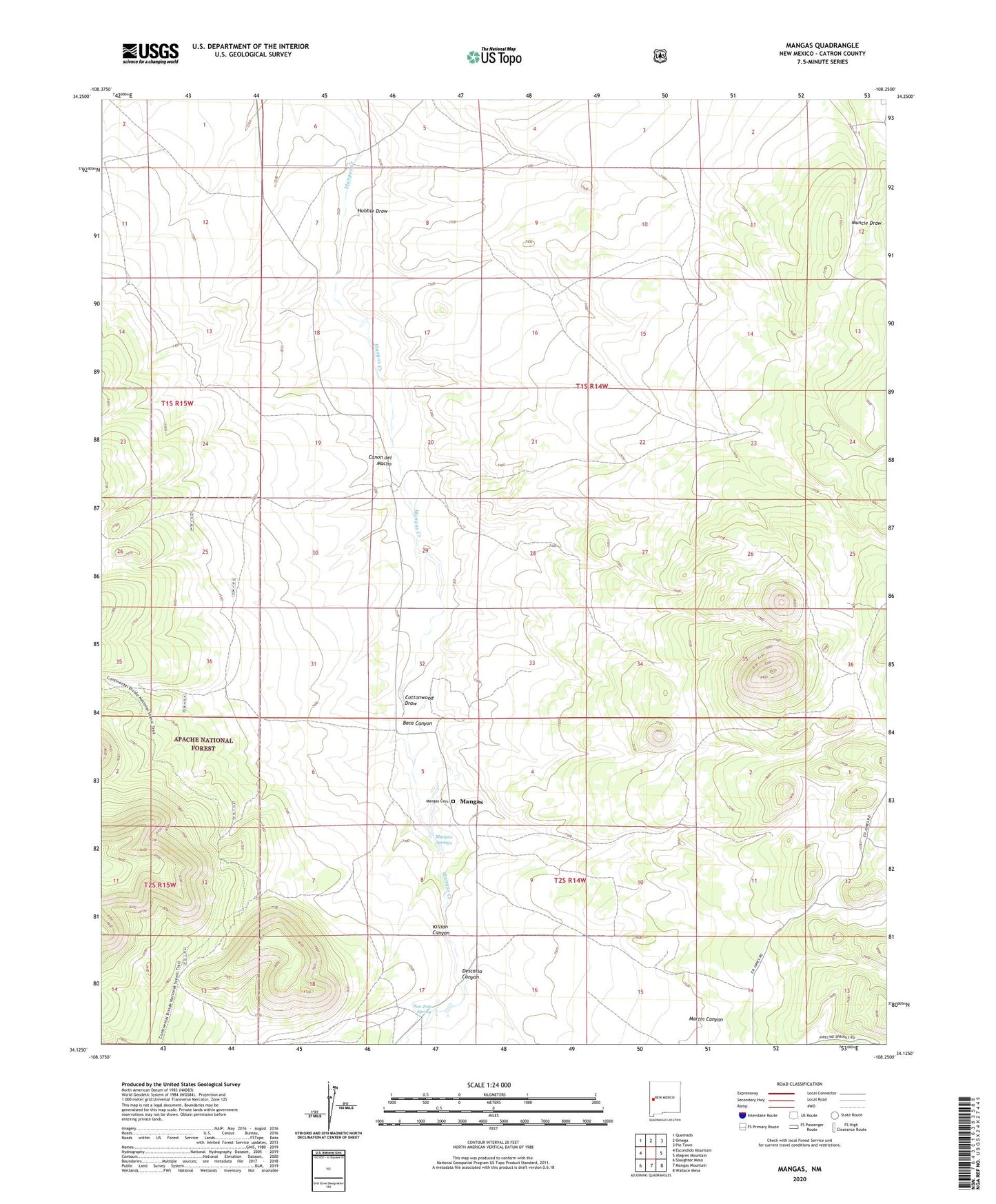
Mangas New Mexico US Topo Map
Couldn't load pickup availability
Also explore the Mangas Forest Service Topo of this same quad for updated USFS data
2023 topographic map quadrangle Mangas in the state of New Mexico. Scale: 1:24000. Based on the newly updated USGS 7.5' US Topo map series, this map is in the following counties: Catron. The map contains contour data, water features, and other items you are used to seeing on USGS maps, but also has updated roads and other features. This is the next generation of topographic maps. Printed on high-quality waterproof paper with UV fade-resistant inks.
Quads adjacent to this one:
West: Escondido Mountain
Northwest: Quemado
North: Omega
Northeast: Pie Town
East: Alegres Mountain
Southeast: Wallace Mesa
South: Mangas Mountain
Southwest: Slaughter Mesa
This map covers the same area as the classic USGS quad with code o34108b3.
Contains the following named places: Baca, Baca Canyon, Canon del Macho, Chief Well, Club Well, Cottonwood Draw, Descalso Canyon, East Mangas Well, Erman Well, Hubble Draw, Killion Canyon, Leyba, Mangas, Mangas Cemetery, Mangas Post Office, Mangas Ranch, Mangas Springs, Mangas Well, Mitchell Well, New Well, Reid, San Jose Catholic Church Cemetery, San Jose Spring, Smith