
MyTopo
Mesa Del Yeso New Mexico US Topo Map
Couldn't load pickup availability
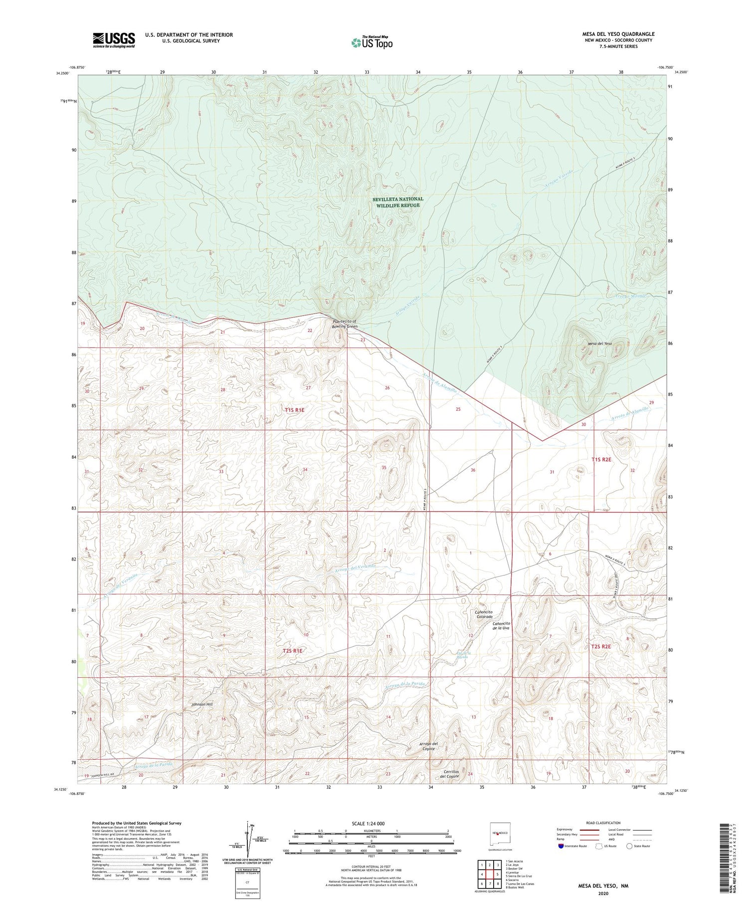
2023 topographic map quadrangle Mesa Del Yeso in the state of New Mexico. Scale: 1:24000. Based on the newly updated USGS 7.5' US Topo map series, this map is in the following counties: Socorro. The map contains contour data, water features, and other items you are used to seeing on USGS maps, but also has updated roads and other features. This is the next generation of topographic maps. Printed on high-quality waterproof paper with UV fade-resistant inks.
Quads adjacent to this one:
West: Lemitar
Northwest: San Acacia
North: La Joya
Northeast: Becker SW
East: Sierra De La Cruz
Southeast: Bustos Well
South: Loma De Las Canas
Southwest: Socorro
This map covers the same area as the classic USGS quad with code o34106b7.
Contains the following named places: 10030 Water Well, 87801, Arroyo Milagro, Arroyo Varrido, Canoncito Colorado, Canoncito de la Uva, Cerrillos del Coyote, Elaina, Elaine Barite Prospect, Johnson Hill, Mesa del Yeso, Ojo de la Parida, Old Stapleton Ranch, Puertecito of Bowling Green, Sabino Ranch, Valle Del Ojo De La Parida, Veranito Wilderness Study Area


