MyTopo
Clarksville New York US Topo Map
Couldn't load pickup availability
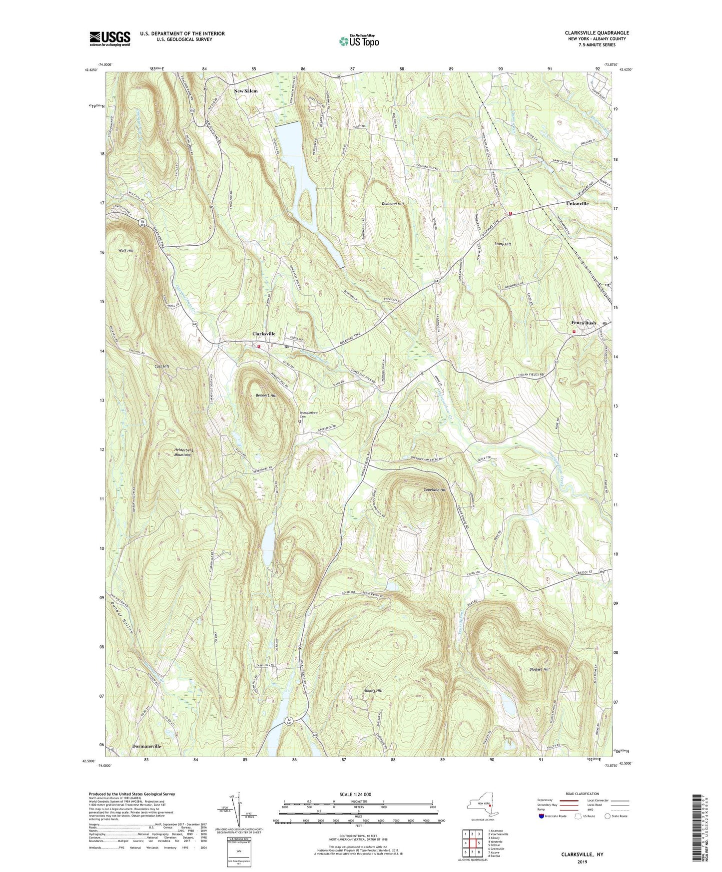
2023 topographic map quadrangle Clarksville in the state of New York. Scale: 1:24000. Based on the newly updated USGS 7.5' US Topo map series, this map is in the following counties: Albany. The map contains contour data, water features, and other items you are used to seeing on USGS maps, but also has updated roads and other features. This is the next generation of topographic maps. Printed on high-quality waterproof paper with UV fade-resistant inks.
Quads adjacent to this one:
West: Westerlo
Northwest: Altamont
North: Voorheesville
Northeast: Albany
East: Delmar
Southeast: Ravena
South: Alcove
Southwest: Greenville
This map covers the same area as the classic USGS quad with code o42073e8.
Contains the following named places: Albany County, Bennett Hill, Blodget Hill, Callanans Corners, Cass Hill, Cedar Grove School, Clarksville, Clarksville Elementary School, Clarksville Post Office, Copeland Hill, Delmar State Game Farm, Diamond Hill, Dunbar Hollow, Feura Bush, Feura Bush Post Office, Five Rivers Environmental Education Center, Keefers Corners, Koong Hill, Lawson Lake, Mount Pleasant Cemetery, New Salem, Onesquethaw Cemetery, Onesquethaw Volunteer Fire Company Station 1, Onesquethaw Volunteer Fire Company Station 2 Feura Bush, Onesquethaw Volunteer Fire Company Station 3 Unionville, Peck Airport, School Number 2, School Number 5, School Number 9, Stony Hill, Tarrytown, Town of New Scotland, Unionville, Unionville Reformed Church, Wolf Hill, ZIP Codes: 12041, 12046, 12067