MyTopo
Ellenburg Mountain New York US Topo Map
Couldn't load pickup availability
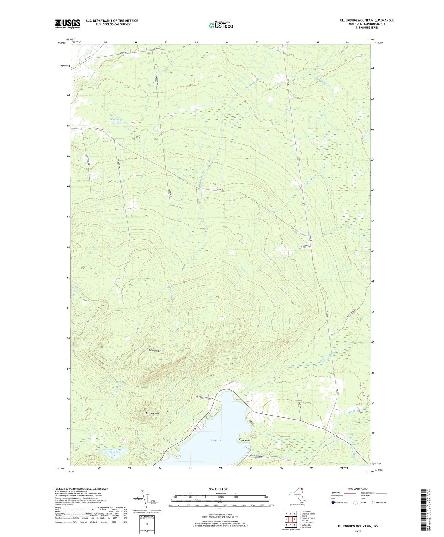
2023 topographic map quadrangle Ellenburg Mountain in the state of New York. Scale: 1:24000. Based on the newly updated USGS 7.5' US Topo map series, this map is in the following counties: Clinton. The map contains contour data, water features, and other items you are used to seeing on USGS maps, but also has updated roads and other features. This is the next generation of topographic maps. Printed on high-quality waterproof paper with UV fade-resistant inks.
Quads adjacent to this one:
West: Ellenburg Center
Northwest: Churubusco
North: Ellenburg Depot
Northeast: Altona
East: Jericho
Southeast: Dannemora
South: Moffitsville
Southwest: Lyon Mountain
This map covers the same area as the classic USGS quad with code o44073g7.
Contains the following named places: Clinton State Forest Number Eight, Dannemora Town Hall, Eagle Point, Ellenburg Mountain, Gordon School, Halfway House, King School, Ledger Corners, Moon Pond, Mud Pond, Saint Germaine Brook, Seine Bay, Spring Brook, Topknot Mountain, Wallace School, White School, ZIP Code: 12935