MyTopo
Ellenburg Depot New York US Topo Map
Couldn't load pickup availability
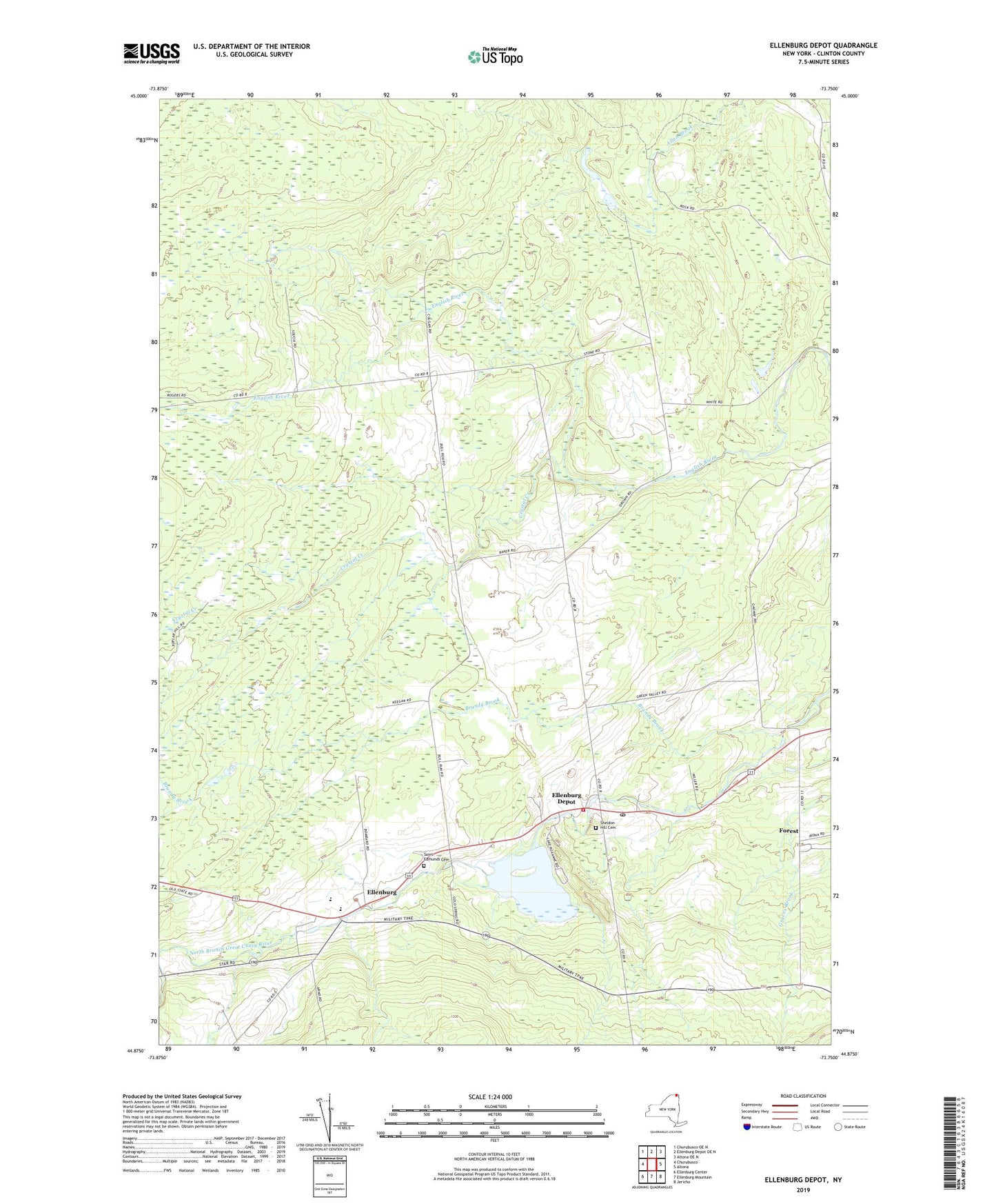
2023 topographic map quadrangle Ellenburg Depot in the state of New York. Scale: 1:24000. Based on the newly updated USGS 7.5' US Topo map series, this map is in the following counties: Clinton. The map contains contour data, water features, and other items you are used to seeing on USGS maps, but also has updated roads and other features. This is the next generation of topographic maps. Printed on high-quality waterproof paper with UV fade-resistant inks.
Quads adjacent to this one:
West: Churubusco
Northwest: Churubusco OE N
North: Ellenburg Depot OE N
Northeast: Altona OE N
East: Altona
Southeast: Jericho
South: Ellenburg Mountain
Southwest: Ellenburg Center
This map covers the same area as the classic USGS quad with code o44073h7.
Contains the following named places: Brandy Brook, Crystal Creek, Dannemora Crossing, Ellenburg, Ellenburg Depot, Ellenburg Depot Fire Department, Ellenburg Depot Post Office, Fernwood School, Forest, Green Valley School, Hammond School, Northern Adirondack Elementary School, Northern Adirondack Junior - Senior High School, Saint Edmunds Cemetery, Saint Edmund's Church, Sarah A Munsil Free Library, Sheldon Hill Cemetery, Silver Lane Dairy, Wesleyan Church, Woods School, ZIP Codes: 12933, 12934