MyTopo
Hermon New York US Topo Map
Couldn't load pickup availability
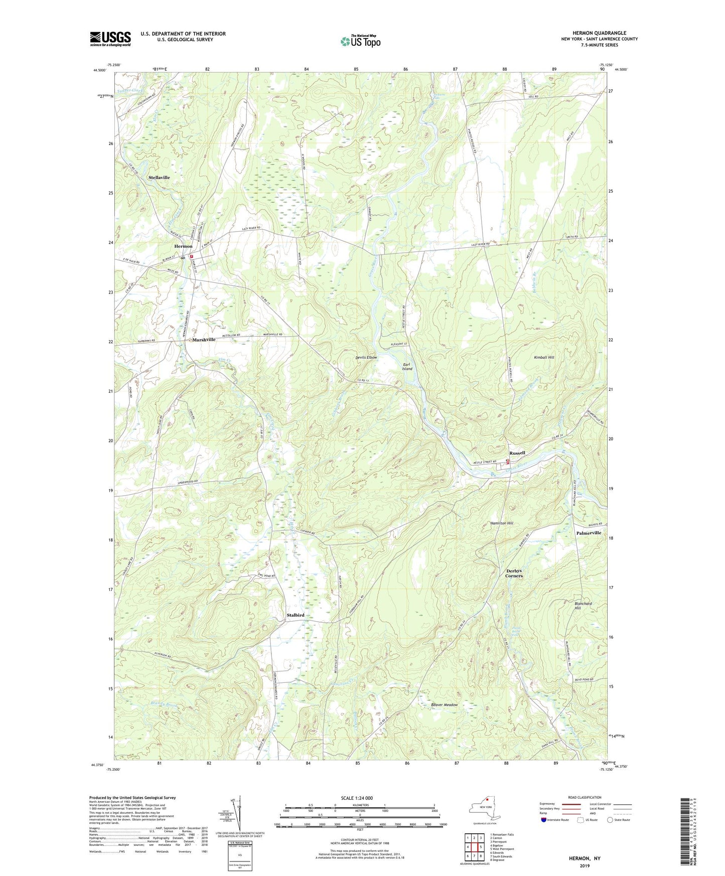
2023 topographic map quadrangle Hermon in the state of New York. Scale: 1:24000. Based on the newly updated USGS 7.5' US Topo map series, this map is in the following counties: St. Lawrence. The map contains contour data, water features, and other items you are used to seeing on USGS maps, but also has updated roads and other features. This is the next generation of topographic maps. Printed on high-quality waterproof paper with UV fade-resistant inks.
Quads adjacent to this one:
West: Bigelow
Northwest: Rensselaer Falls
North: Canton
Northeast: Pierrepont
East: West Pierrepont
Southeast: Degrasse
South: South Edwards
Southwest: Edwards
This map covers the same area as the classic USGS quad with code o44075d2.
Contains the following named places: Acres School, Beaver Meadow, Blanchard Hill, Bullock Creek, Cancross Creek, Clarks Corners, Danes Corners, Derbys Corners, Devils Elbow, Earl Island, Edmond Brook, Fairbanks Corners, First Baptist Church, Fordhams Corners, Gibbons Brook, Hamilton Hill, Hepburn Library of Hermon, Hermon, Hermon Census Designated Place, Hermon Fire Department, Hermon Post Office, Jacksons Falls, Kimball Hill, Lazy River Game Bird Farm, Marshville, Palmerville, Pleasant Creek, Plumb Brook, Plumb Brook Falls, Putnams Corners, Russell, Russell Fire Department, Russell Post Office, Russell Public Library, Russell Rescue Squad, Scotts Corners, Stalbird, Stellaville, Town of Russell, Village of Hermon, Whippoorwill Corners, Whippoorwill Corners State Forest, WNYS-AM (Canton), ZIP Code: 13652