MyTopo
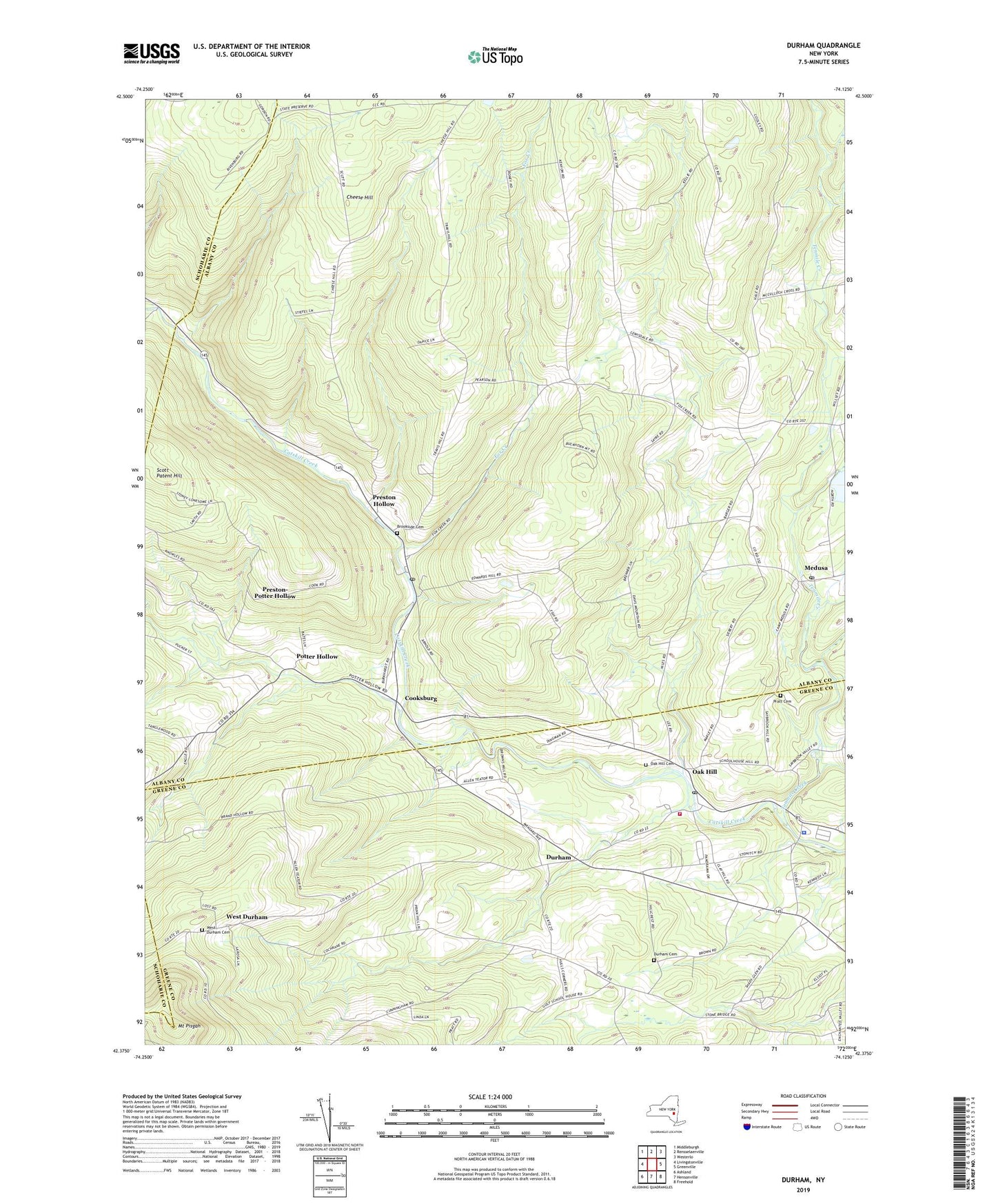
Durham New York US Topo Map
Couldn't load pickup availability
2019 topographic map quadrangle Durham in the state of New York. Scale: 1:24000. Based on the newly updated USGS 7.5' US Topo map series, this map is in the following counties: Albany, Greene, Schoharie. The map contains contour data, water features, and other items you are used to seeing on USGS maps, but also has updated roads and other features. This is the next generation of topographic maps. Printed on high-quality waterproof paper with UV fade-resistant inks.
Quads adjacent to this one:
West: Livingstonville
Northwest: Middleburgh
North: Rensselaerville
Northeast: Westerlo
East: Greenville
Southeast: Freehold
South: Hensonville
Southwest: Ashland
Contains the following named places: Brookside Cemetery, Central School, Cheese Hill, Cheese Hill School, Cooksburg, Craw School, Durham, Durham Cemetery, Durham Elementary School, Durham Police Department, Durham United Methodist Church, Eightmile Creek, Fox Creek, Heather Ridge Farm, Medusa, Medusa Post Office, Mount Pisgah, Oak Hill, Oak Hill Cemetery, Oak Hill Durham Volunteer Fire Company, Oak Hill Post Office, Potter Hollow, Potter Hollow Census Designated Place, Pratt Cemetery, Preston Hollow, Preston Hollow Census Designated Place, Preston Hollow Post Office, Preston-Potter Hollow Census Designated Place, Rensselaerville Volunteer Ambulance, Sayer School, School Number 14, School Number 19, Squirmer Valley, Tenmile Creek, Town of Durham, Town of Rensselaerville, West Durham, West Durham Cemetery, ZIP Codes: 12120, 12422, 12460, 12469