MyTopo
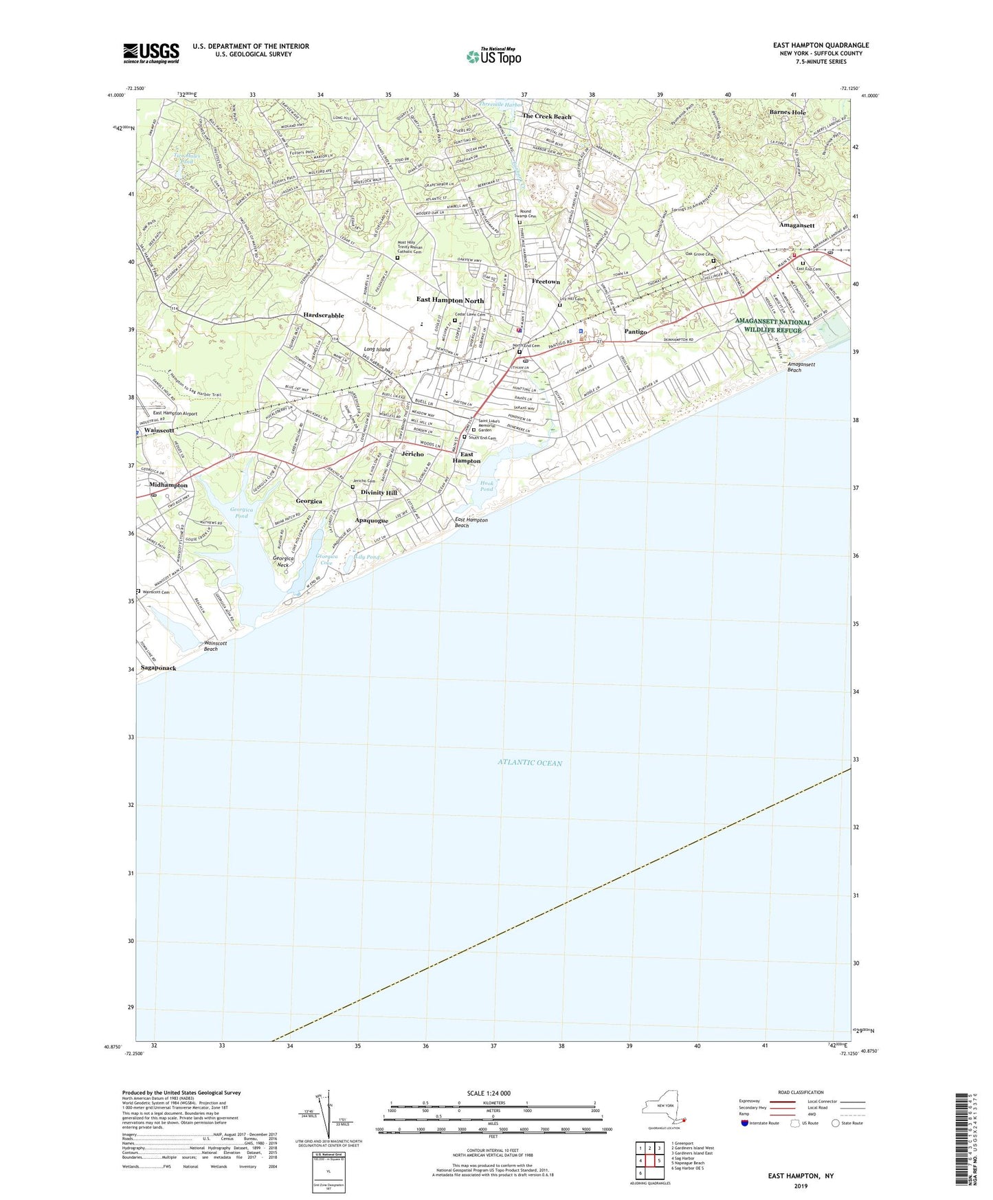
East Hampton New York US Topo Map
Couldn't load pickup availability
2023 topographic map quadrangle East Hampton in the state of New York. Scale: 1:24000. Based on the newly updated USGS 7.5' US Topo map series, this map is in the following counties: Suffolk. The map contains contour data, water features, and other items you are used to seeing on USGS maps, but also has updated roads and other features. This is the next generation of topographic maps. Printed on high-quality waterproof paper with UV fade-resistant inks.
Quads adjacent to this one:
West: Sag Harbor
Northwest: Greenport
North: Gardiners Island West
Northeast: Gardiners Island East
East: Napeague Beach
Southwest: Sag Harbor OE S
This map covers the same area as the classic USGS quad with code o40072h2.
Contains the following named places: Amagansett, Amagansett Beach, Amagansett Census Designated Place, Amagansett Fire Department, Amagansett Free Library, Amagansett Life Saving Station, Amagansett National Wildlife Refuge, Amagansett Post Office, Amagansett School, Apaquogue, Atlantic Double Dunes Preserve, Balsam Farms, Barnes Hole, Bistrians Heliport, Briar Patch Road Historic District, Buell's Lane Historic District, Calvary Baptist Church, Cedar Lawn Cemetery, Divinity Hill, East End Cemetery, East End Church of Christ, East Hampton, East Hampton Airport, East Hampton Beach, East Hampton Fire Department, East Hampton Golf Club, East Hampton High School, East Hampton Library, East Hampton Marina, East Hampton Middle School, East Hampton North Census Designated Place, East Hampton Post Office, East Hampton Town Hall, East Hampton Village Ambulance Service, East Hampton Village Hall, East Hampton Village Police Department, Egypt Lane Historic District, First Presbyterian Church, First United Methodist Church, Freetown, Fulling Mill Farm Preserve, Georgica, Georgica Cove, Georgica Life Saving Station, Georgica Neck, Georgica Pond, Hardscrabble, Hayground Windmill, Home Sweet Home Museum, Hook Pond, Hook Windmill, Jericho, Jericho Cemetery, John M Marshall Elementary School, Jones Road Historic District, Lily Hill Cemetery, Lily Pond, Maidstone Club East Course, Maidstone Club West Course, Midhampton, Most Holy Trinity Church, Most Holy Trinity Roman Catholic Cemetery, Mulford House and Farm, North End Cemetery, North Main Street Historic District, Oak Grove Cemetery, Osborn - Jackson House Museum, Pantigo, Pantigo Road Historic District, Round Swamp Cemetery, Saint Luke Episcopal Church, Saint Luke's Memorial Garden, South End Cemetery, South Fork Country Club, Tanbark Creek, Three Mile Harbor Mobile Home Park, Town of East Hampton Police Department, Town Pond, Two Holes Pond, Village of East Hampton, Wainscott, Wainscott Beach, Wainscott Cemetery, Wainscott Census Designated Place, Wainscott Chapel, Wainscott Pond, Wainscott Post Office, Wainscott Windmill, Waters Chapel, West Amagansett, WVEH-FM (East Hampton), ZIP Code: 11975