MyTopo
Gardiners Island East New York US Topo Map
Couldn't load pickup availability
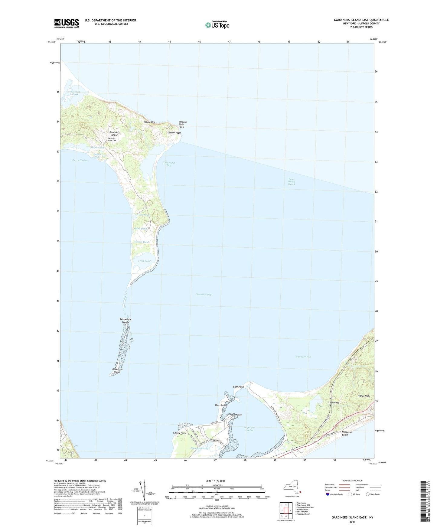
2023 topographic map quadrangle Gardiners Island East in the state of New York. Scale: 1:24000. Based on the newly updated USGS 7.5' US Topo map series, this map is in the following counties: Suffolk. The map contains contour data, water features, and other items you are used to seeing on USGS maps, but also has updated roads and other features. This is the next generation of topographic maps. Printed on high-quality waterproof paper with UV fade-resistant inks.
Quads adjacent to this one:
West: Gardiners Island West
Northwest: Plum Island
North: Plum Island OE E
East: Montauk Point
South: Napeague Beach
Southwest: East Hampton
This map covers the same area as the classic USGS quad with code o41072a1.
Contains the following named places: Airport Pond, Alberts Landing, Bostwick Creek, Cartwright Island, Cartwright Shoals, Cherry Harbor, Cherry Point, Eastern Plain, Eastern Plain Point, Fresh Pond, Gales Pond, Gardiners Island, Gardiners Island Cemetery, Gardiners Island Two Lookout Tower, Gardiners Island Windmill, Gaylor Hole, Goff Point, Great Pond, Hicks Island, Hither Hills State Park, Home Pond, Lazy Point, Lily Pond, Little Pond, Napeague, Napeague Bay, Napeague Harbor, Napeague Pond, Quincetree Landing, Tobaccolot Bay, Tobaccolot Pond, Town of East Hampton, Whale Hill, Willow Brook