MyTopo
Greenport New York US Topo Map
Couldn't load pickup availability
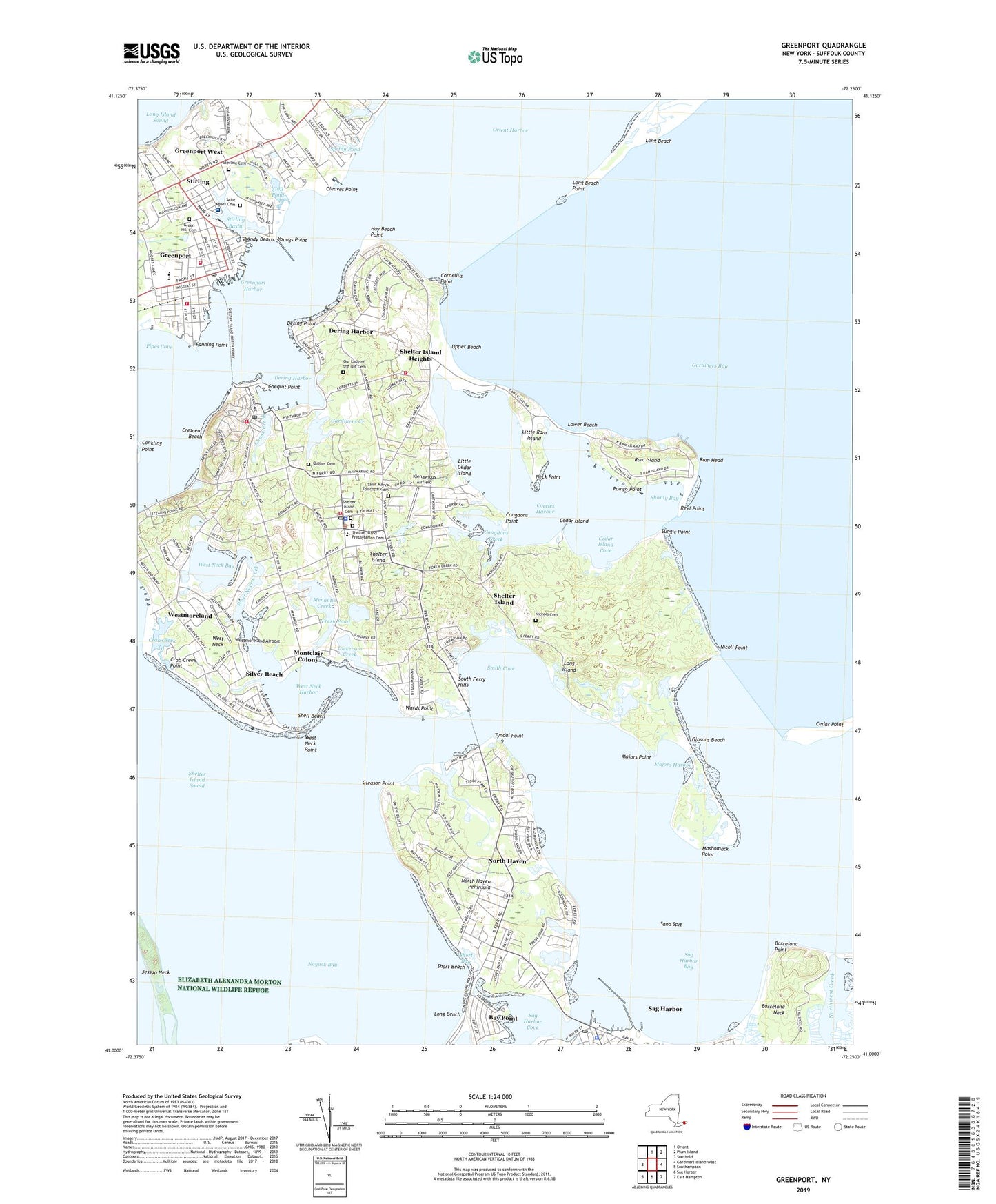
2023 topographic map quadrangle Greenport in the state of New York. Scale: 1:24000. Based on the newly updated USGS 7.5' US Topo map series, this map is in the following counties: Suffolk. The map contains contour data, water features, and other items you are used to seeing on USGS maps, but also has updated roads and other features. This is the next generation of topographic maps. Printed on high-quality waterproof paper with UV fade-resistant inks.
Quads adjacent to this one:
West: Southold
North: Orient
Northeast: Plum Island
East: Gardiners Island West
Southeast: East Hampton
South: Sag Harbor
Southwest: Southampton
This map covers the same area as the classic USGS quad with code o41072a3.
Contains the following named places: Barcelona Neck, Barcelona Point, Bay Point, Bible Baptist Church, Brecknock Hall, Cedar Island, Cedar Island Cove, Cedar Island Lighthouse, Cedar Point, Chase Creek, Chequit Point, Cleaves Point, Clinton Memorial African Methodist Episcopal Zion Church, Coecles Harbor, Coecles Harbor Marina and Boatyard, Congdons Creek, Congdons Point, Cornelius Point, Crab Creek, Crab Creek Point, Crescent Beach, Dering Harbor, Dering Harbor Marina, Dering Harbor Village Hall, Dering Point, Dickerson Creek, Eastern Long Island Heliport, Eastern Long Island Hospital, Fanning Point, First Baptist Church of Greenport, First Presbyterian Church, Floyd Memorial Library, Fresh Pond, Gardiners Bay Country Club, Gardiners Creek, Gibsons Beach, Gleason Point, Green Hill Cemetery, Greenport, Greenport Basin, Greenport Fire Station, Greenport Harbor, Greenport Homes, Greenport Post Office, Greenport Theatre, Greenport United Methodist Church, Greenport Village Hall, Greenport Village Historic District, Gull Pond, Hay Beach Point, Holy Trinity Episcopal Church, Island Boatyard, Island End Golf And Country Club, Jessup Neck, Klenawicus Airfield, Little Cedar Island, Little Northwest Creek, Little Ram Island, Long Beach, Long Beach Bar Lighthouse, Long Beach Point, Lower Beach, Majors Harbor, Majors Point, Mashomack Point, Mashomack Preserve, Maycroft-Tuller School, Menantic Creek, Montclair Colony, Neck Point, Nichols Cemetery, Nicoll Point, North Haven, North Haven Peninsula, Northwest Harbor, Noyack Bay, Our Lady of the Isle Cemetery, Our Lady of the Isle Church, Passionist Monastery, Pomps Point, Quaker Cemetery, Ram Head, Ram Island, Ram Island Yacht Club, Reel Point, Retreat House, Sag Harbor Bay, Sag Harbor Cove, Sag Harbor Police Department, Sag Harbor Post Office, Sag Harbor Yacht Club, Saint Agargyroi Greek Orthodox Church, Saint Agnes Cemetery, Saint Agnes Roman Catholic Church, Saint Agnes School, Saint Mary's Episcopal Cemetery, Saint Marys Episcopal Church, Saint Peter's Evangelical Lutheran Church, Sand Spit, Sandy Beach, Shanty Bay, Shell Beach, Shelter Island, Shelter Island Cemetery, Shelter Island Census Designated Place, Shelter Island Country Club, Shelter Island EMS, Shelter Island Fire Department Heights Station 3, Shelter Island Fire Department Manhanset Station, Shelter Island Fire Station, Shelter Island Heights, Shelter Island Heights Census Designated Place, Shelter Island Heights Historic District, Shelter Island Heights Post Office, Shelter Island High School, Shelter Island Police Department, Shelter Island Post Office, Shelter Island Presbyterian Cemetery, Shelter Island Presbyterian Church, Shelter Island Sound, Shelter Island Windmill, Shelter Island Yacht Club, Short Bay, Short Beach, Silver Beach, Silver Lake, Smith Cove, South Ferry Hills, Spring Pond, Sterling Cemetery, Stirling, Stirling Basin, Sungic Point, The Shores at Peconic Landing, Town of Shelter Island, Tyndal Point, Union School, Upper Beach, Village of Dering Harbor, Village of Greenport, Village of North Haven, Wards Point, West Neck, West Neck Bay, West Neck Creek, West Neck Harbor, West Neck Point, Westmoreland, Westmoreland Airport, Youngs Point, ZIP Codes: 11939, 11944, 11964, 11965


