MyTopo
Bigelow New York US Topo Map
Couldn't load pickup availability
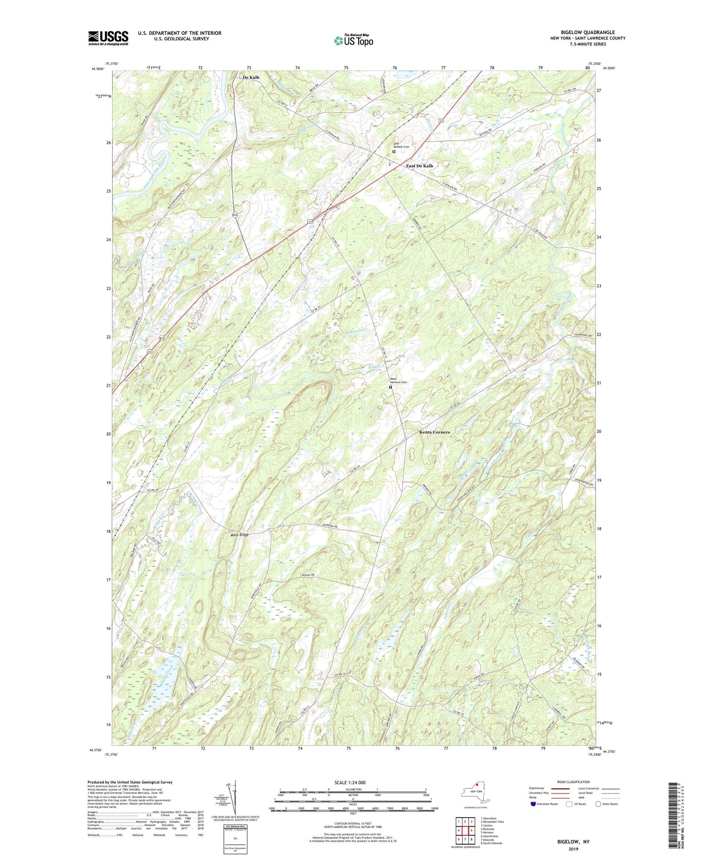
2023 topographic map quadrangle Bigelow in the state of New York. Scale: 1:24000. Based on the newly updated USGS 7.5' US Topo map series, this map is in the following counties: St. Lawrence. The map contains contour data, water features, and other items you are used to seeing on USGS maps, but also has updated roads and other features. This is the next generation of topographic maps. Printed on high-quality waterproof paper with UV fade-resistant inks.
Quads adjacent to this one:
West: Richville
Northwest: Heuvelton
North: Rensselaer Falls
Northeast: Canton
East: Hermon
Southeast: South Edwards
South: Edwards
Southwest: Gouverneur
This map covers the same area as the classic USGS quad with code o44075d3.
Contains the following named places: Anderson Creek, Bigelow, Brandy Brook, Carter Creek, Days School, De Kalb, East De Kalb, East DeKalb Cemetery, Gebarton Acres, Hermon - Dekalb Central School, Kents Corners, Moss Ridge, Town of De Kalb, Town of Hermon, West Hermon Cemetery, ZIP Codes: 13630, 13681