MyTopo
Fine New York US Topo Map
Couldn't load pickup availability
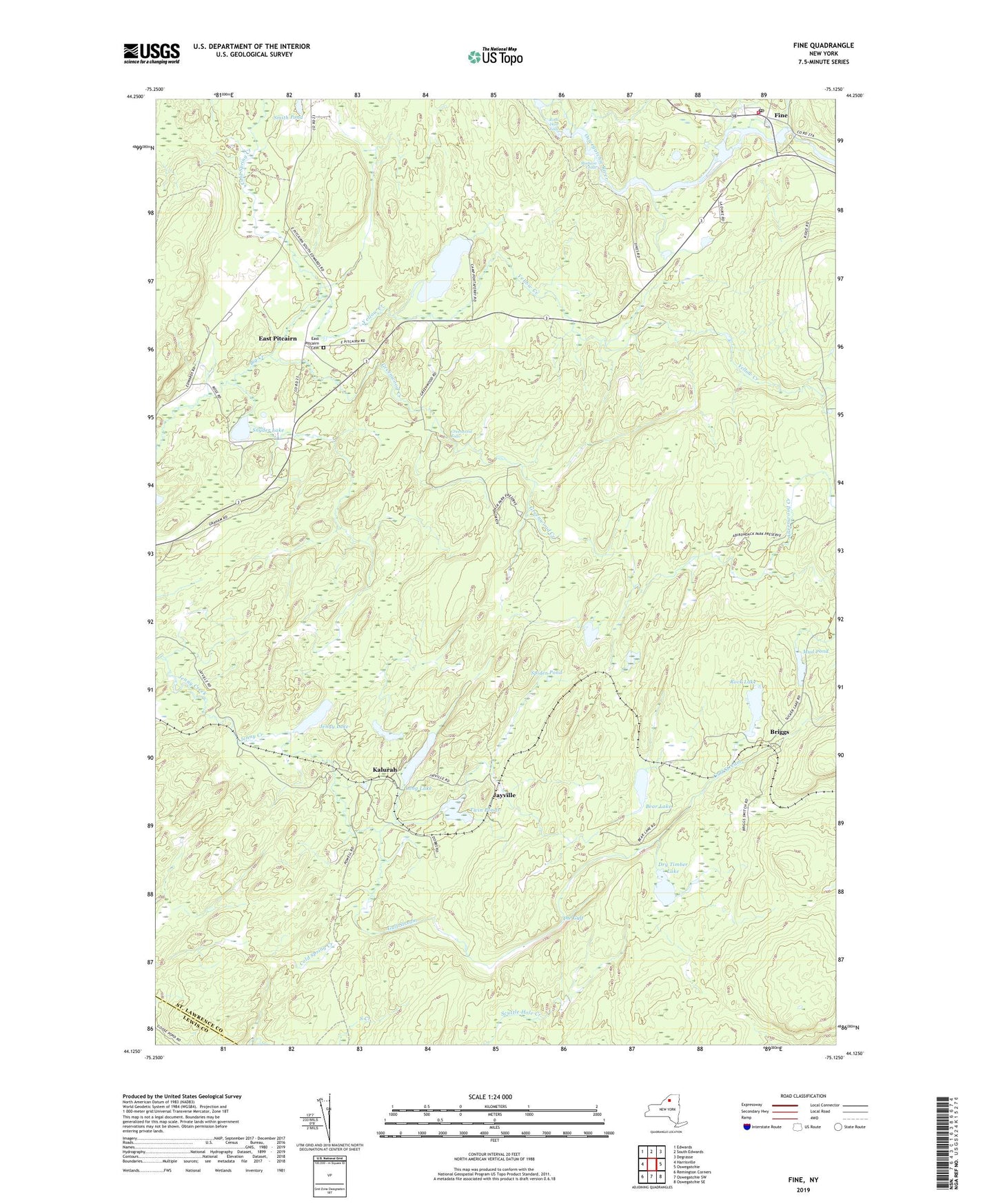
2019 topographic map quadrangle Fine in the state of New York. Scale: 1:24000. Based on the newly updated USGS 7.5' US Topo map series, this map is in the following counties: St. Lawrence, Lewis. The map contains contour data, water features, and other items you are used to seeing on USGS maps, but also has updated roads and other features. This is the next generation of topographic maps. Printed on high-quality waterproof paper with UV fade-resistant inks.
Quads adjacent to this one:
West: Harrisville
Northwest: Edwards
North: South Edwards
Northeast: Degrasse
East: Oswegatchie
Southeast: Oswegatchie SE
South: Oswegatchie SW
Southwest: Remington Corners
Contains the following named places: Bear Lake, Briggs, Camp Portaferry, Camp Trefoil, Cold Spring Brook State Forest, Cold Spring Creek, Dry Timber Lake, East Pitcairn, East Pitcairn Cemetery, Fine, Fine Post Office, Fine Volunteer Fire Department, Grass Pond, Greenwood Creek, Greenwood Creek State Forest, Greenwood Falls, Gulf Stream, Jayville, Jenny Lake, Kalurah, Long Lake, Madison Chute, Mud Pond, Portaferry Lake, Rock Dam Falls, Rock Lake, Snyder Lake, Spider Pond, The Gulf, Twin Ponds, Yellow Creek