MyTopo
Hoffmeister New York US Topo Map
Couldn't load pickup availability
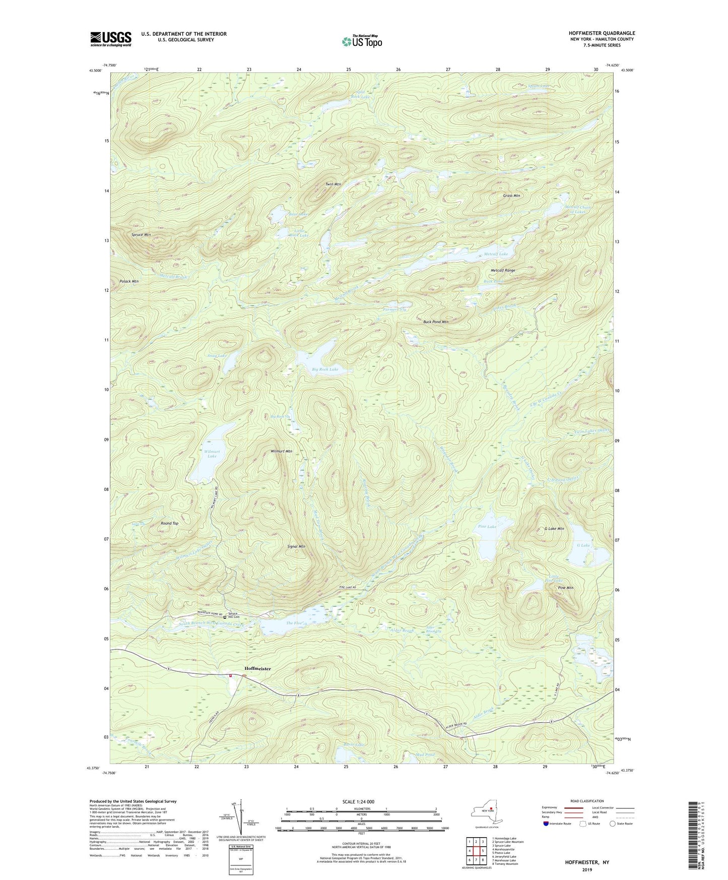
2019 topographic map quadrangle Hoffmeister in the state of New York. Scale: 1:24000. Based on the newly updated USGS 7.5' US Topo map series, this map is in the following counties: Hamilton. The map contains contour data, water features, and other items you are used to seeing on USGS maps, but also has updated roads and other features. This is the next generation of topographic maps. Printed on high-quality waterproof paper with UV fade-resistant inks.
Quads adjacent to this one:
West: Morehouseville
Northwest: Honnedaga Lake
North: Spruce Lake Mountain
Northeast: Spruce Lake
East: Piseco Lake
Southeast: Tomany Mountain
South: Morehouse Lake
Southwest: Jerseyfield Lake
Contains the following named places: Alder Brook, Alder Brook Vly, Barto Lake, Bear Lake, Beaudry Brook, Big Rock Lake, Big Rock Vly, Buck Pond, Buck Pond Mountain, Farmers Vly, G Lake, G Lake Mountain, G Lake Outlet, Grass Mountain, Hoffmeister, Hoffmeister Post Office, Jones Brook, Lane Vly, L-D Pond Outlet, Little Pine Lake, Little Rock Lake, Mad Tom Brook, Metcalf Chain of Lakes, Metcalf Lake, Metcalf Range, Morehouse Volunteer Fire Department, Morehouseville Church, Mountain Home, Mud Pond, Pine Lake, Pine Mountain, Roaring Brook, Round Top, Signal Mountain, Snag Lake, Split Rock Lake, Spoon Lake, Spruce Hill Cemetery, Spruce Mountain, The Floe, Town of Morehouse, Twin Lakes Outlet, Twin Mountain, Wagoner Brook, Wilmurt Lake, Wilmurt Lake Outlet, Wilmurt Mountain, ZIP Code: 13353