MyTopo
Piseco Lake New York US Topo Map
Couldn't load pickup availability
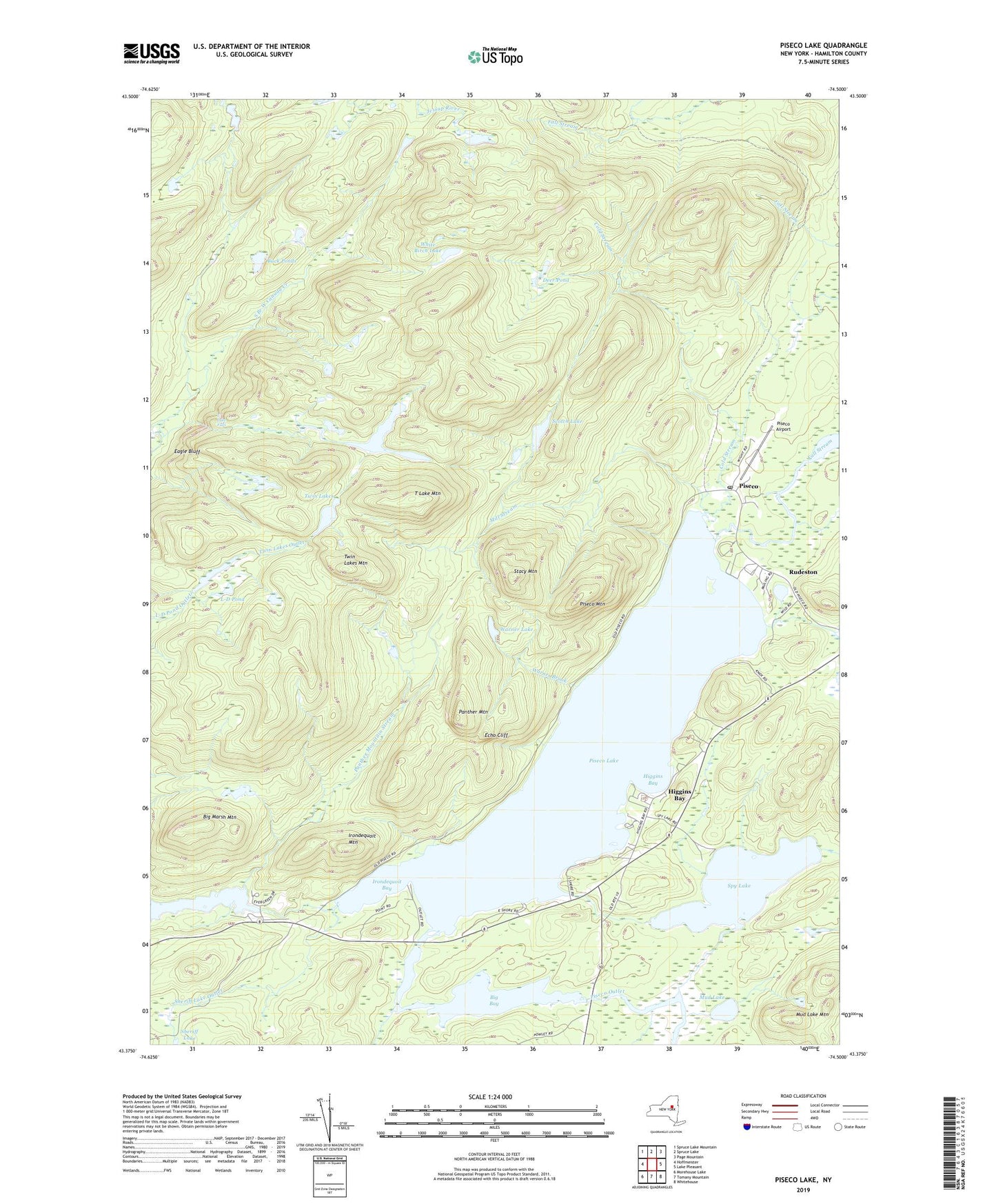
2023 topographic map quadrangle Piseco Lake in the state of New York. Scale: 1:24000. Based on the newly updated USGS 7.5' US Topo map series, this map is in the following counties: Hamilton. The map contains contour data, water features, and other items you are used to seeing on USGS maps, but also has updated roads and other features. This is the next generation of topographic maps. Printed on high-quality waterproof paper with UV fade-resistant inks.
Quads adjacent to this one:
West: Hoffmeister
Northwest: Spruce Lake Mountain
North: Spruce Lake
Northeast: Page Mountain
East: Lake Pleasant
Southeast: Whitehouse
South: Tomany Mountain
Southwest: Morehouse Lake
This map covers the same area as the classic USGS quad with code k43074d5.
Contains the following named places: Big Bay, Big Marsh Mountain, Buck Ponds, Cold Stream, Deer Pond, Eagle Bluff, Echo Cliff, Evergreen Lake, Fall Lake, Fall Stream, Higgins Bay, Irondequoit Bay, Irondequoit Mountain, Knox Bay Seaplane Base, L-D Pond, Little Sand Point State Campsite, Mill Stream, Mud Lake, Mud Lake Mountain, Panther Mountain, Panther Mountain Stream, Piseco, Piseco Airport, Piseco Lake, Piseco Mountain, Piseco Post Office, Point Comfort State Campsite, Poplar Point State Campsite, Rudeston, Sand Lake Outlet, Scotch Lake, Sheriff Lake Outlet, Spy Lake, Stacy Mountain, T Lake, T Lake Falls, T Lake Mountain, Twin Lakes, Twin Lakes Mountain, Warner Brook, Warner Lake, White Birch Lake