MyTopo
Spruce Lake New York US Topo Map
Couldn't load pickup availability
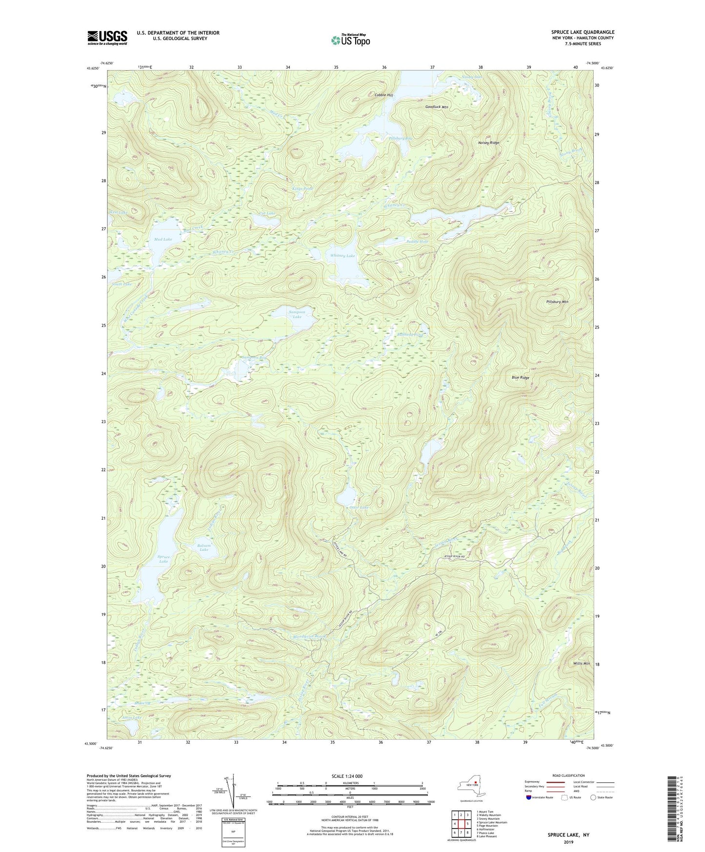
2023 topographic map quadrangle Spruce Lake in the state of New York. Scale: 1:24000. Based on the newly updated USGS 7.5' US Topo map series, this map is in the following counties: Hamilton. The map contains contour data, water features, and other items you are used to seeing on USGS maps, but also has updated roads and other features. This is the next generation of topographic maps. Printed on high-quality waterproof paper with UV fade-resistant inks.
Quads adjacent to this one:
West: Spruce Lake Mountain
Northwest: Mount Tom
North: Wakely Mountain
Northeast: Snowy Mountain
East: Page Mountain
Southeast: Lake Pleasant
South: Piseco Lake
Southwest: Hoffmeister
Contains the following named places: Amos Lake, Balsam Lake, Belden Vly, Big Brook, Bloodgood Brook, Blue Ridge, Bullhead Pond, Cat Lake, Cedar Lakes, Cobble Hill, Dewitt Pond, Goodluck Mountain, Kings Pond, Little Moose Pond, Mud Creek, Mud Lake, Noisey Inlet, Noisey Ridge, Otter Lake, Pillsbury Bay, Pillsbury Lake, Pillsbury Mountain, Pillsbury Mountain Forest Fire Observation Station, Puddle Hole, Sampson Bog, Sampson Lake, Spruce Lake, Stony Brook, Town of Arietta, West Canada Lakes, Whitney Creek, Whitney Lake, Willis Mountain, ZIP Code: 12139