MyTopo
Morehouse Lake New York US Topo Map
Couldn't load pickup availability
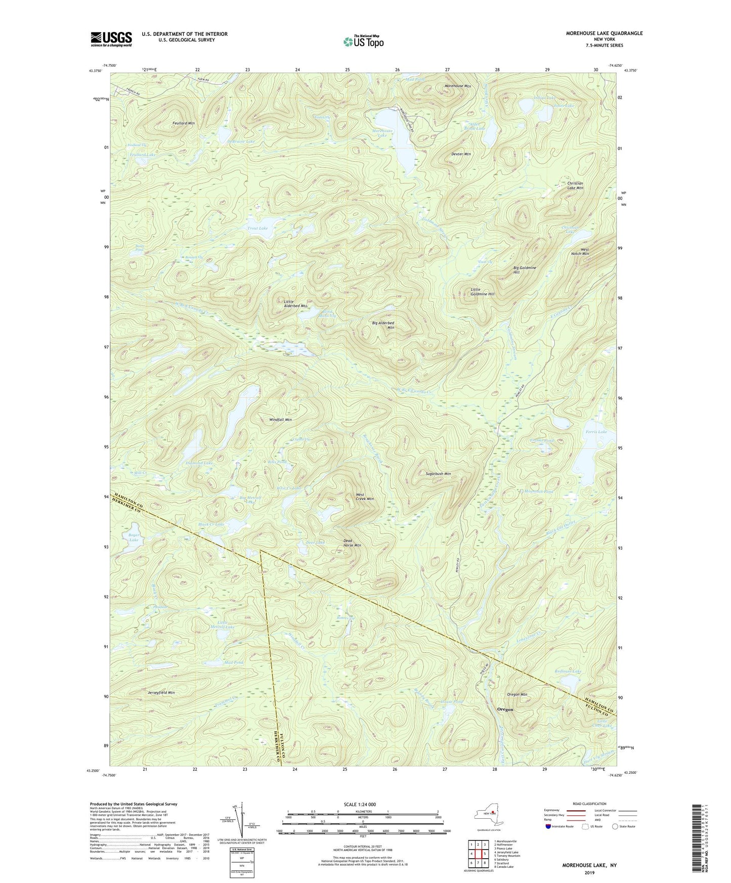
2023 topographic map quadrangle Morehouse Lake in the state of New York. Scale: 1:24000. Based on the newly updated USGS 7.5' US Topo map series, this map is in the following counties: Hamilton, Fulton, Herkimer. The map contains contour data, water features, and other items you are used to seeing on USGS maps, but also has updated roads and other features. This is the next generation of topographic maps. Printed on high-quality waterproof paper with UV fade-resistant inks.
Quads adjacent to this one:
West: Jerseyfield Lake
Northwest: Morehouseville
North: Hoffmeister
Northeast: Piseco Lake
East: Tomany Mountain
Southeast: Canada Lake
South: Stratford
Southwest: Salisbury
This map covers the same area as the classic USGS quad with code k43074c5.
Contains the following named places: Alder Brook Lake, Basin Pond, Bennett Vly, Big Alderbed, Big Alderbed Mountain, Big Goldmine Hill, Big Metcalf Lake, Bills Pond, Black Cat Outlet, Black Creek Lake, Blind Mans Vly, Bowers Vly, Boyer Lake, Brayhouse Brook, Christian Lake, Christian Lake Mountain, Coon Vly, Crystal Vly, Dead Horse Mountain, DeBraine Lake, Deer Lake, Dexter Mountain, Diamond Lake, Ferris Lake, Feullard Lake, Feullard Mountain, Feullard Vly, Foster Vly, Franks Pond, Goldmine Stream, House Pond, Indigo Lake, Jerseyfield Lake, Jerseyfield Mountain, Jones Lake, Limestone Creek, Little Alderbed Mountain, Little Goldmine Hill, Little Metcalf Lake, Long Lake, Morehouse Lake, Morehouse Mountain, Mountain Pond, Mud Pond, Oregon, Oregon Mountain, Powley Place, Punkhole, Redlouse Lake, Sugarbush Mountain, Trout Lake, West Branch East Canada Creek, West Creek Lake, West Creek Mountain, West Notch Mountain, Windfall Mountain