MyTopo
Keene Valley New York US Topo Map
Couldn't load pickup availability
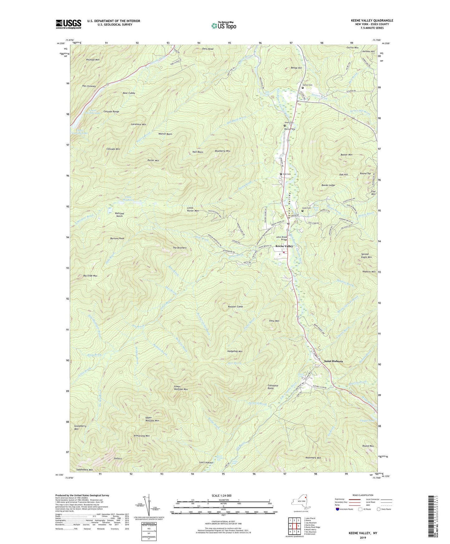
2019 topographic map quadrangle Keene Valley in the state of New York. Scale: 1:24000. Based on the newly updated USGS 7.5' US Topo map series, this map is in the following counties: Essex. The map contains contour data, water features, and other items you are used to seeing on USGS maps, but also has updated roads and other features. This is the next generation of topographic maps. Printed on high-quality waterproof paper with UV fade-resistant inks.
Quads adjacent to this one:
West: North Elba
Northwest: Lake Placid
North: Keene
Northeast: Jay Mountain
East: Rocky Peak Ridge
Southeast: Underwood
South: Dix Mountain
Southwest: Mount Marcy
Contains the following named places: Armstrong Mountain, Artists Falls, Ausable Club Golf Course, Baxter Mountain, Bear Brook, Bear Cubby, Beaver Meadows Falls, Beede Brook, Beede Hill, Beede Ledge, Bennies Brook, Big Slide Mountain, Black Brook, Blueberry Mountain, Burtons Peak, Cascade Mountain, Cascade Range, Cathedral Rocks, Crystal Brook, Deer Brook, Dickey Brook, Dry Brook, East River Trail, Estes Cemetery, Flume Brook, Gill Brook, Gooseberry Mountain, Gothics, Hedgehog Mountain, Hogback Brook, Holt Cemetery, Hopkins Brook, Hull Basin, Hull Basin Brook, Hulls Falls, Icy Brook, Johns Brook, Johns Brook Bridge, Johns Brook Trail, Keene Valley, Keene Valley Congregational Church, Keene Valley Hose and Ladder Company 1, Keene Valley Library, Keene Valley Post Office, Laramore Mountain, Leach Trail, Little Meadows, Little Porter Mountain, Lost Lookout, Lower Cascade Lake, Lower Wolfjaw Mountain, Marcy Field, Mossy Cascade Brook, Noonmark Mountain, Norton Brook, Norton Cemetery, Oak Hill, Ore Bed Brook, Owls Head, Phelps Brook, Phelps Falls, Porter Brook, Porter Mountain, Putnam Brook, Pyramid Brook, Railroad Notch, Roaring Brook, Rock Cut Brook, Rooster Comb, Rooster Comb Brook, Round Mountain, Round Top, Russell Falls, Saddleback Mountain, Saint Huberts, Shaw Cemetery, Slide Brook, Slide Mountain Brook, Snow Mountain, Southside Trail, Spread Eagle Mountain, Spruce Hill Brook, Stimson Trail, The Brothers, The Chimney, Town of Keene, Upper Wolfjaw Mountain, Walton Basin, Walton Brook, Wedge Brook, Weston Trail, White Trail, Wolfjaw Brook, ZIP Code: 12942