MyTopo
Limekiln Lake New York US Topo Map
Couldn't load pickup availability
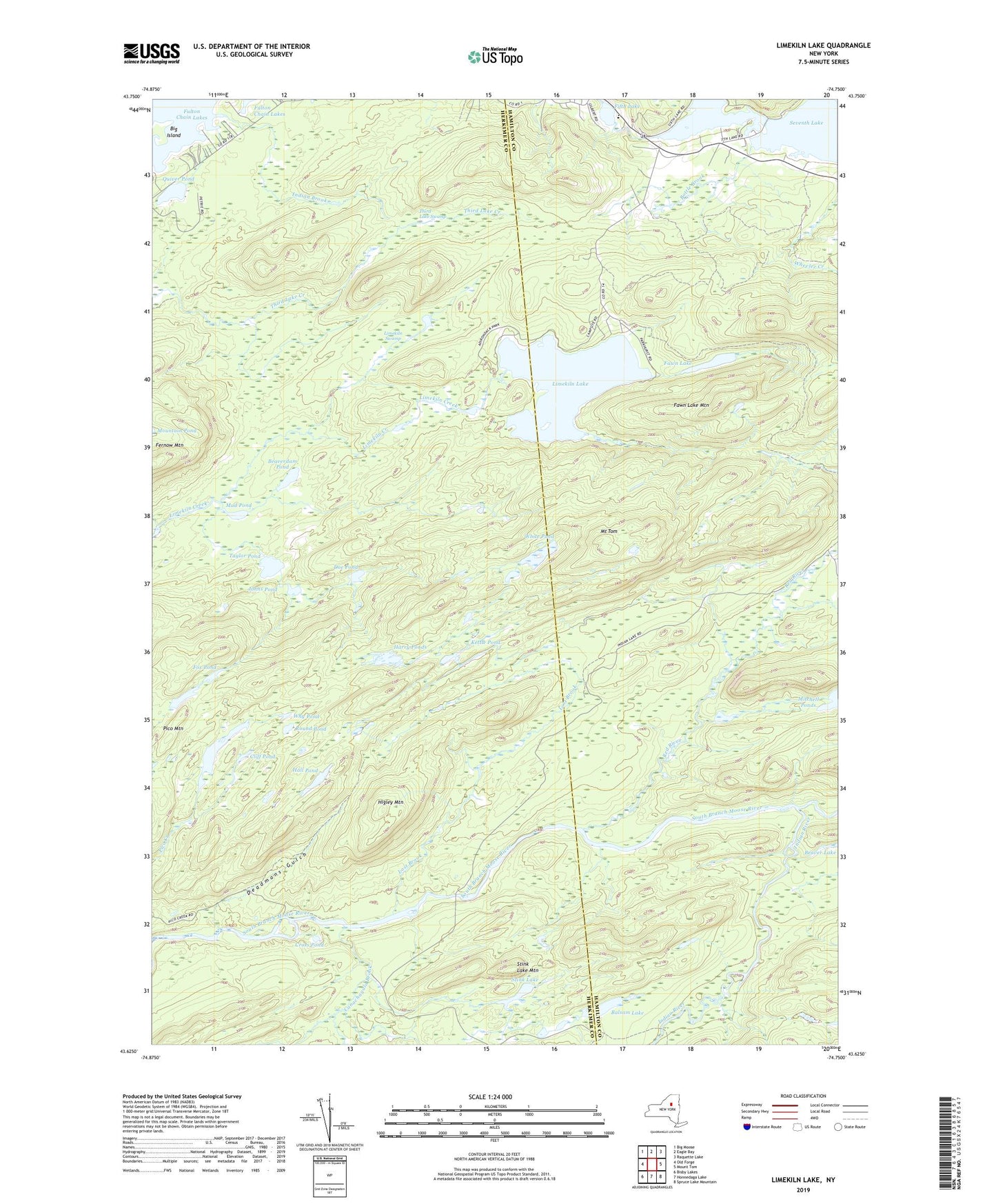
2019 topographic map quadrangle Limekiln Lake in the state of New York. Scale: 1:24000. Based on the newly updated USGS 7.5' US Topo map series, this map is in the following counties: Herkimer, Hamilton. The map contains contour data, water features, and other items you are used to seeing on USGS maps, but also has updated roads and other features. This is the next generation of topographic maps. Printed on high-quality waterproof paper with UV fade-resistant inks.
Quads adjacent to this one:
West: Old Forge
Northwest: Big Moose
North: Eagle Bay
Northeast: Raquette Lake
East: Mount Tom
Southeast: Spruce Lake Mountain
South: Honnedaga Lake
Southwest: Bisby Lakes
Contains the following named places: Balsam Lake, Beaverdam Pond, Bottle Brook, Canachagala Brook, Cliff Pond, Cross Pond, Deadmans Gulch, Doe Pond, Fawn Lake, Fawn Lake Mountain, Fifth Lake, First Stillwater, Fourth Lake, Fox Pond, Hall Pond, Harry Ponds, Higley Mountain, Indian Brook, Indian River, Inlet Elementary School, Inlet Golf Club, Inlet Volunteer Emergency Services, Johns Pond, Kettle Pond, Limekiln Lake, Limekiln Swamp, Lost Brook, Mount Tom, Mud Pond, Natural Hatchery Brook, Pico Lake, Pico Mountain, Quiver Pond, Red River, Round Pond, Sixth Lake, Stink Lake, Stink Lake Mountain, Taylor Pond, Third Lake Swamp, White Pond, Why Pond