MyTopo
Louisville New York US Topo Map
Couldn't load pickup availability
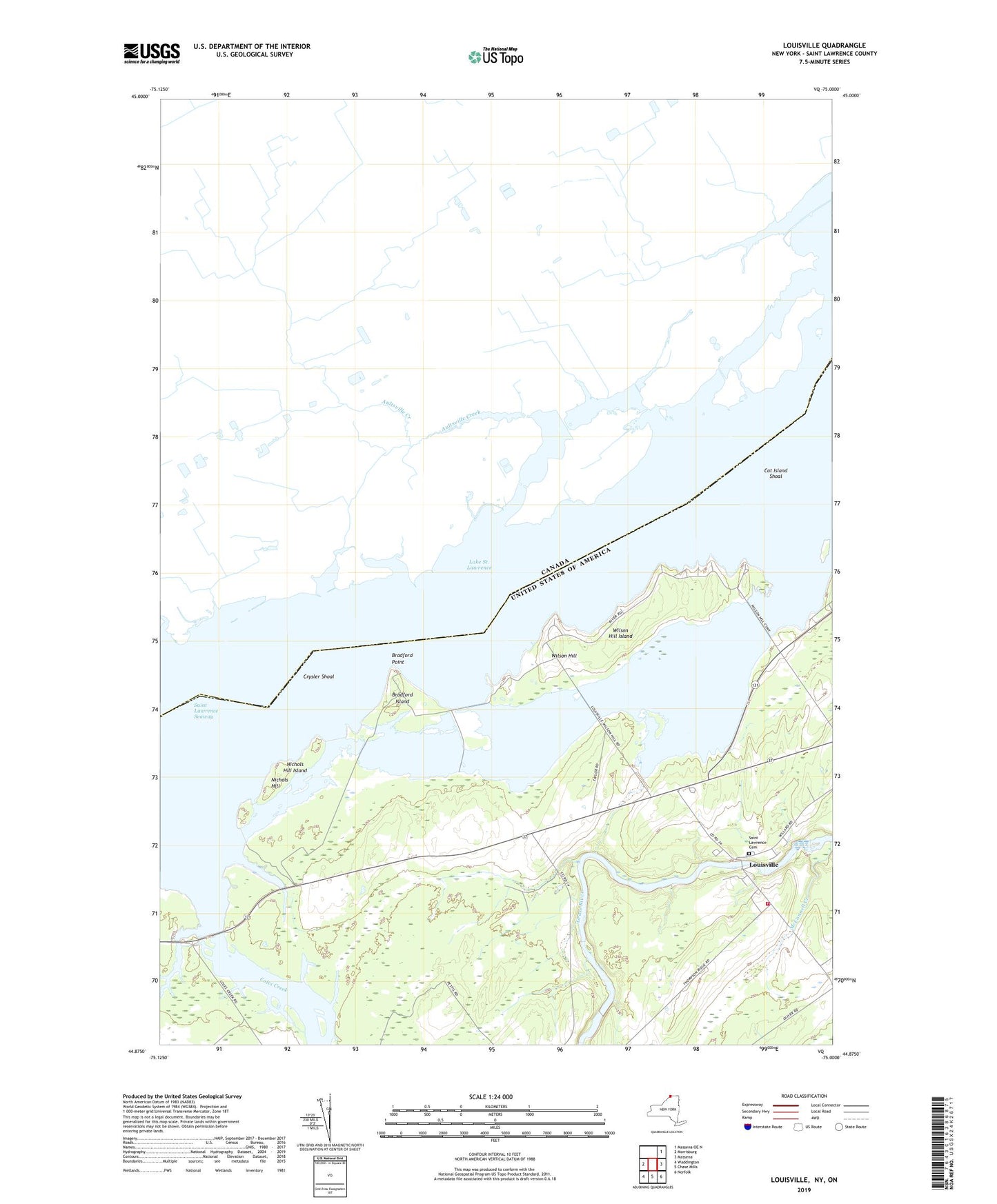
2023 topographic map quadrangle Louisville in the state of New York. Scale: 1:24000. Based on the newly updated USGS 7.5' US Topo map series, this map is in the following counties: St. Lawrence. The map contains contour data, water features, and other items you are used to seeing on USGS maps, but also has updated roads and other features. This is the next generation of topographic maps. Printed on high-quality waterproof paper with UV fade-resistant inks.
Quads adjacent to this one:
Northeast: Massena OE N
East: Massena
Southeast: Norfolk
South: Chase Mills
Southwest: Waddington
This map covers the same area as the classic USGS quad with code o44075h1.
Contains the following named places: Bradford Cemetery, Bradford Island, Bradford Point, Cat Island, Cat Island Shoal, Coles Creek, Coles Creek Marina, Crysler Shoal, Gooseneck Island, Lawrence Cemetery, Leading Light, Louisville, Louisville Corner, Louisville School, Louisville Volunteer Fire Department Station 1, Nichols Hill, Nichols Hill Island, Saint Lawrence Cemetery, Saint Lawrence Church, School Number 1, School Number 13, School Number 2, School Number 6, Strawberry Island, Town of Louisville, Treasure Island, Wilson Hill, Wilson Hill Island, Wilson Hill State Fish and Game Managemen, Wright Cemetery