MyTopo
Norfolk New York US Topo Map
Couldn't load pickup availability
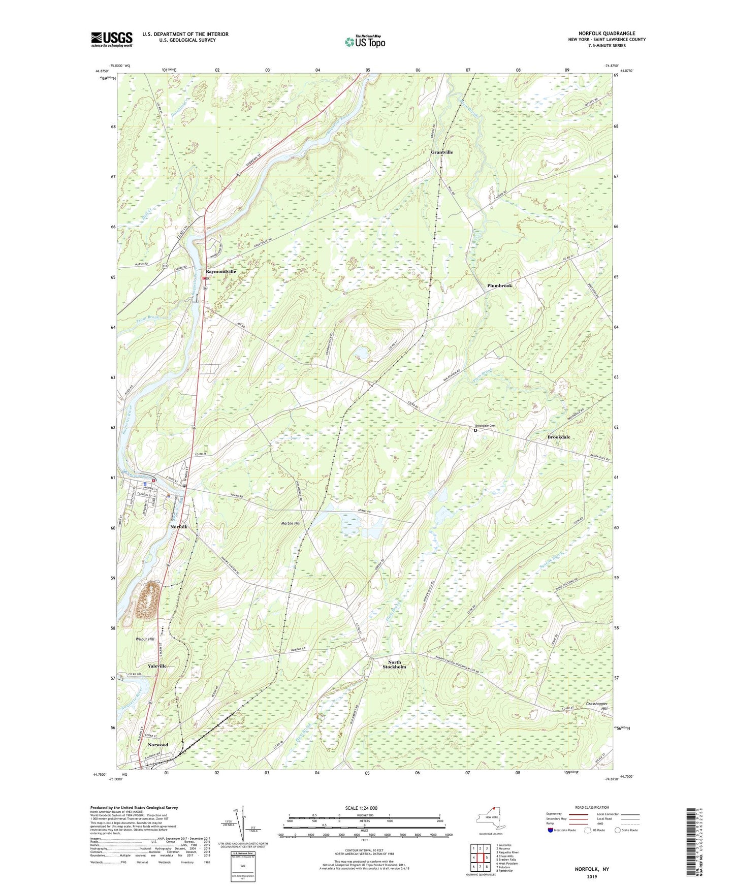
2023 topographic map quadrangle Norfolk in the state of New York. Scale: 1:24000. Based on the newly updated USGS 7.5' US Topo map series, this map is in the following counties: St. Lawrence. The map contains contour data, water features, and other items you are used to seeing on USGS maps, but also has updated roads and other features. This is the next generation of topographic maps. Printed on high-quality waterproof paper with UV fade-resistant inks.
Quads adjacent to this one:
West: Chase Mills
Northwest: Louisville
North: Massena
Northeast: Raquette River
East: Brasher Falls
Southeast: Parishville
South: Potsdam
Southwest: West Potsdam
This map covers the same area as the classic USGS quad with code o44074g8.
Contains the following named places: Brookdale, Brookdale Cemetery, Church of the Visitation, First Congregational Church, Grantville, Hall Creek, Hepburn Library of Norfolk, Knapps Station Community Church, Marble Hill, Norfolk, Norfolk Census Designated Place, Norfolk Mobile Home Park, Norfolk Post Office, Norfolk Town Sewage District 1 Wastewater Treatment Facility, Norfolk Volunteer Fire Department Station 1, Norfolk Volunteer Fire Department Station 2, Norfolk Volunteer Rescue Squad, Norfolk Wesleyan Church, North Stockholm, Norwood, Norwood Library, Norwood Union School, Norwood-Norfolk School, Pine Grove Mobile Home Park, Plumbrook, Raymondville, Raymondville Golf and Country Club, Raymondville Post Office, Saint Raymond Church, School Number 12, School Number 13, School Number 17, School Number 2, School Number 3, School Number 6, Town of Norfolk, Trout Brook, Wilbur Hill, Yaleville, ZIP Codes: 13667, 13668, 13678