MyTopo
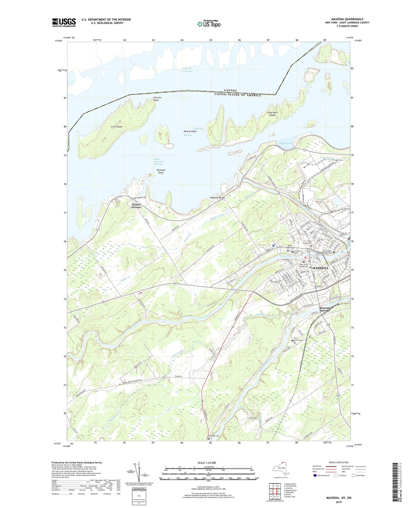
Massena New York US Topo Map
Couldn't load pickup availability
2023 topographic map quadrangle Massena in the state of New York. Scale: 1:24000. Based on the newly updated USGS 7.5' US Topo map series, this map is in the following counties: St. Lawrence. The map contains contour data, water features, and other items you are used to seeing on USGS maps, but also has updated roads and other features. This is the next generation of topographic maps. Printed on high-quality waterproof paper with UV fade-resistant inks.
Quads adjacent to this one:
West: Louisville
North: Massena OE N
East: Raquette River
Southeast: Brasher Falls
South: Norfolk
Southwest: Chase Mills
This map covers the same area as the classic USGS quad with code o44074h8.
Contains the following named places: Adath Israel Cemetery, Adath Israel Synagogue, Adirondack Manor Assisted Living Facility, Advent Christian Church, Alcoa Park, Big Sny, Calvary Cemetery, Church of Christ, Church of the Sacred Heart, Croil Island, Delany Island, Delany Shoal, DeVaults Point, Dike Number 1, Dodge Cemetery, Dodge Creek, Elm Park, Emmanuel Congregational Church, Fiftysix Auto Drive-In, First Baptist Church, First United Methodist Church, Haig Farms, Harrigate School, Harte-Haven Shopping Center, Holy Family School, Hopsons Bay, Hutchins Creek, Kent Mill Cemetery, Lincoln School, Little Sny, Long Sault Islands, Long Sault Rapids, Louisville Landing, Louisville Landing Church, Louisville Volunteer Fire Department Station 2, Madison Elementary School, Massena, Massena Baptist Church, Massena Beach, Massena Central High School, Massena Country Club, Massena Fire Department, Massena Industrial Park, Massena Intake Dam, Massena Junior High School, Massena Memorial Hospital, Massena Police Department, Massena Post Office, Massena Power Canal, Massena Public Library, Massena Springs, Massena Springs Park, McConnell Creek, Miller Cemetery, New Testament Church, Nightengale Elementary School, Pilgrim Holiness Church, Pine Grove Cemetery, Pine Grove Chapel, Plum Brook, Richards Landing, Richards Point, Rod and Gun Club, Saint John's Episcopal Church, Saint Lawrence Seaway, Saint Lawrence Seaway Development Corporation Administration Building, Saint Lawrence State Forest Number 15, Saint Lawrence Yacht Club, Saint Mary's And Saint Joseph's Church, Saint Marys School, Saint Peter's Roman Catholic Cemetery, Saint Regis Nursing Home, School Number 10, School Number 11, School Number 2, School Number 3, School Number 4, School Number 5, Seaway Valley Ambulance Service, Seventh Day Adventist Church, South Sault Rapids, Talcotts Point, Thomas E Perdue Heliport, Tracy Landing, Trinity Catholic School, Tucker Terrace, Village of Massena, Washington School, West Orvis Street Cemetery, Wilson Hill Range Lights, WMSA Radio Tower (Ticonderoga), WMSA-AM (Massena), WSTS Radio Tower (Ticonderoga), WYBG-AM (Massena), ZIP Code: 13662