MyTopo
Chase Mills New York US Topo Map
Couldn't load pickup availability
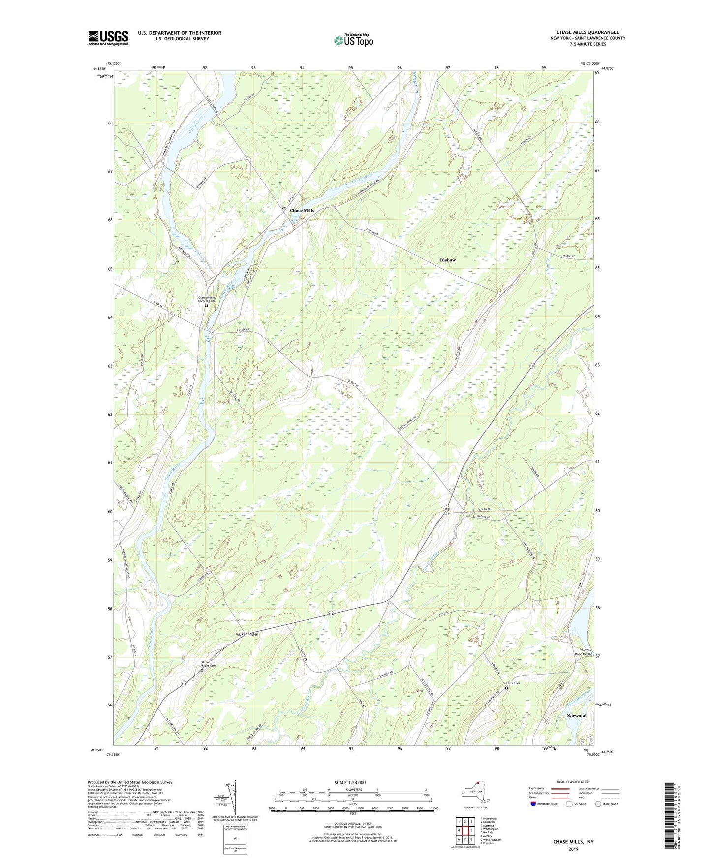
2023 topographic map quadrangle Chase Mills in the state of New York. Scale: 1:24000. Based on the newly updated USGS 7.5' US Topo map series, this map is in the following counties: St. Lawrence. The map contains contour data, water features, and other items you are used to seeing on USGS maps, but also has updated roads and other features. This is the next generation of topographic maps. Printed on high-quality waterproof paper with UV fade-resistant inks.
Quads adjacent to this one:
West: Waddington
North: Louisville
Northeast: Massena
East: Norfolk
Southeast: Potsdam
South: West Potsdam
Southwest: Morley
This map covers the same area as the classic USGS quad with code o44075g1.
Contains the following named places: Allen Corners, Chamberlain Corners, Chamberlain Corners Cemetery, Chase Mills, Chase Mills Post Office, Clark Cemetery, Dalton Crossing, Dishaw, Dixon Corners, Haskell Ridge, Haskell Ridge Cemetery, North Winds Farm, School Number 1, School Number 10, School Number 12, School Number 3, School Number 5, School Number 6, School Number 9, Smith Corners, Visitation Cemetery, Yaleville Road Bridge, ZIP Code: 13621